
1 to 2-inch rainfall by Wednesday; slushy snow for northeast Minnesota
Heaviest rains favor Tuesday evening
Go Deeper.
Create an account or log in to save stories.
Like this?
Thanks for liking this story! We have added it to a list of your favorite stories.


Here comes another unusually warm March rainstorm for most of Minnesota.
Let’s break down the system and precipitation timing and totals.
The system
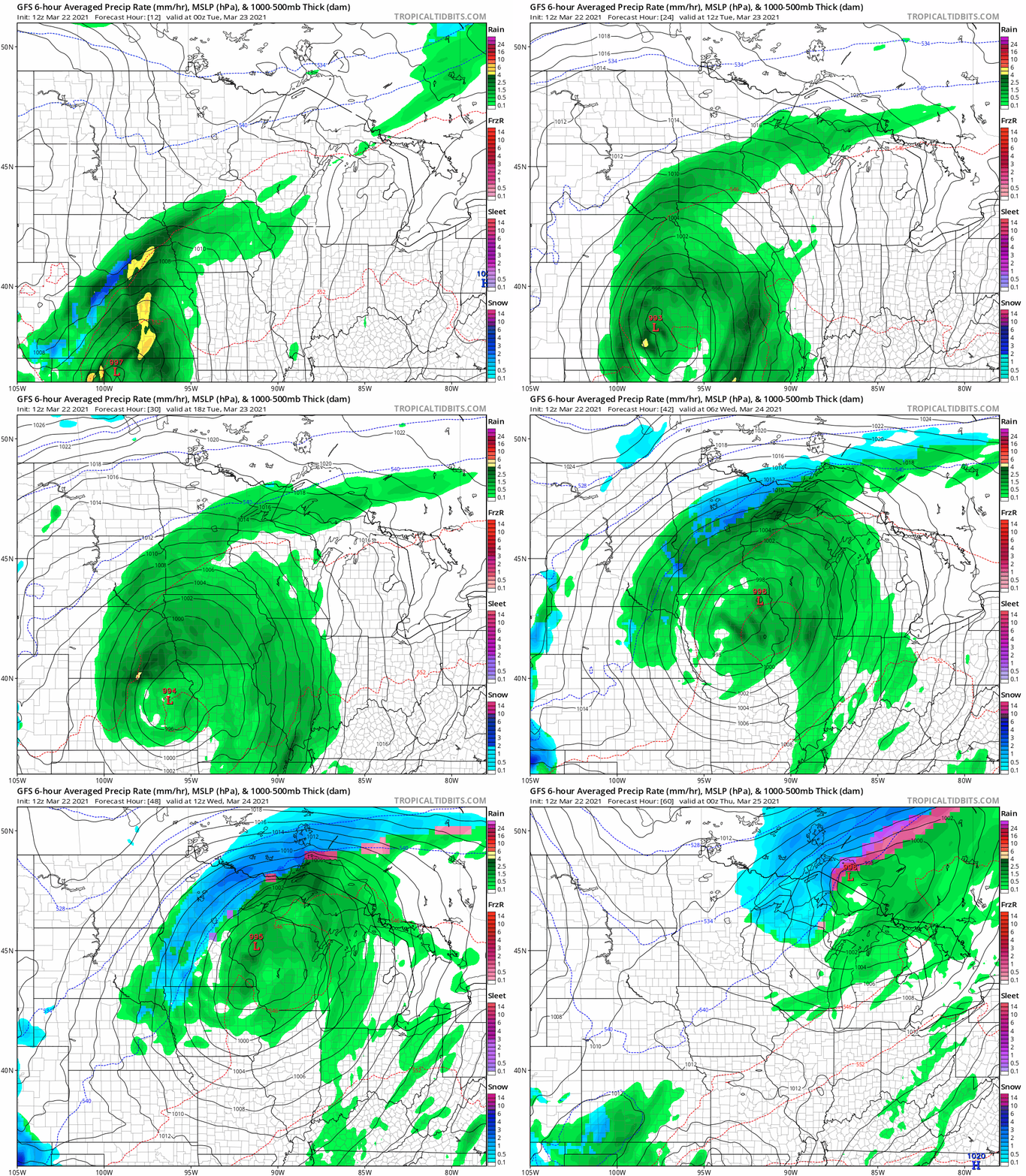
Yet another unusually warm March storm system tracks from Kansas to Lake Superior Tuesday through Wednesday. This one is warm enough for rain across most of Minnesota. A band of snow will develop across northern Minnesota late Tuesday night into Wednesday.
NOAA’s GFS model tracks the system.
Turn Up Your Support
MPR News helps you turn down the noise and build shared understanding. Turn up your support for this public resource and keep trusted journalism accessible to all.
Heavy rainfall totals
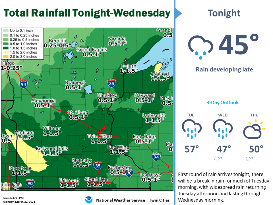
Again, we should be talking about the heavy snow band with this system given it’s falling on March 23. Rain spreads north through Minnesota Tuesday morning. The heaviest rainfall bands arrive late Tuesday afternoon and Tuesday night.
Much of Minnesota will pick up an inch of rain, with local 2-inch totals possible across southwest Minnesota by Wednesday.
Slush up north
This system will pull in just enough sub-freezing air to produce snow in northern Minnesota late Tuesday into Wednesday. Here’s the view on accumulations from the Duluth National Weather Service office.

Another inch of moisture for much of Minnesota will help ease dryness and boost lake levels as we head into the warm season.

