
Coldest night of the rest of spring ahead; 60 degrees warmer Monday
Thursday morning will likely be the coldest temperature until late this year
Go Deeper.
Create an account or log in to save stories.
Like this?
Thanks for liking this story! We have added it to a list of your favorite stories.


Get ready for yet another wild Minnesota temperature ride.
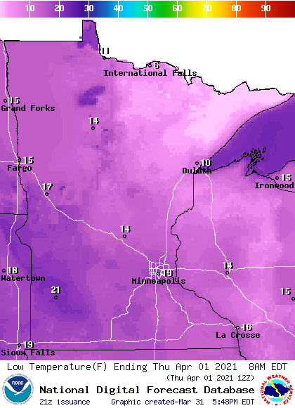
Our bracingly brisk air mass brings a frigid last few hours of March and the first few hours of April. Thursday morning will likely be the coldest morning for at least eight months.
Low temperatures dip into the single digits to near zero across northern Minnesota early Thursday morning. Teens and 20s will be common across southern Minnesota Thursday morning.
Highs recover Thursday afternoon. It will feel much nicer out there with less wind, bright sun, and highs in the 50s west to 40s across most of Minnesota.
Turn Up Your Support
MPR News helps you turn down the noise and build shared understanding. Turn up your support for this public resource and keep trusted journalism accessible to all.
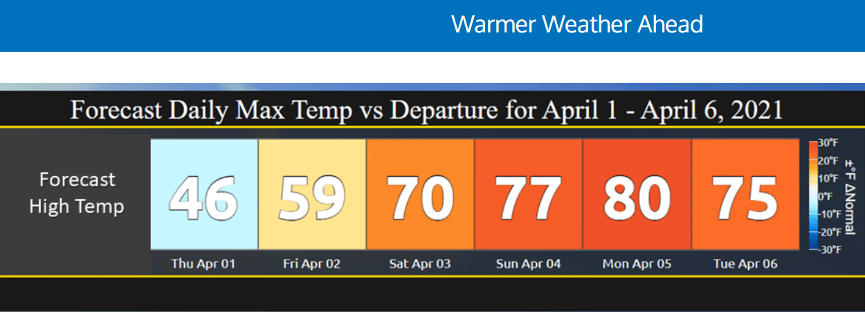
60 degrees warmer by Monday?
Check out the forecast high temperature map for next Monday.

Highs will approach 80 degrees from the Twin Cities westward. That about 60 degrees warmer than where we will be Thursday morning. The record high for the Minneapolis-St. Paul International Airport Monday is 80 degrees. We have a shot.
It’s remarkable that the Twin Cities and southern Minnesota will stay above freezing at night for most of next week. That’s pretty rare for the first week of April.
It’s still too early to think about planting annuals, but your daffodils may start putting on a show next week.

