
June preview: Highs in the 70s for much of Minnesota this weekend
Temperatures running 20 to 30 degrees above average.
Go Deeper.
Create an account or log in to save stories.
Like this?
Thanks for liking this story! We have added it to a list of your favorite stories.


Here we go.
Yet another unseasonably warm air mass blows into Minnesota in the next 48 hours. This will be the warmest air mass in 6 months for most of Minnesota. The last time the Twin Cities hit 80 degrees was October 6, 2020.
June-like jet stream
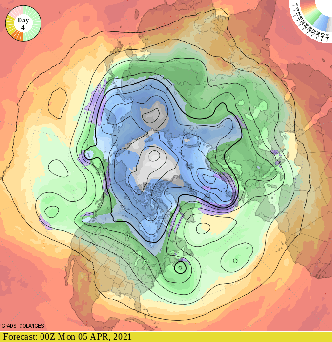
Check out the upper wind pattern by Sunday. The jet stream lifts way north into Canada near Hudson Bay. The westerly wind flow aloft will allow milder spring air to drift north across Minnesota. This pattern is more typical of June than early April.
Turn Up Your Support
MPR News helps you turn down the noise and build shared understanding. Turn up your support for this public resource and keep trusted journalism accessible to all.
Climbing the thermometer
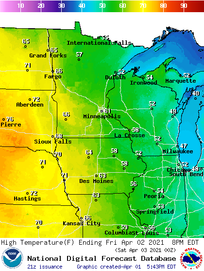
Highs Friday afternoon push into the 50s north, 60s in the Twin Cities, and near 70 in western Minnesota.
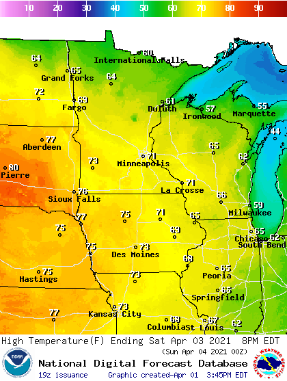
By Saturday the 70s spread across more of Minnesota.
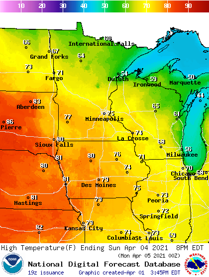
By Sunday the warmth intensifies.
And by Monday highs may reach 80 in western Minnesota.
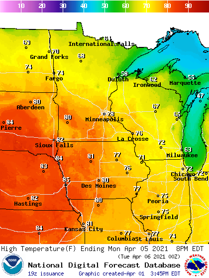
Get out there Minnesota.

