
Rain and thunder waves moving north again; 1 to 3 inches of rain this week
A wetter pattern unfolding across Minnesota this week.

Go Deeper.
Create an account or log in to save stories.
Like this?
Thanks for liking this story! We have added it to a list of your favorite stories.


The next rain and thunder waves move north across Minnesota through Tuesday night.
A slow-moving low-pressure system stalls across Minnesota this week. Waves of showers and thunderstorms will swirl around the low this week. The National Oceanic and Atmospheric Administration’s GFS captures the essence of the system, with the next rain waves growing across Minnesota Tuesday afternoon and evening. Additional rain waves arrive Wednesday and Thursday as the system stalls over southeast Minnesota.

The highest rain chances for the Twin Cities favor late Tuesday afternoon, and especially Tuesday evening through the overnight hours into Wednesday morning.
Marginal risk again
Monday evening’s storm waves produced some impressive hail reports.
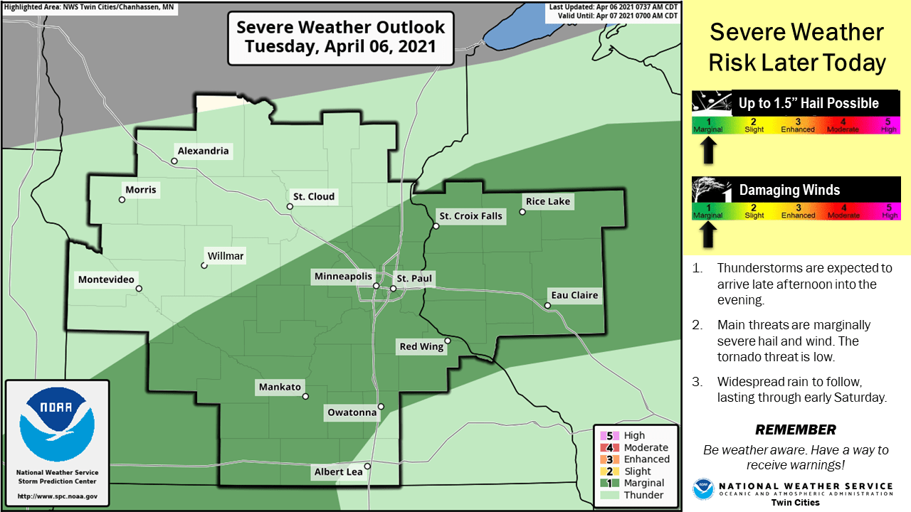
NOAA’s Storm Prediction Center includes a sliver of territory in Minnesota under a marginal severe risk again through Tuesday night. A few storms from southwest Minnesota through the Twin Cities could get marginally feisty once again.
Soaking rains again
Additional waves of rain will add up this week. Most forecast models crank out 1” to 3” of rain across much of Minnesota this week.
Keep the rain gear handy, and keep an ear out for a few possible severe storm warnings again through Tuesday evening.
Turn Up Your Support
MPR News helps you turn down the noise and build shared understanding. Turn up your support for this public resource and keep trusted journalism accessible to all.

