
More occasional fits of rain through Friday; frost returns next week
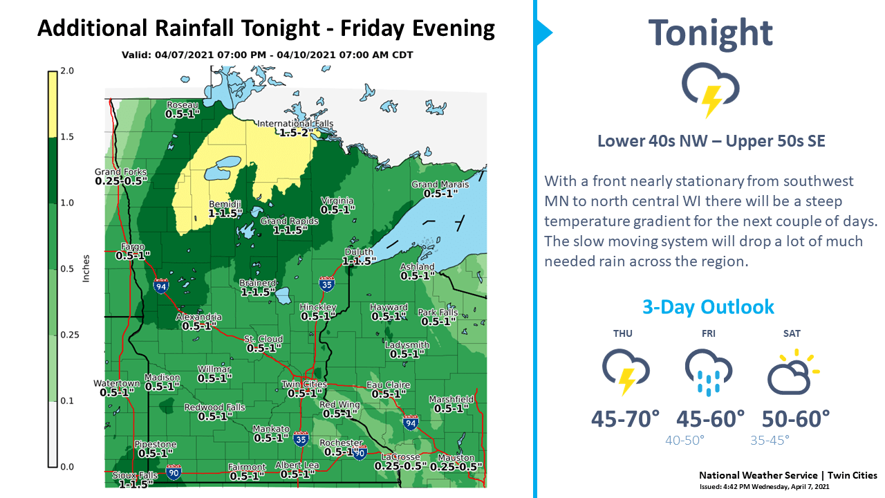
An inch of additional rainfall is expected
Go Deeper.
Create an account or log in to save stories.
Like this?
Thanks for liking this story! We have added it to a list of your favorite stories.


Our April monsoon continues this week. That’s good news for drought areas favoring northern and western Minnesota.
Low-pressure strolls through Minnesota at a leisurely pace Thursday and Friday. That means more occasional bouts of rain and thunder.
NOAA’s GFS model shows the low-pressure center staggering north through Minnesota through Friday.
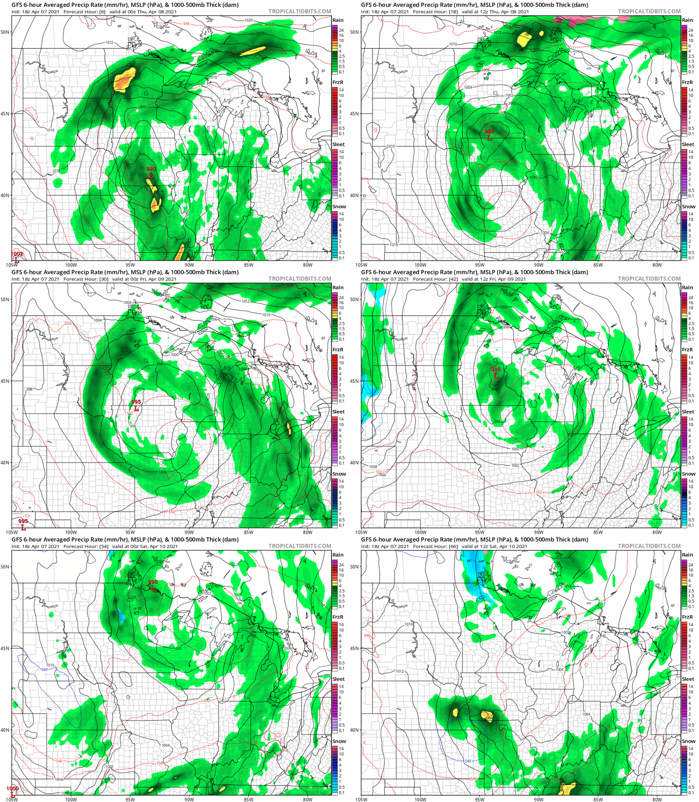
Occasional rain bands continue to wrap around the system. Again, it won’t rain all the time, but expect a few more waves of rain through at least Friday before the system pulls away Saturday.
Turn Up Your Support
MPR News helps you turn down the noise and build shared understanding. Turn up your support for this public resource and keep trusted journalism accessible to all.
Sunday brings more sunshine and milder temperatures. The average high and low by Sunday in the Twin Cities are 56 and 35.

Cold front next week
Check out NOAA GFS forecast temperatures in Alaska Friday morning.
There’s still plenty of frigid air upstream from Minnesota. And some of that will head our way next week.
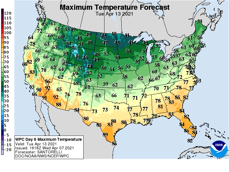
Highs next week will struggle to reach 50 degrees in the Twin Cities, with 40s up north.
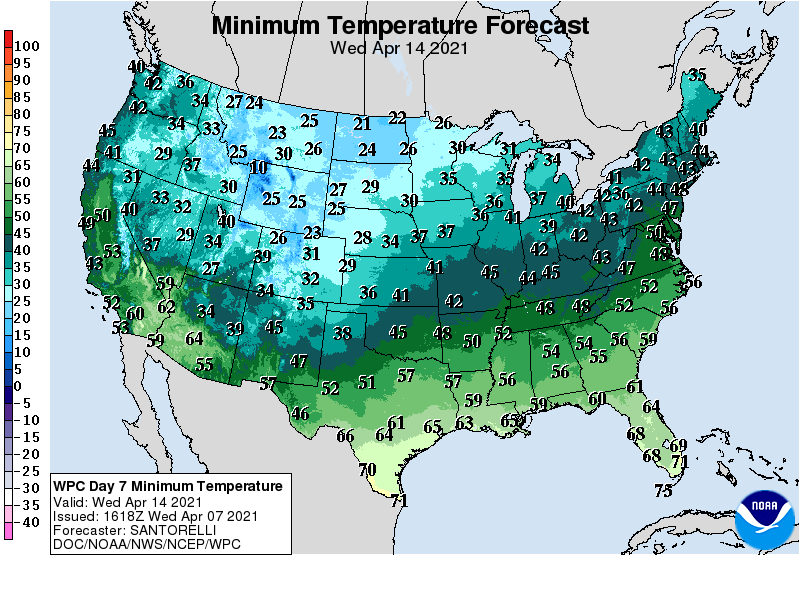
Overnight lows could deliver another frost with freezing temperatures likely across most of central and northern Minnesota.
There are signs that milder air will return after next week.

