
Glorious Earth Day gives way to occasional showers through this weekend
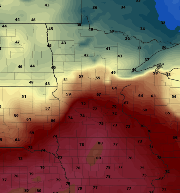
Temps Monday likely hit 70 again from the Twin Cities southward.
Go Deeper.
Create an account or log in to save stories.
Like this?
Thanks for liking this story! We have added it to a list of your favorite stories.


Thursday’s sunshine and relative warmth are almost enough to renew our faith in the season formerly known as spring.
Temperatures pushed into the 60s across most of Minnesota Thursday afternoon.
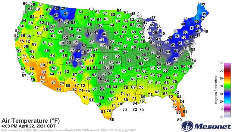
The average high for the Twin Cities Thursday is 61 degrees.
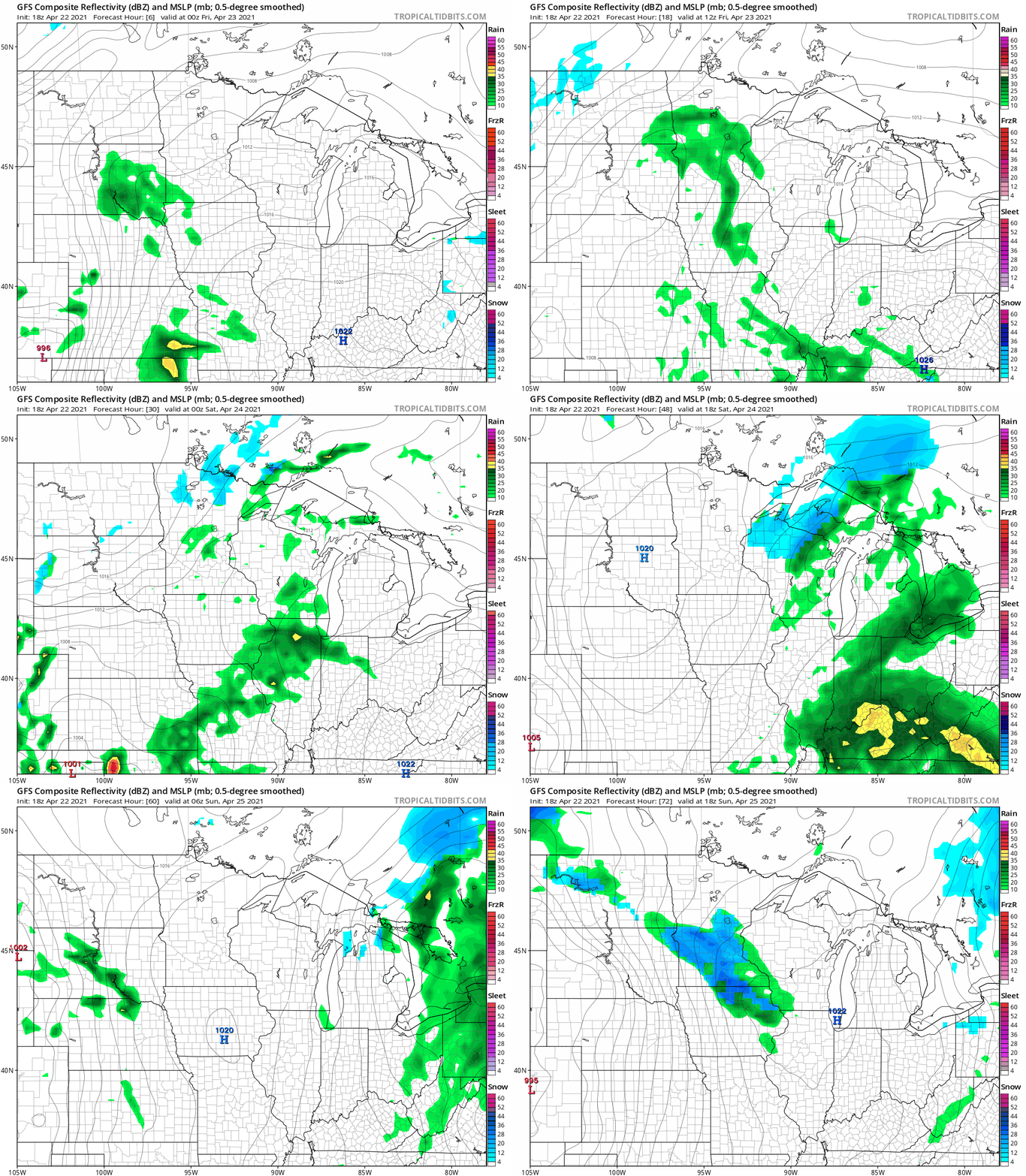
Showers return to the forecast picture overnight into Friday. In fact, 3 separate waves of generally light precipitation will cross Minnesota this weekend. Some will be rain. Some will be snow.
Turn Up Your Support
MPR News helps you turn down the noise and build shared understanding. Turn up your support for this public resource and keep trusted journalism accessible to all.
A weak low-pressure wave spreads showers northeast into Minnesota Friday. Then a cold front brings a band of snow across northern and central Minnesota Saturday morning. Finally, another batch of rain and snow showers breaks out ahead of an approaching warm front Sunday.
NOAA’s GFS model paints the 3 waves this weekend.
70 by Monday?
Monday will be one of those days where you can find summer or winter temperatures within a 3-hour drive of the Twin Cities.
A strong warm front looks likely to set up very near the Twin Cities. That will produce a sharp temperature gradient Monday north and south of the Twin Cities. Highs should reach 70 Monday from the Twin Cities southward, with much cooler air to the north.
Want summer? Drive 3 hours south into Iowa. Want winter? Head for the North Shore past Duluth.
Here’s the European model temperature output for 7 pm Monday.
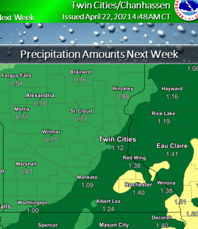
More rain Tuesday and Wednesday
Shower coverage increases Tuesday and Wednesday next week. Another April soaking is likely for Minnesota.
Warmer again late next week?
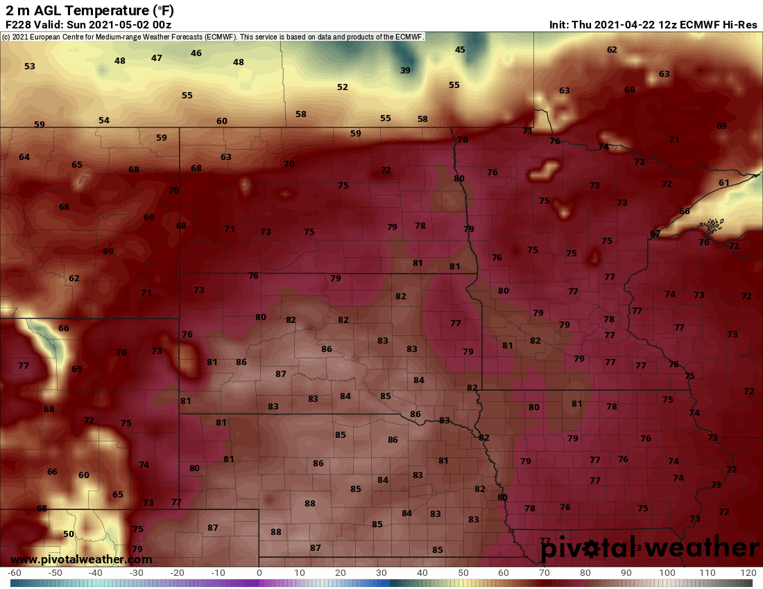
Signs point to milder air again late next week. Right now the European model is cranking out 70s and even some 80s a week from Saturday.
Stay tuned.

