
Thursday was the warmest day in 3 weeks; 80s ahead Saturday
Highs soar into the 80s for most of southern Minnesota Saturday

Go Deeper.
Create an account or log in to save stories.
Like this?
Thanks for liking this story! We have added it to a list of your favorite stories.


Welcome to the warmest air mass in three weeks.
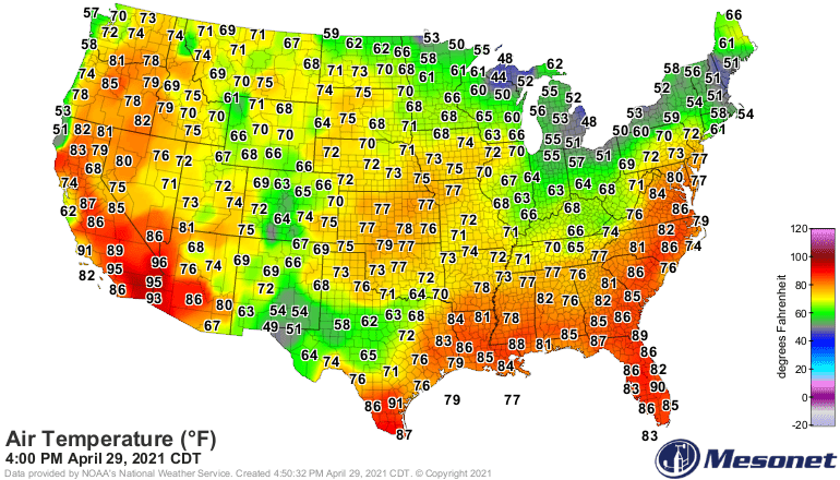
The temperature hit 67 degrees at the Minneapolis-St. Paul Airport Thursday afternoon under breezy but sunny bright blue skies. Temperatures in the Upper Midwest ran slightly above average at many locations Thursday.
Cool start Friday
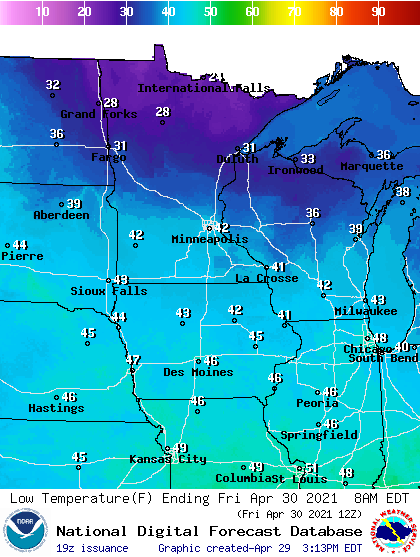
Friday brings a cool morning to Minnesota. Lows dip below freezing in central and northern Minnesota, with low 40s in the south.
Friday afternoon brings more sunshine, and temperatures into the 60s once again. Less wind will make it feel glorious Friday afternoon. Note the red hues in South Dakota Friday. Preview of coming attractions Saturday.

80s Saturday
Saturday brings the second warmest day of April. The high temperature reached 85 in the Twin Cities on April 5. We’ll get close Saturday afternoon.
Scattered showers Sunday
A cool front drops south through Minnesota Sunday. It brings cooler temperatures and scattered showers. It won’t rain all day Sunday but expect a few hours of showers roaming the radar scope.
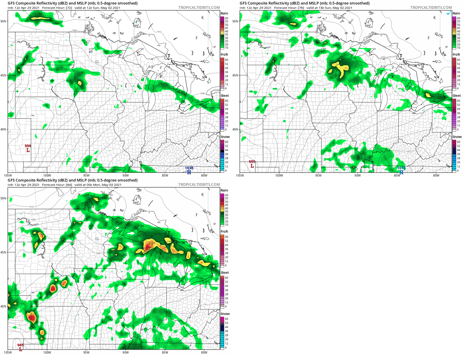
NOAA’s GFS model paints the rain zones Sunday. This loop runs from 7 a.m. to 7 p.m. Sunday.
Turn Up Your Support
MPR News helps you turn down the noise and build shared understanding. Turn up your support for this public resource and keep trusted journalism accessible to all.

