
Slow-motion spring: Cool but sunny most of this week
Temperatures running about 5 degrees cooler than average this week

Go Deeper.
Create an account or log in to save stories.
Like this?
Thanks for liking this story! We have added it to a list of your favorite stories.


I’m thinking about calling this the “Tulip Spring” of 2021.
Our slow-motion warmup this spring is perfect for spring flowers that like it cool and not too hot. Outside of Saturday’s 80- to 90-degree warmth across southern Minnesota, the last few weeks have been pleasantly cool.
Monday brought another cool spring day to most of Minnesota. Notice the heat is held at bay well south of the Upper Midwest on Monday afternoon’s temperature map.

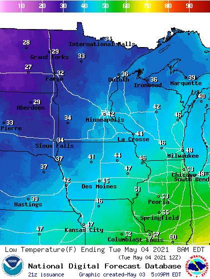
Tuesday brings plenty of sunshine to Minnesota. Frost is part of a chilly morning across most of western through northern Minnesota. The Twin Cities bottoms out in the low 40s Tuesday morning.
Turn Up Your Support
MPR News helps you turn down the noise and build shared understanding. Turn up your support for this public resource and keep trusted journalism accessible to all.
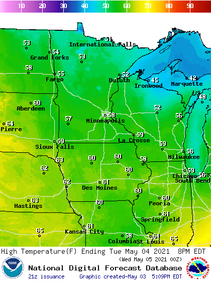
Our cool air mass yields highs mostly in the 50s Tuesday afternoon.
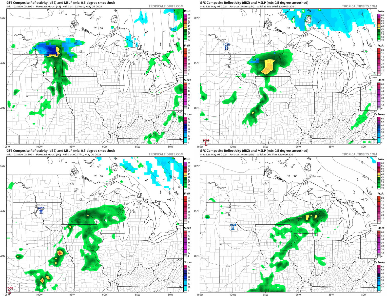
Wednesday brings a chance or showers to southern Minnesota. NOAA’s GFS model paints the precip zones.
Thursday and Friday bring more cool high pressure. That means lots of sunshine and pleasantly cool temperatures.
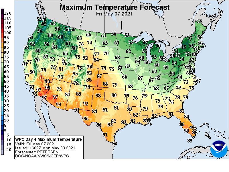
The early peek at the weekend looks cool. There are signs of highs in the upper 60s and possibly 70 degrees again by next Tuesday or Wednesday.
The Weather Lab tulips are happy.

