Spring ripens: 60s this week blossom into 70s the following
Our spring warmup is finally here
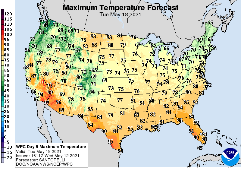
Finally, spring.
There’s no denying the beauty of our current weather pattern across Minnesota. Temperatures kissed the 70-degree mark at several locations in Minnesota Wednesday, including some locations in the Twin Cities.
Thursday brings yet another spectacular weather day to Minnesota. Expect a mix of sunshine and a few puffy cumulus clouds. Highs will push 70 degrees once again in many locations.
Shower chance Friday
Friday brings a weak weather system to southern Minnesota. It will produce a few scattered showers. NOAA’s North American Mesoscale Forecast System (NAM) paints the shower chances between 7 a.m. and 7 p.m. Friday.
Create a More Connected Minnesota
MPR News is your trusted resource for the news you need. With your support, MPR News brings accessible, courageous journalism and authentic conversation to everyone - free of paywalls and barriers. Your gift makes a difference.
The weekend brings a mix of clouds and some sun, with sunnier skies across northern Minnesota. Highs linger in the upper 60s across southern Minnesota but should hit 70 up north with more abundant sunshine.
Warmer next week
Next week looks glorious, especially on Monday and Tuesday. Highs will push well into the 70s across most of Minnesota.
A few showers and thunderstorms may visit Minnesota next Wednesday and Thursday.
The upper air pattern looks even warmer by around Sunday, May 23.
Some forecast models are cranking out highs in the 80s for much of the last week in May.
Stay tuned.