Tracking rainfall timing into Friday; July-like weekend ahead
Much of Minnesota needs rain
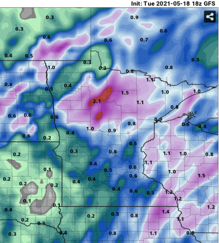
Welcome to “hit or miss” convective rainfall season.
It’s very typical to get highly localized downpours during the warm season in the Midwest. Like, your neighbor down the street picks up a welcome soaking, and you’re still watering your thirsty young plants.
Expect more dry hours than rain through Friday morning. The best chance for a good soaking favors Wednesday night into Thursday.
NOAA’s HRRR model paints scattered showers and thundershowers moving north through Minnesota Wednesday into Thursday morning. Here’s the model output from 1 p.m. Wednesday to 1 a.m. Thursday.
Create a More Connected Minnesota
MPR News is your trusted resource for the news you need. With your support, MPR News brings accessible, courageous journalism and authentic conversation to everyone - free of paywalls and barriers. Your gift makes a difference.
Overall rainfall totals range from spotty and light to as much as half an inch in many areas. A few lucky locations in central and northern Minnesota may pick up an inch or more by Friday morning. Here’s the NOAA Global Forecast System’s projected rainfall output into Friday morning.
July-like weekend ahead
The forecast models continue to crank up the heat and humidity for this upcoming weekend. Highs soar well into the 80s by Saturday afternoon. The lake beckons.
Rain and thunder chances favor northern Minnesota this weekend. Rain chances increase again for the Twin Cities Sunday afternoon and evening into Monday.