
Cold front: 30 degrees colder by Thursday. Decent Memorial Day weekend
A chilly rain Thursday, sunnier skies return Friday and Saturday
Go Deeper.
Create an account or log in to save stories.
Like this?
Thanks for liking this story! We have added it to a list of your favorite stories.


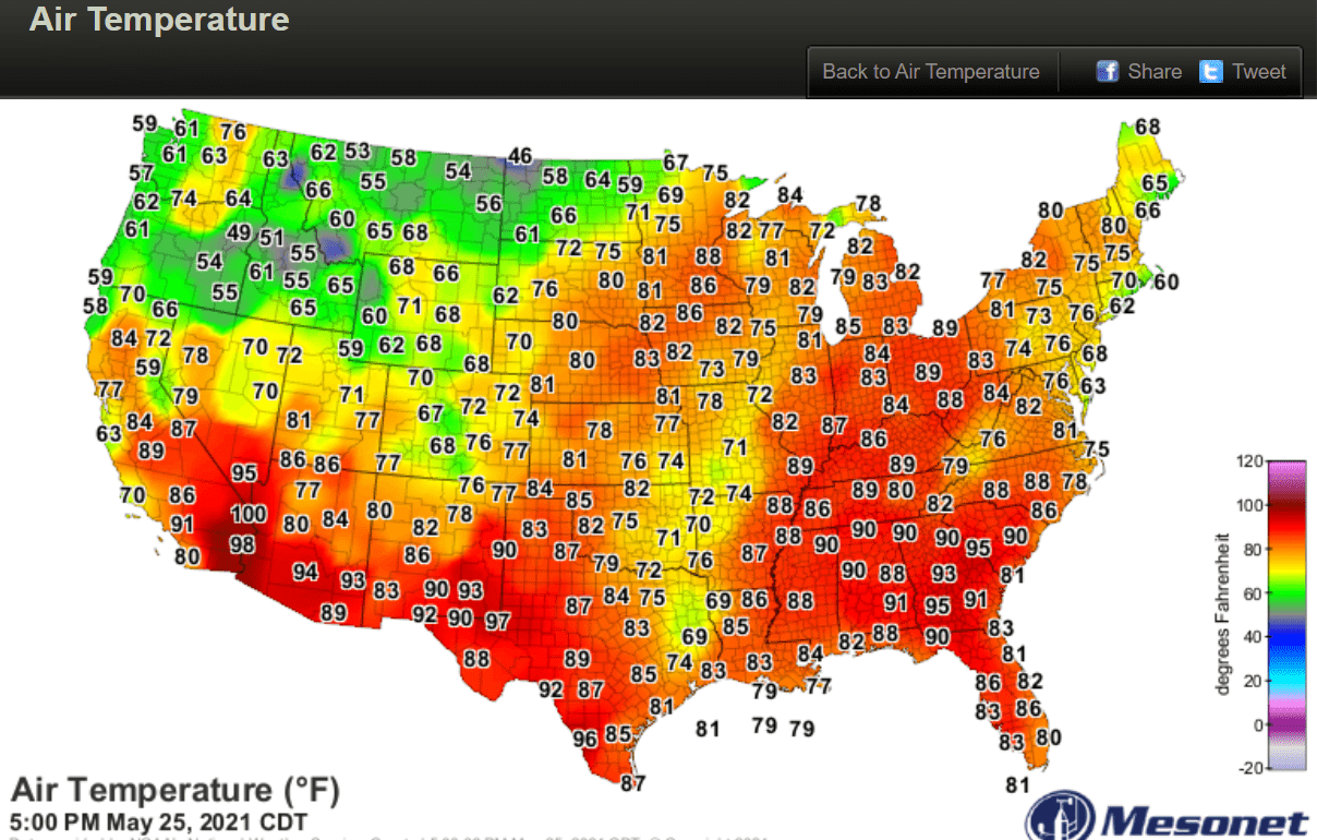
It’s been a summery start to this week across most of Minnesota. Highs Tuesday again pushed well into the 80s across our region. It’s a sea of red on the temperature map Tuesday afternoon.
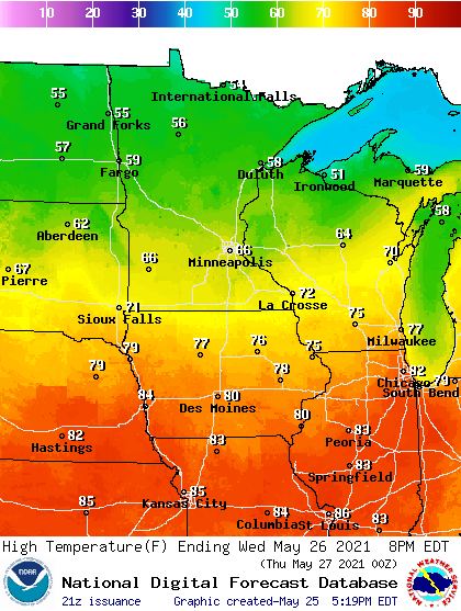
Our summery warmth gives way to a sharp cold front Wednesday. Brisk northwest winds are pushing in much colder air. Wednesday brings plenty of sunshine, but highs hover in the 60s central and south with 50s up north. You can see the summery 80s getting shoved south to Des Moines on Wednesday’s high-temperature map below.
Rainy Thursday
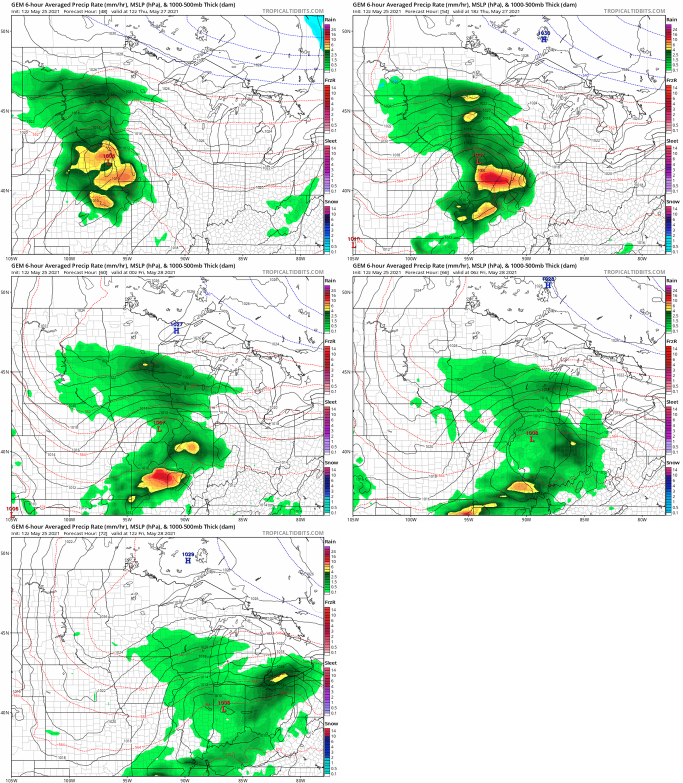
Thursday brings a flashback to cooler April-like weather. A low-pressure system tracking through Iowa brings rain to central and southern Minnesota Thursday. The Canadian model loop below shows the rain shield from 7 a.m. Thursday to 7 a.m. Friday.
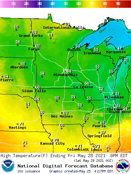
Highs Thursday and Friday will be around 30 degrees colder than Tuesday afternoon. Most of Minnesota will hover in the 50s. More sunshine in northern Minnesota will boost temperatures into the 60s.
Decent Memorial Day weekend
The Memorial Day weekend looks pretty decent but a bit cooler than average. Highs will be in the 60s Saturday, with temperatures closer to 70 Sunday and Memorial Day.

At this time shower chances look spotty and favor Monday.
Turn Up Your Support
MPR News helps you turn down the noise and build shared understanding. Turn up your support for this public resource and keep trusted journalism accessible to all.

