
Tracking Thursday's rainfall
Soaking rains Thursday for much of central and southern Minnesota.
Go Deeper.
Create an account or log in to save stories.
Like this?
Thanks for liking this story! We have added it to a list of your favorite stories.


It’s a bright sunny Wednesday.
We’re already tracking the next low-pressure system through the Upper Midwest Thursday. This system brings widespread rainfall to most of Minnesota Thursday.
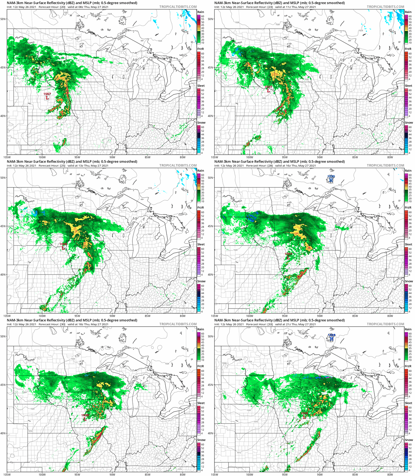
The low-pressure center tracks through Iowa Thursday. The rain shield will spread from southwest Minnesota Thursday morning into the Twin Cities during the morning hours and across most of central and southern Minnesota during the day. Basically, it will rain from about Lake Mille Lacs southward.
The National Oceanic and Atmospheric Administration’s NAM 3 km resolution model paints the rain zone moving across central and southern Minnesota Thursday. There may be a few embedded thundershowers across southern Minnesota.
Turn Up Your Support
MPR News helps you turn down the noise and build shared understanding. Turn up your support for this public resource and keep trusted journalism accessible to all.
Soaking rains
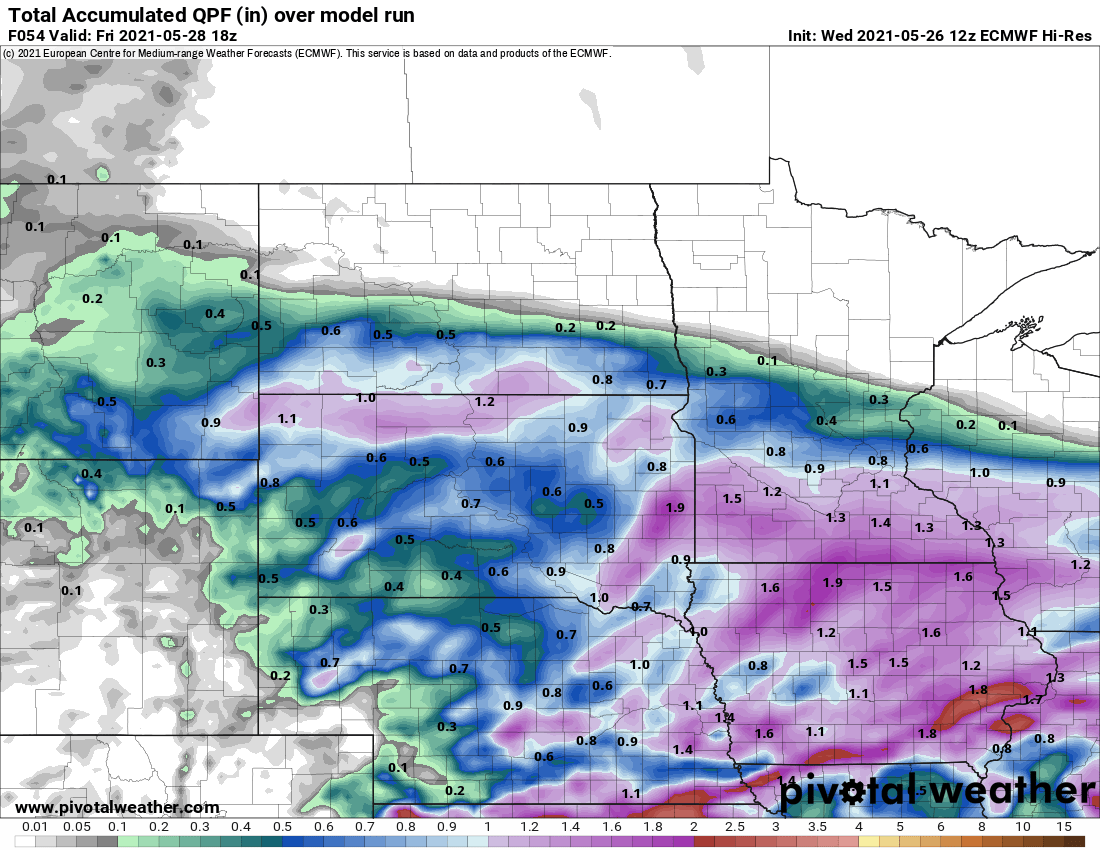
Overall rainfall totals look plentiful across central and southern Minnesota Thursday. By Friday morning, anywhere from .50” to 1” is likely with some local rainfall totals over an inch.
A few showers may linger across southern Minnesota early Friday morning. But the trend will be for direr and sunnier skies as we move through Friday and into Saturday.
Chilly though Friday
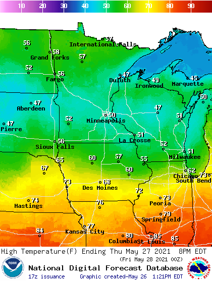
The rain and clouds will hold temperatures in the 50s across Minnesota Thursday.
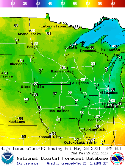
By Friday, increasing sunshine will help temperatures moderate into the low 60s in many locations.
I’ll post a detailed look at the Memorial Day weekend forecast later today.

