
Storms likely across northern Minnesota overnight
Some storms may pack hail, high winds and downpours
Go Deeper.
Create an account or log in to save stories.
Like this?
Thanks for liking this story! We have added it to a list of your favorite stories.


It’s likely to be a stormy Monday night and stormy early Tuesday morning across parts of northern Minnesota.
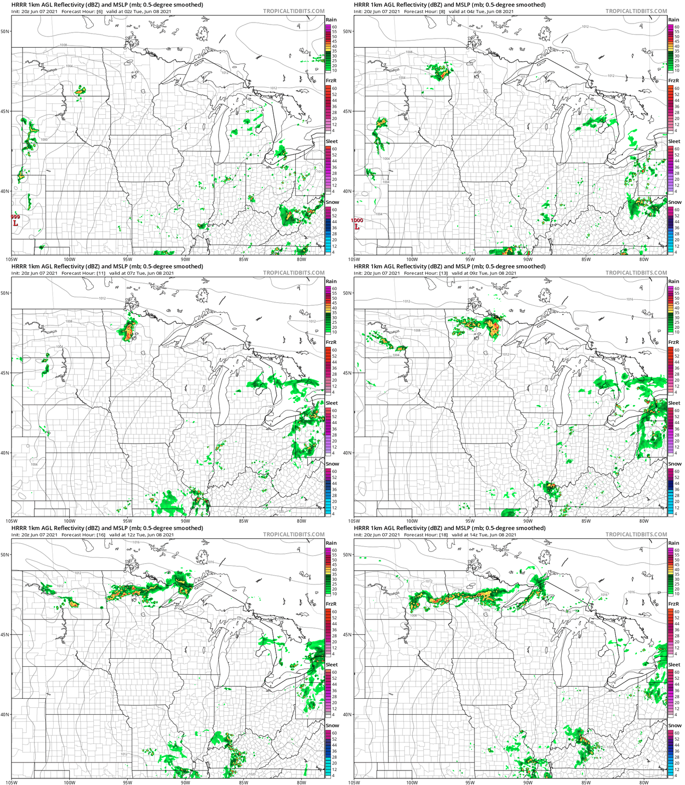
A frontal zone dividing intense heat to the south and milder air to the north is the breeding ground for scattered thunderstorms overnight.
NOAA’s HRRR model depicts the notion of scattered strong storm clusters moving from northwest Minnesota Monday night across northern Minnesota during the early Tuesday morning hours. This forecast loop below runs from 7 p.m. Monday evening to 9 a.m. Tuesday.
NOAA’s Storm Prediction Center paints a slight risk for severe storms (yellow) from the Red River Valley eastward across much of northern Minnesota. A marginal risk (green) surrounds the slight risk zone.

Here’s a reminder of what the various levels of severe weather risk mean:

Be prepared for occasional thunderstorms across Minnesota overnight into early Tuesday morning. A few storms could reach severe limits.
Turn Up Your Support
MPR News helps you turn down the noise and build shared understanding. Turn up your support for this public resource and keep trusted journalism accessible to all.

