
Searching for rain: Scattered strong thunderstorms likely late Wednesday and Thursday
Rainfall looks localized but could produce an inch in some areas
Go Deeper.
Create an account or log in to save stories.
Like this?
Thanks for liking this story! We have added it to a list of your favorite stories.


It looks like a rainfall lottery the next two days across Minnesota. Some lucky winners will get a decent soaking. But overall rainfall coverage looks spotty.
Opportunity 1: Spotty storms late Wednesday
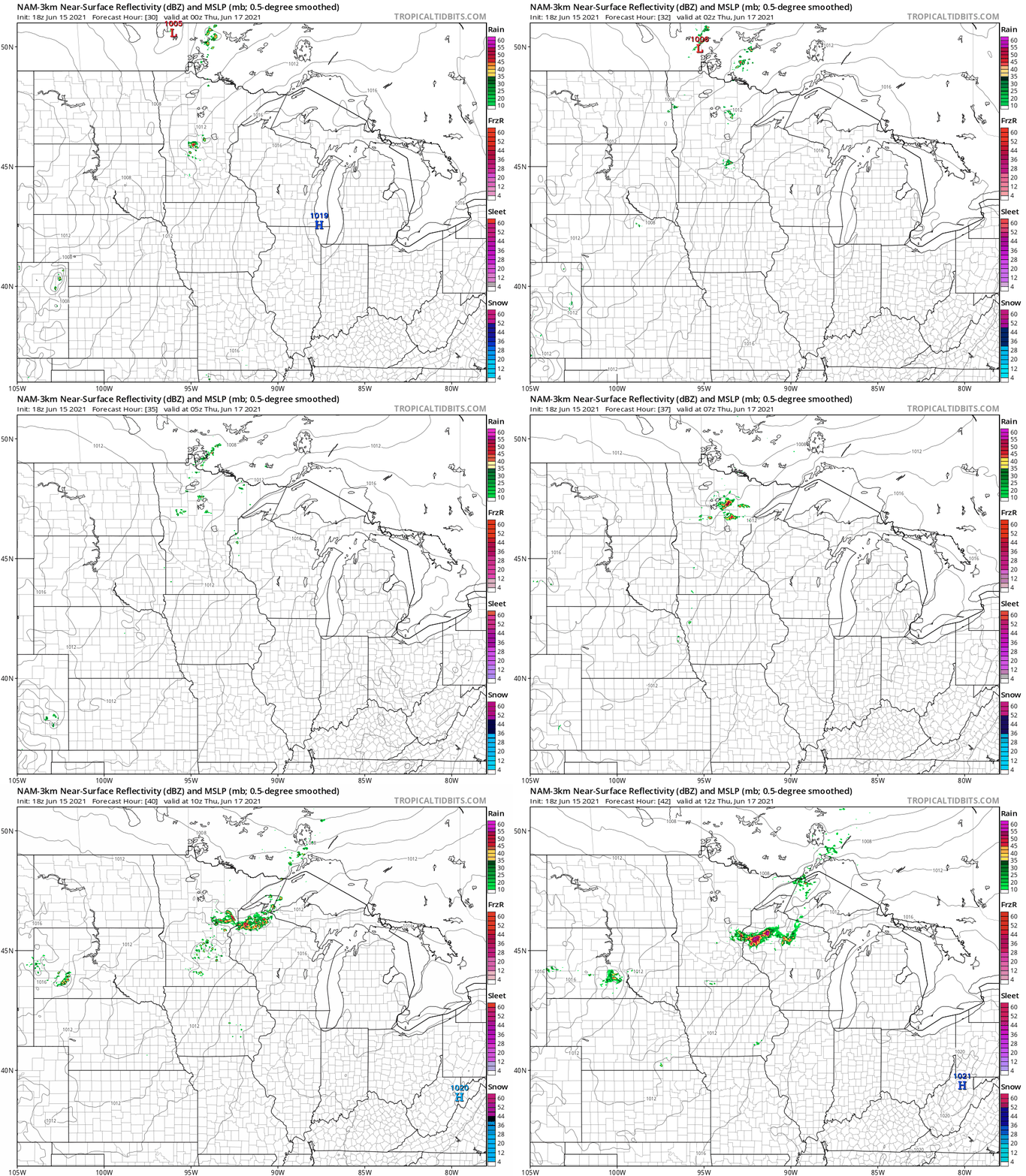
A weak weather wave drifts south across Minnesota Wednesday. It should be strong enough to produce a few spotty thunderstorms drifting southward especially late Wednesday afternoon and evening.
NOAA’s NAM 3 km resolution model catches the spotty potential thunderstorm blips between 7 p.m. and Wednesday and 1 a.m. Thursday.
Opportunity 2: Thursday
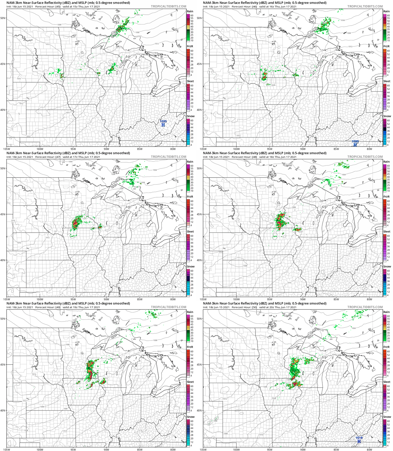
Thunderstorm clusters may become a bit more widespread by midday Thursday across southern Minnesota. This time NOAA’s NAM model (and others) paint the possible thunder zone further south across southern Minnesota. The NAM 3k has the northern edge of the thunder complex clipping the Twin Cities, with the best chance for stronger storms across southern Minnesota to the south.
Turn Up Your Support
MPR News helps you turn down the noise and build shared understanding. Turn up your support for this public resource and keep trusted journalism accessible to all.
Rainfall potential
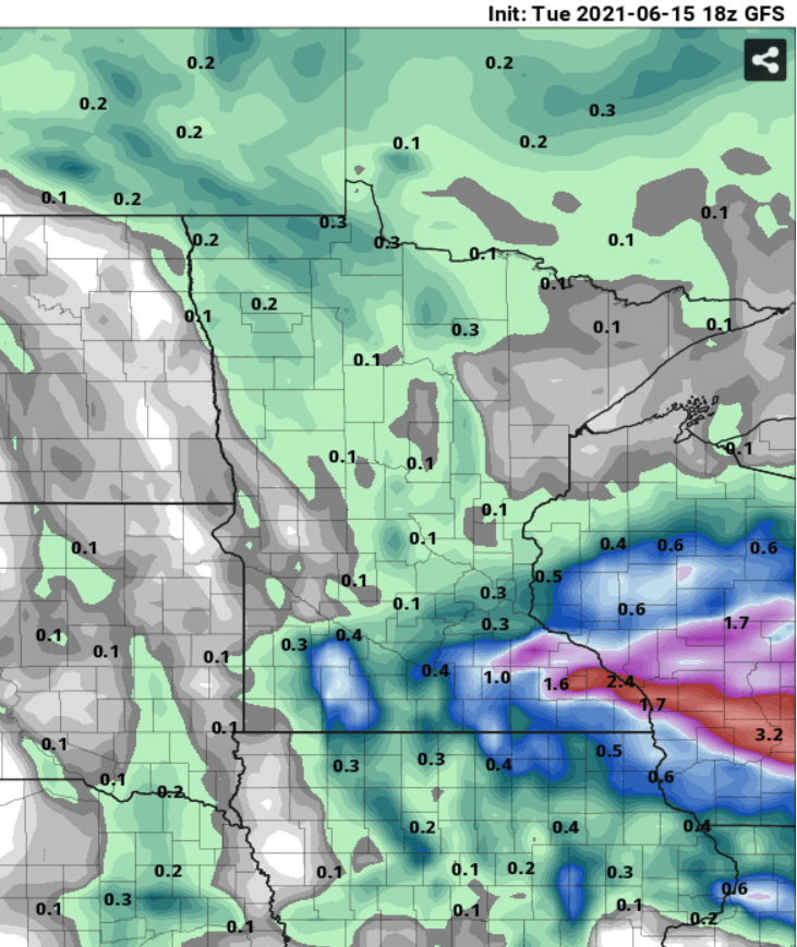
Precise spatial and quantitative rainfall forecasting with summer convective storms is rarely possible. But getting a general idea of where heavier rainfall is likely is usually useful. Most forecast model output through Thursday favors the best chance for a soaking rain south of the Twin Cities along the I-90 corridor in places like Rochester, Minn. and La Crosse, Wisc.
There is a marginal severe risk for much of Minnesota Wednesday and a marginal to slight risk for southeast Minnesota Thursday.
Opportunity 3: Sunday into Monday
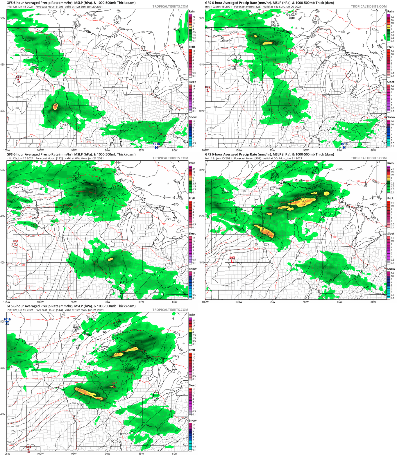
A much better and potentially more widespread chance for meaningful rains appears on the forecast maps Sunday and Monday. Most models including the European and American GFS favor more widespread rain and thunder with significant rain potential.
NOAA’s GFS model paints numerous rain and thunder patches crossing the Upper Midwest Sunday into Monday morning.
By next Tuesday the European model cranks out more widespread 1 inch rainfall totals, with some multi-inch blotches possible.
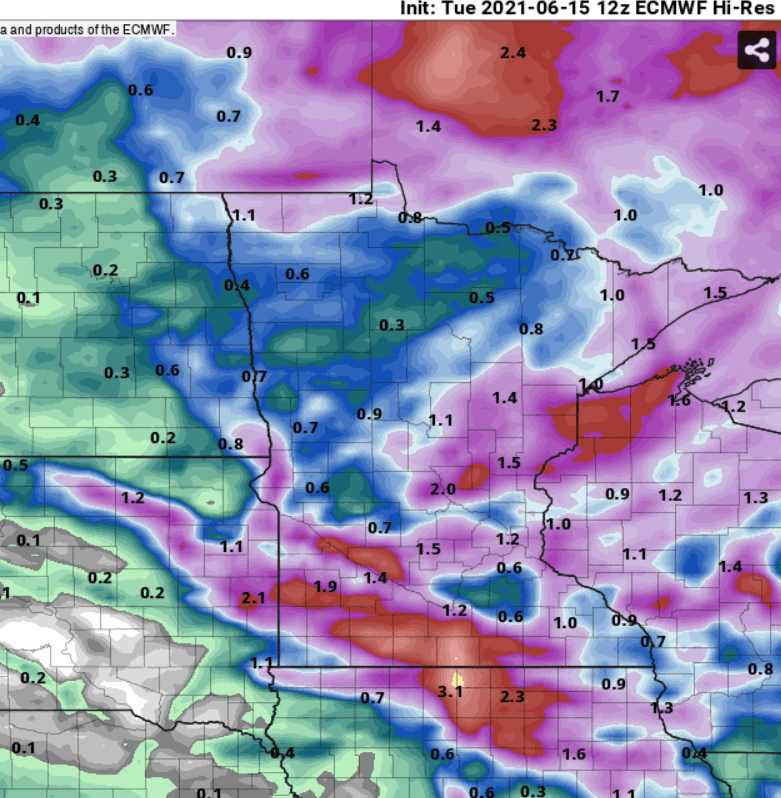
So while this does not appear to be enough to stave off a growing drought overall, some lucky spots could pick up an inch or more of rain in the next week.
Stay tuned.

