
Fire weather watch Friday; rain chances increase Sunday
The weather pattern is beautiful, but most of us need rain

Go Deeper.
Create an account or log in to save stories.
Like this?
Thanks for liking this story! We have added it to a list of your favorite stories.


This is one of those forecasts I’d love to feel better about. Most summers we’d be trumpeting bright sunny days with highs in the 80s and low humidity.
But singing the praises of great weather this summer with our nagging and deepening drought and elevated fire danger across Minnesota sounds a little tone-deaf, to say the least. I enjoy these beautiful days as much as anyone. But with water restrictions now in place in many communities and farm fields rapidly drying out, I know there are real consequences of our growing drought.
Fire weather watch Friday
Friday brings another warm dry and breezy day across most of Minnesota. That’s triggered a fire weather watch for much of Minnesota Friday.
URGENT - FIRE WEATHER MESSAGE National Weather Service Twin Cities/Chanhassen MN
354 PM CDT Thu Jun 17 2021
...CRITICAL FIRE WEATHER CONDITIONS POSSIBLE FRIDAY AFTERNOON...
.West winds 15 to 20 mph with gusts around 30 mph, afternoon humidity around 20 percent, and the ongoing drought will result in possible critical fire weather conditions Friday afternoon.
Douglas-Todd-Morrison-Mille Lacs-Kanabec-Stevens-Pope-Stearns- Benton-Sherburne-Isanti-Chisago-Lac Qui Parle-Swift-Chippewa- Kandiyohi-Meeker-Wright-Hennepin-Anoka-Ramsey-Washington- Yellow Medicine-Renville-McLeod-Carver-
354 PM CDT Thu Jun 17 2021 ...FIRE WEATHER WATCH IN EFFECT FROM FRIDAY AFTERNOON THROUGH FRIDAY EVENING FOR GUSTY WINDS AND LOW HUMIDITY FOR CENTRAL MINNESOTA...
The National Weather Service in Twin Cities/Chanhassen has issued a Fire Weather Watch, which is in effect from Friday afternoon through Friday evening.
* AFFECTED AREA...Central Minnesota.
* WIND...West 15 to 20 mph with frequent gusts around 30 mph.
* HUMIDITY...Around 20 percent.
* IMPACTS...Any fires that develop will likely spread rapidly. Outdoor burning is not recommended.
PRECAUTIONARY/PREPAREDNESS ACTIONS... A Fire Weather Watch means that critical fire weather conditions are forecast to occur. Listen for later forecasts and possible Red Flag Warnings.
Sunny Friday and Saturday
Bright sunshine returns Friday and Saturday to most of Minnesota. Highs push the 90-degree mark in southern Minnesota Friday with 70s common up north.
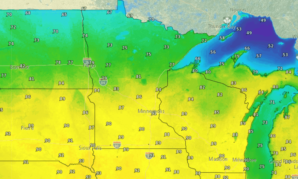
By Saturday, temperatures will be more pleasant across Minnesota with lower 80s south and 60s up north.
Rain chance increases Sunday
Sunday offers the best hope of soaking rains for much of Minnesota. NOAA’s GFS model is among those showing the potential for more widespread shower and thunderstorm coverage Sunday.
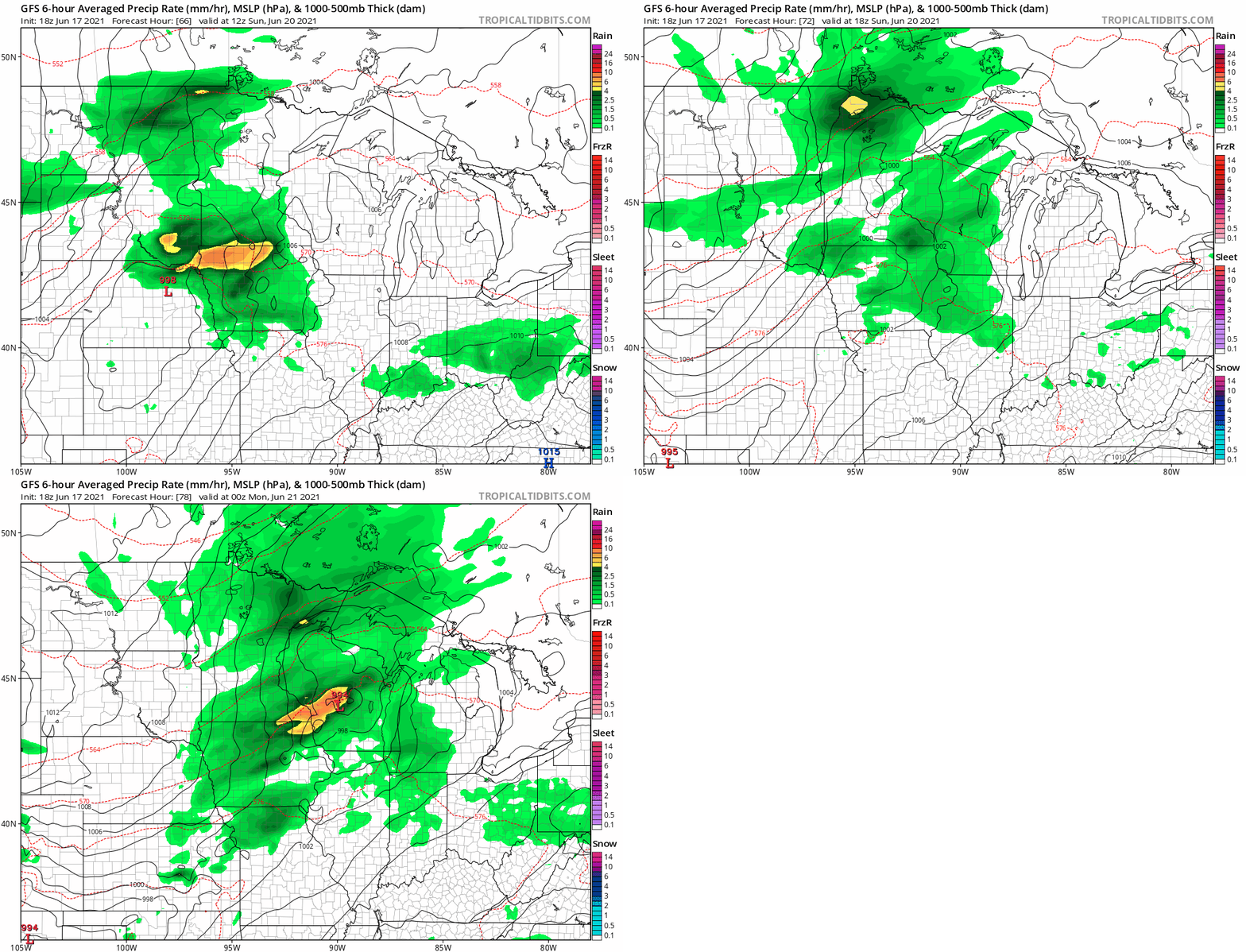
Next week starts cooler with highs in the 70s south and even some 50s and 60s north.
Turn Up Your Support
MPR News helps you turn down the noise and build shared understanding. Turn up your support for this public resource and keep trusted journalism accessible to all.

