Rain chances emerging Thursday and this weekend
Our warm weather pattern continues
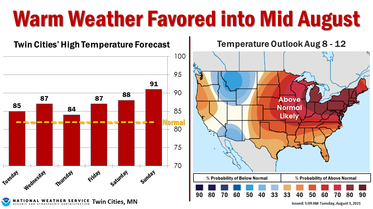
We’re searching the weather maps for rain this summer in Minnesota. It looks like we may have found some.
Two different weather systems will bring rain chances to Minnesota through the weekend. The first is a weak front that crosses Minnesota late Wednesday and Thursday.
NOAA’s GFS model paints scattered rain and some thunderstorms slowly crossing Minnesota from Wednesday evening through Thursday.
Overall rainfall totals look fairly spotty and light Thursday. Most areas are likely to see less than a quarter inch Thursday.
Create a More Connected Minnesota
MPR News is your trusted resource for the news you need. With your support, MPR News brings accessible, courageous journalism and authentic conversation to everyone - free of paywalls and barriers. Your gift makes a difference.
Weekend thunder
A better chance for more significant rain arrives this weekend when a low-pressure wave tracks across northern Minnesota. Scattered waves of rain and thunder are more likely and coverage looks more widespread.
The Canadian model paints occasional rain zones this weekend.
The forecast models are still grabbing hold of various notions of rainfall coverage and totals through this weekend. To my eye, the European model seems to have a good handle on the possible distribution and amount of rainfall. It suggests widespread half to 1 inch totals across most of Minnesota, with local totals to 2 inches.
We’ll keep an eye out for changes in possible rainfall distribution as the week moves forward.