
Scattered thunderstorms into Tuesday, free AC ahead this week
A cool front sweeps in a cooler and much less humid air mass this week.
Go Deeper.
Create an account or log in to save stories.
Like this?
Thanks for liking this story! We have added it to a list of your favorite stories.


Get ready for a change of air masses this week Minnesota.
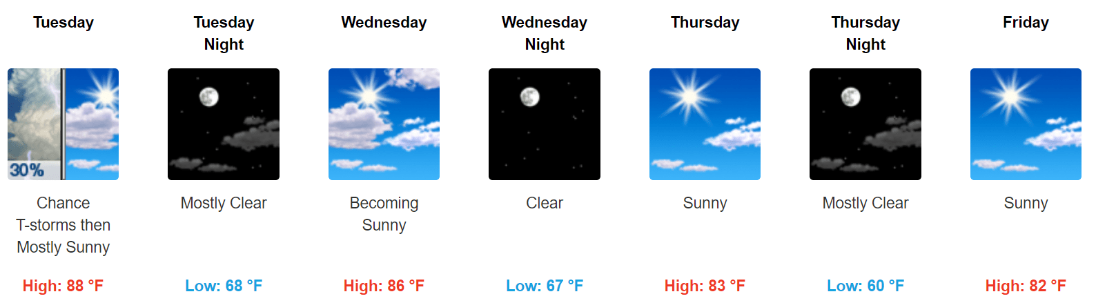
A cool front will trigger some scattered strong storms favoring the northern half of Minnesota and Wisconsin Monday and Tuesday. Then northwest breezes will kick in statewide by Wednesday pumping in much less humid air into Minnesota for the rest of the week.
If we can avoid another thick smoke invasion from Canada, this could be one of the most pleasant air masses of the summer for Minnesota.
Thunderstorm chances into Tuesday
A cool front cutting into the warm humid air mass currently over Minnesota will trigger some strong to potentially severe storms favoring the Red River Valley and northwest Minnesota into Tuesday morning.
Turn Up Your Support
MPR News helps you turn down the noise and build shared understanding. Turn up your support for this public resource and keep trusted journalism accessible to all.
The National Oceanic and Atmospheric Administration’s Storm Prediction Center paints a slight risk for severe storms across that region.

NOAA’s HRRR model develops a line of storms moving through the Red River Valley this evening. The loop below runs from 7 p.m. Monday to 9 a.m. Tuesday.
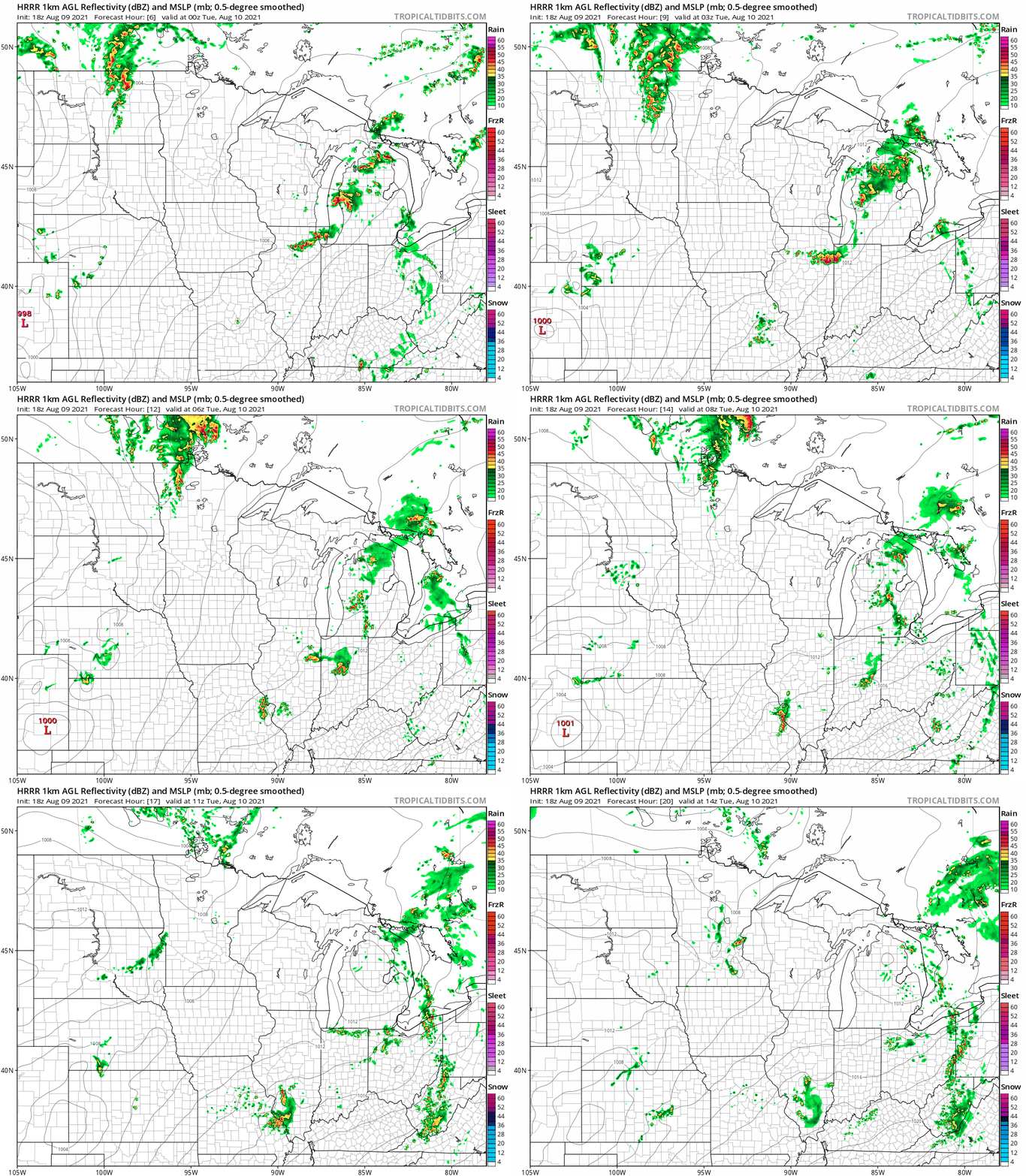
There is a chance an insolated thunderstorm could survive the trip into the greater Twin Cities area early Tuesday morning. The highest risk for severe storms Tuesday is across Wisconsin and the system moves east.

Free AC ahead
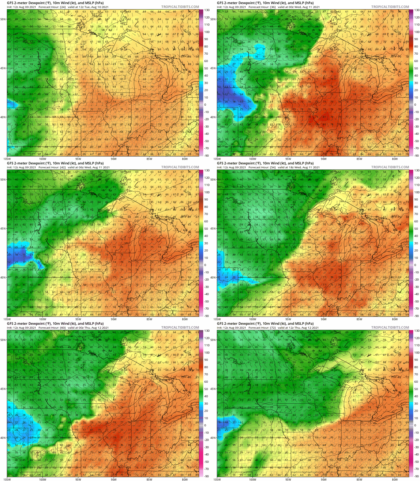
Behind the cool front, northwest winds will pump in a cooler and much drier air mass into Minnesota this week. Watch how tropical dew points near 70 degrees near the Twin Cities Tuesday are shoved eastward and replaced by arid dew points in the 30s and 40s Wednesday and Thursday across the Upper Midwest on NOAA’s GFS model.
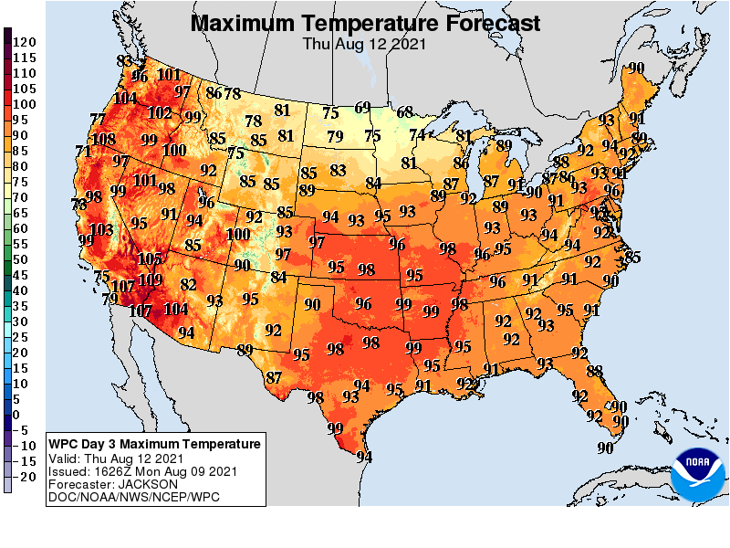
High temperatures will fall into the 70s north and low 80s south by Thursday.
Overnight lows will dip into the cool upper 40s and low 50s up north by Friday morning.
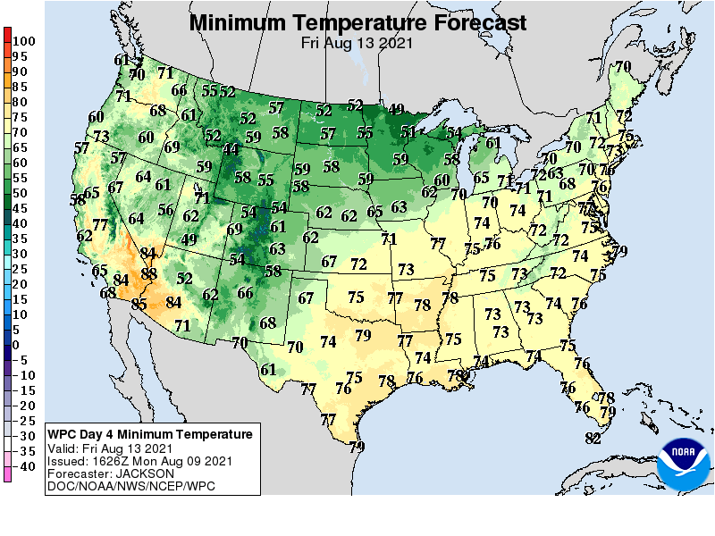
Enjoy the free AC later this week.

