
A few thunderstorms overnight, then another long dry spell ahead for Minnesota
Recent rains helped some areas, but drought will deepen in the next week.

Go Deeper.
Create an account or log in to save stories.
Like this?
Thanks for liking this story! We have added it to a list of your favorite stories.


A narrow band of showers and thunderstorms may cross Minnesota overnight into Wednesday morning. NOAA’s HRRR model above shows a narrow line of showers and possible thunderstorms crossing the state between 1 a.m. and 7 a.m. Wednesday.
After that fleeting rain chance, the forecast maps strongly favor another dry week ahead for most of Minnesota. And that means our ongoing drought will deepen in many areas over the next week or two.
Recent rains helped crops
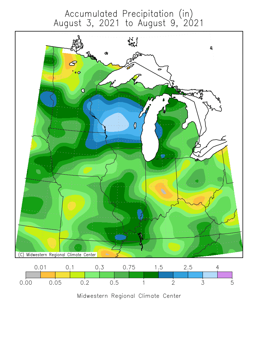
Last weekend’s abundant rains focused mainly on southern Minnesota. Many growing areas picked up 1 to more than 2 inches of rainfall in the last week.
That was enough to help many crops maintain growth. Minnesota crop report this week shows that 71 percent of Minnesota’s corn is in fair to good condition, with 5 percent in excellent condition. Soybeans show similar development.
Turn Up Your Support
MPR News helps you turn down the noise and build shared understanding. Turn up your support for this public resource and keep trusted journalism accessible to all.
Here’s more detail from the report:
Topsoil moisture supplies were rated 39 percent very short, 41 percent short, 19% adequate and 1 percent surplus. Subsoil moisture supplies were rated 38 percent very short, 44 percent short, 18 percent adequate and 0 percent surplus.
Corn in the dough stage reached 44 percent, four days behind last year and one day behind the average.
Corn condition remained at 36 percent good to excellent. Soybeans setting pods reached 84 percent, two days behind last year but 3 days ahead of average. Soybean condition remained unchanged at 34 percent good to excellent.
Though crops have benefitted from recent rains, it’s not enough to raise water levels in many area lakes, ponds and rivers. Surface water across Minnesota remains at near-record-low levels in many areas.
Many areas in northern Minnesota received little rainfall in the past week.
Another dry forecast
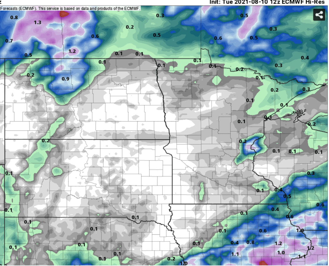
The upper air pattern over North America over the next week favors mostly dry weather for the Upper Midwest. Forecast models print out very little precipitation across Minnesota and the Dakotas through Tuesday.
Here’s the European model precipitation output through Tuesday.
Thursday’s U.S. Drought Monitor product is likely to show drought deepening across many parts of Minnesota.
We’re going to need a significant and persistent pattern change in the next couple of months to dig out of this summer’s deepening drought. many areas are 6 inches below average rainfall this summer.
Stay tuned.

