
Greenwood Fire forecast: Southerly winds shift to westerly Saturday. Spotty rain Friday night
Spotty rain chances and a wind shift ahead for the Greenwood Fire zone.
Go Deeper.
Create an account or log in to save stories.
Like this?
Thanks for liking this story! We have added it to a list of your favorite stories.


There’s a change in weather conditions ahead for the Greenwood Fire zone in northeast Minnesota.
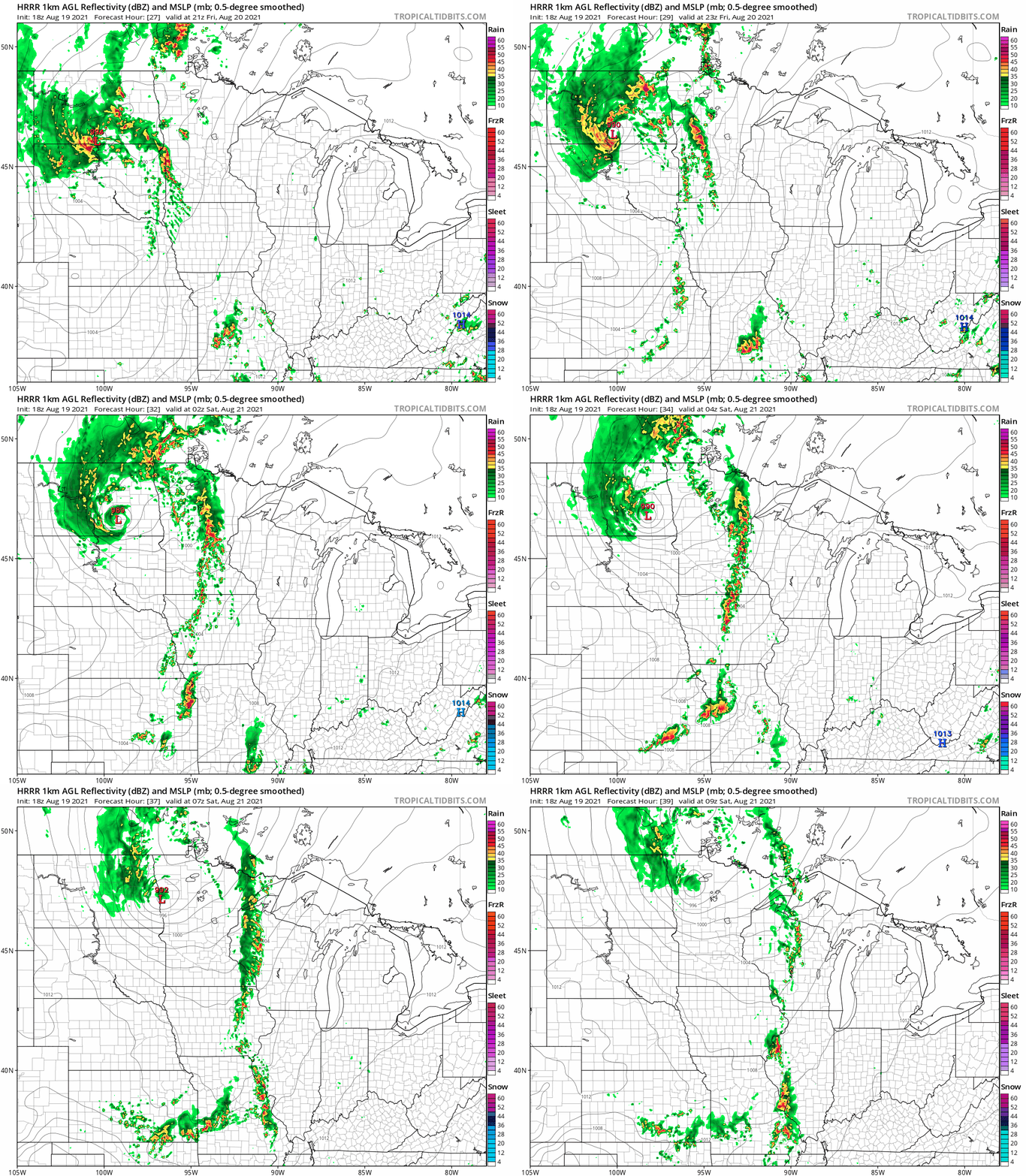
A cold front approaching the state will trigger showers and thunderstorms in western Minnesota Friday afternoon. The storm zone will shift east Friday night and also weaken some as it moves into eastern Minnesota.
NOAA’s HRRR model tracks the thunder zone eastward through Minnesota late Friday. The loop below runs from 4 p.m. Friday to 4 a.m. Saturday.
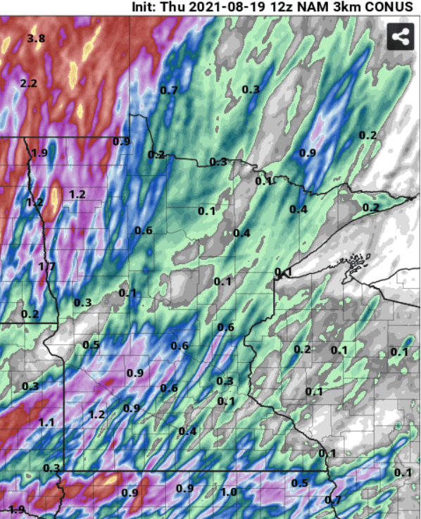
Rainfall totals look impressive for the worst drought areas in northwest Minnesota, where multi-inch totals could fall. But storms will become spotty and deliver less rain in the east. Here’s NOAA’s NAM 3 km model’s rainfall output through 7 p.m. Saturday.
Turn Up Your Support
MPR News helps you turn down the noise and build shared understanding. Turn up your support for this public resource and keep trusted journalism accessible to all.
Westerly winds Saturday
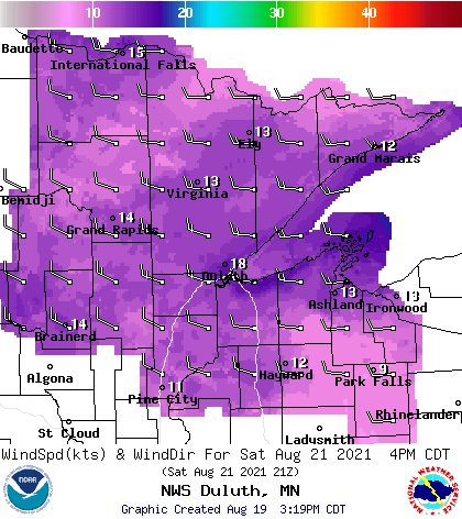
The persistent southerly winds we’ve seen this week will shift and blow from the west behind the front Saturday.
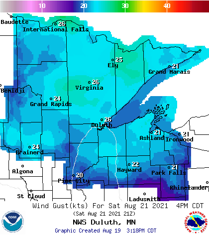
Winds Saturday will run between 15 and 25 mph with gusts over 30 mph likely in the fire zone Saturday. Here are the forecast wind gusts at 4 p.m. Saturday. Keep in mind that gusts can be higher in the fire zone as intense updrafts enhance gust potential.
Combine the gusty west winds with lower dew points and humidity in the drier inbound air mass, and we could see the Greenwood Fire push aggressively eastward Saturday afternoon.
Residents east of the fire zone toward Isabella and Finland will want to pay especially close attention to fire information and weather forecasts for Saturday.

