
Weather bliss through Wednesday. Rain chances return Thursday into Friday.
August temperatures running 2 to 4 degrees warmer than average across Minnesota.

Go Deeper.
Create an account or log in to save stories.
Like this?
Thanks for liking this story! We have added it to a list of your favorite stories.


Our weather pattern early this week is a pleasant departure from last week’s seemingly incessant storms.
High pressure brings sunshine and pleasant temperatures to Minnesota through Wednesday. Highs will be mostly in the 70s with a few 80s Tuesday and Wednesday.
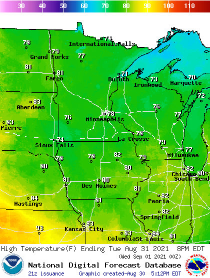
Our next rain chances arrive Thursday. A frontal system will spawn scattered rain and thunder across most of Minnesota Thursday.
The National Oceanic and Atmospheric Administration’s Global Forecast System model paints areas of rain moving across the state between midnight Wednesday through 7 a.m. Friday.
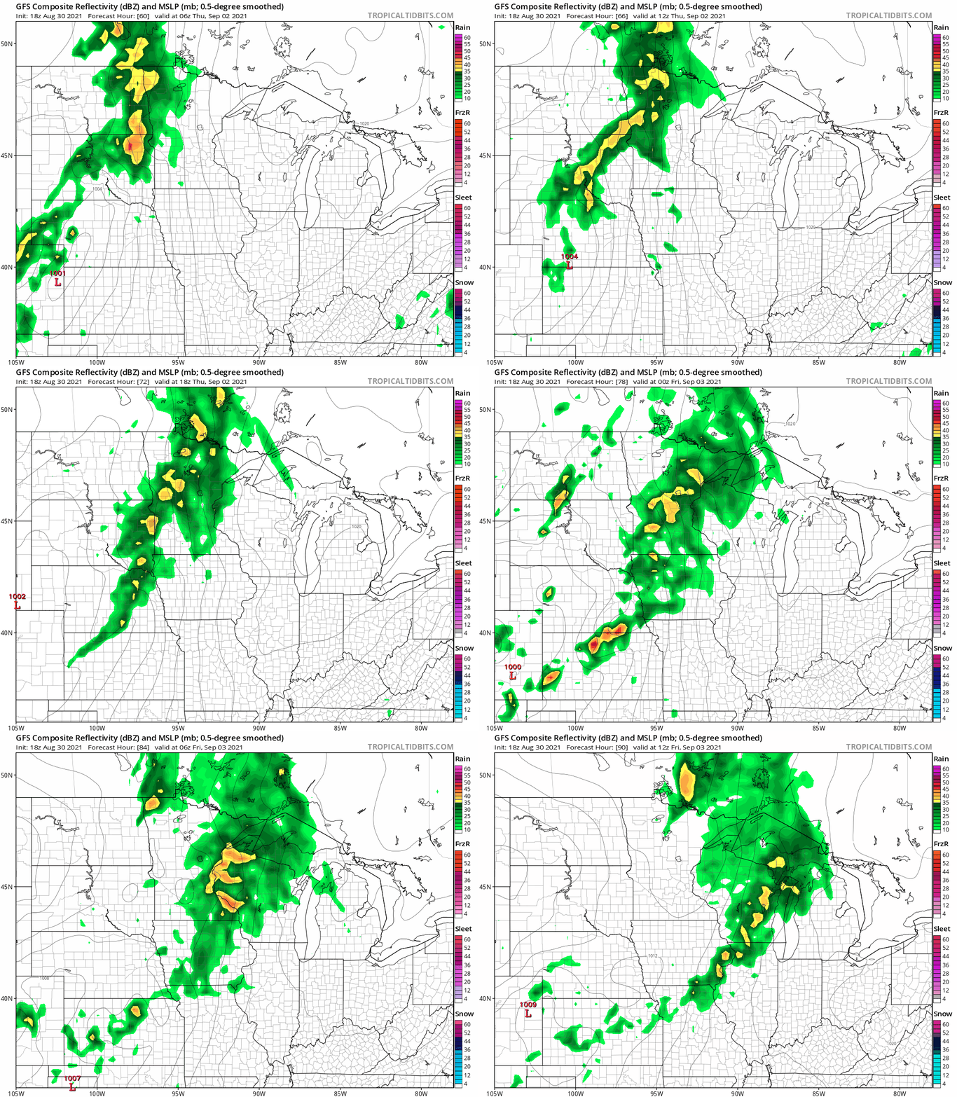
It’s still too early to get a precise gauge on rainfall potential for later this week. The Canadian model’s early read suggests that many locations could get one-half inch with an inch or more across parts of northern Minnesota.

Now that much of Minnesota has had significant rainfall, we can enjoy our pleasantly dry and warm weather a little more this week.
Turn Up Your Support
MPR News helps you turn down the noise and build shared understanding. Turn up your support for this public resource and keep trusted journalism accessible to all.

