
Another shot of rain Thursday; above average Labor Day weekend
Western Minnesota could see 1 to 3 inches of rain. Less in eastern Minnesota.
Go Deeper.
Create an account or log in to save stories.
Like this?
Thanks for liking this story! We have added it to a list of your favorite stories.


September and meteorological fall got off to a lovely start Wednesday.
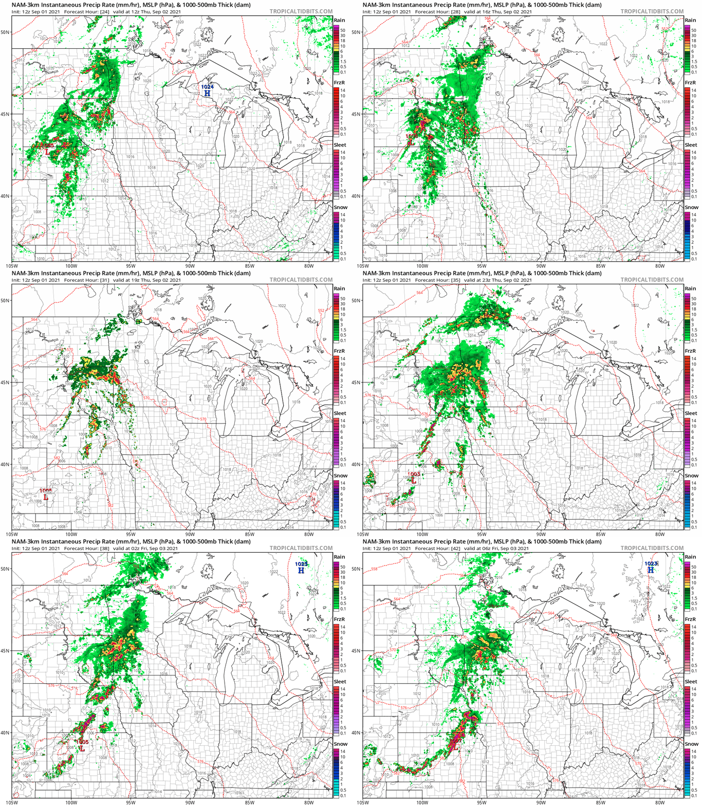
Thursday brings our next rainmaker to Minnesota. Scattered rain and thunder move into western Minnesota Thursday morning and midday. Rain will slowly push east into eastern Minnesota by late evening. Most forecast models hold off rain in the Twin Cities and northeast Minnesota until after dark or later.
NOAA’s NAM 3 km resolution model paints the rain zones from Thursday morning to after midnight early Friday.
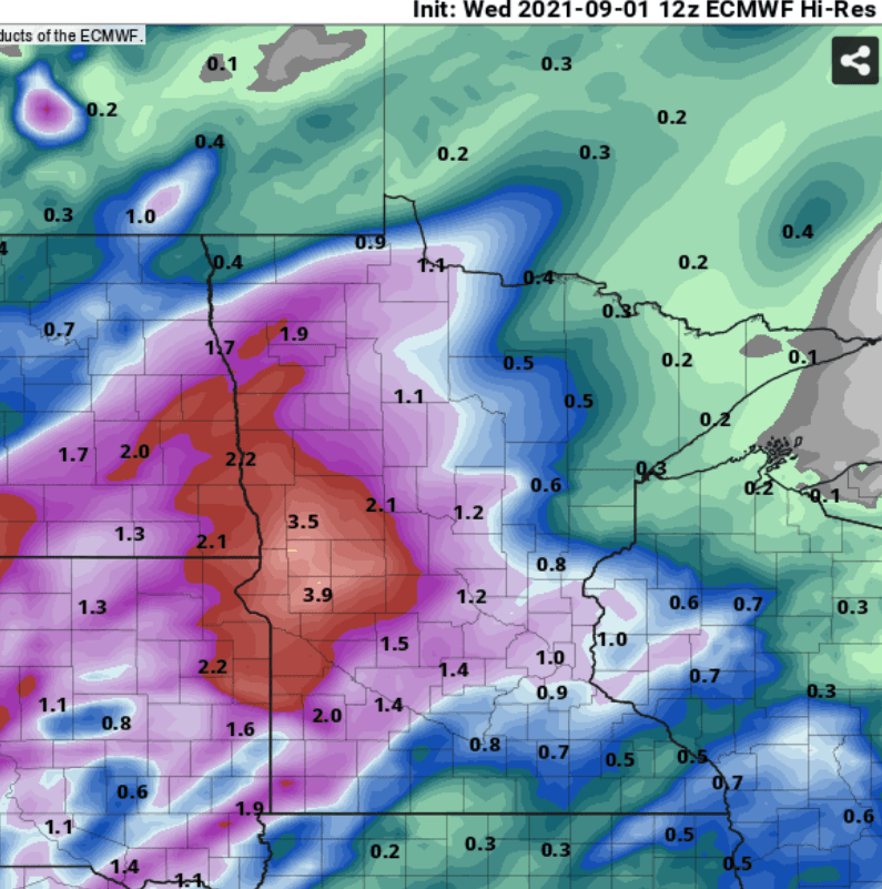
Overall rainfall totals look heaviest in western Minnesota, where 1 to 3 inches plus could fall. The system will likely produce less rain in eastern Minnesota. The Twin Cities looks likely to pick up 0.5 inch to as much as an inch locally. And northeast Minnesota could receive the least rain, unfortunately, with less than 0.25 to 0.5 inch likely.
Here’s the European model rainfall output.
Above-average Labor Day weekend
Labor Day weekend is climatologically the driest of the big three summer holiday weekends. This year looks pleasantly cool and mostly dry.
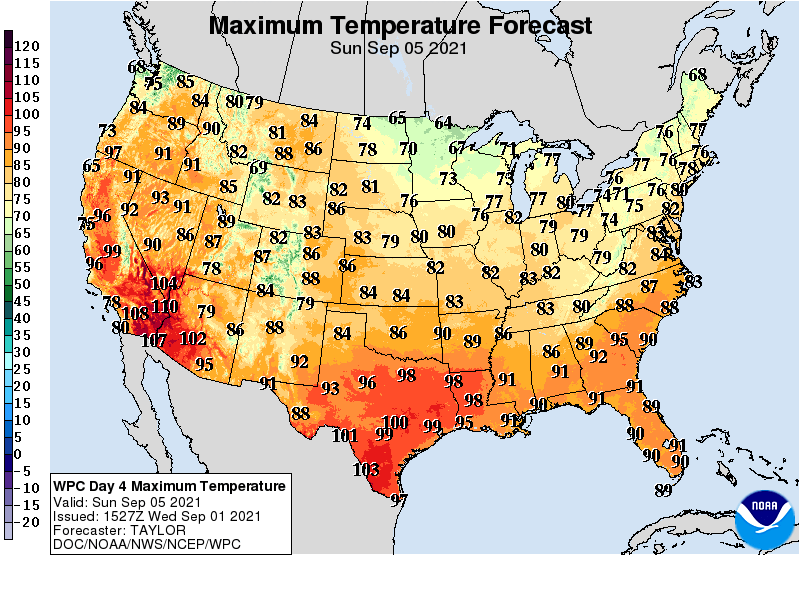
Skies bring a mix of sun and clouds with only spotty shower chances Saturday. Highs run in the 70s south and 60s north this weekend.
Turn Up Your Support
MPR News helps you turn down the noise and build shared understanding. Turn up your support for this public resource and keep trusted journalism accessible to all.

