
September sky: Breezy and mild, a few spotty showers Wednesday
It's a mashed potato sky above Minnesota today. Lumpy cumulus clouds may leak a few isolated showers.

Go Deeper.
Create an account or log in to save stories.
Like this?
Thanks for liking this story! We have added it to a list of your favorite stories.


It’s a classic September sky above Minnesota today.
Our breezy and cooler northwest flow, combined with still potent early September sunshine is perfect for billowing cloud towers this afternoon.
A few of those puffy clouds will build high enough to produce some isolated passing showers. You may even hear a thunder clap in the stronger cells.
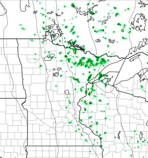
NOAA’s WRF model shows blotches of green indicating isolated pop-up showers across eastern Minnesota and Wisconsin Wednesday afternoon.
Best air mass of the year this week?
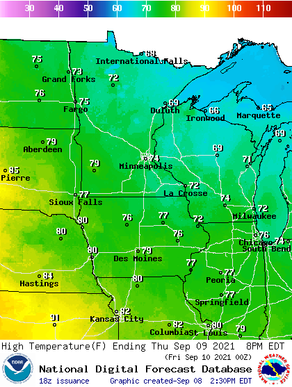
Our inbound air mass is one of the most pleasant of the year in Minnesota. Thursday brings another glorious weather day. Highs will run in the 70s this week across most of Minnesota with a few upper 60s up north. With dew points mostly in the 50s, this air is nearly ideal for human comfort.
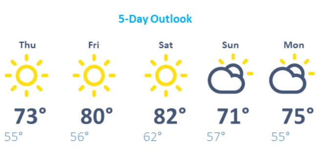
It’s a windows open forecast this week.
Turn Up Your Support
MPR News helps you turn down the noise and build shared understanding. Turn up your support for this public resource and keep trusted journalism accessible to all.

