
Spectacular November weekend ahead; rain or snow late next week?
60s return this first weekend of November.
Go Deeper.
Create an account or log in to save stories.
Like this?
Thanks for liking this story! We have added it to a list of your favorite stories.


One more time.
Minnesota will enjoy yet another spectacular autumn weekend for this first weekend of November. Southerly winds blow a milder air mass into Minnesota starting on Friday. It won’t feel as warm with winds gusting to around 30 mph Friday in open areas, but highs will climb through the 50s.
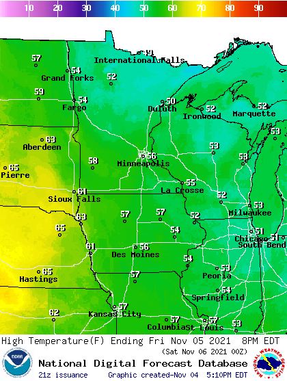
By Saturday highs will reach the 60s in southern Minnesota with 50s up north.

Sunday’s average high in the Twin Cities is 46 degrees. With highs into the mid-60s temperatures will be running about 20 degrees warmer than average Sunday. Some locations in southwest Minnesota could approach 70 degrees Sunday afternoon.

Rain or snow next week?
Forecast models still suggest a wetter weather system later next week. There is still a wide variance in suggest solutions between models. NOAA’s American GFS model brings a lead wave through on Wednesday with mostly rain, then a colder system Friday with the potential for accumulating snow. Again, don’t take this model output literally this far out, but use it as a guide to what type of weather conditions may occur late next week.
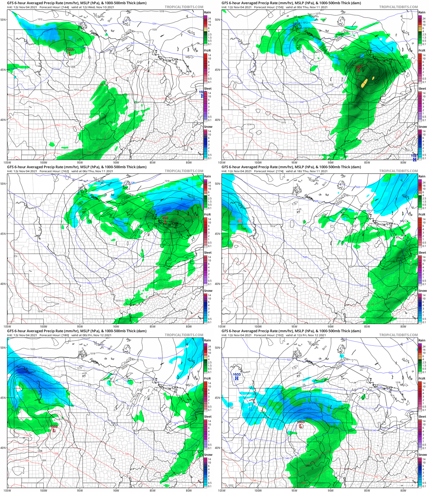
We’ll hopefully see more forecast model consensus on coverage and precipitation types in the coming days. But for now, the best actionable advice is to be aware of the possibility of rain or snow later next week.
Stay tuned.
Turn Up Your Support
MPR News helps you turn down the noise and build shared understanding. Turn up your support for this public resource and keep trusted journalism accessible to all.

