
Rain and snow Wednesday, wintry pattern change ahead
A major pattern change will bring some snow and much colder air to Minnesota.

Go Deeper.
Create an account or log in to save stories.
Like this?
Thanks for liking this story! We have added it to a list of your favorite stories.


Minnesota is about to get a reminder that we live at 45-degrees north latitude, and it’s mid-November.
A storm system blows rain into most of Minnesota Wednesday. It will be cold enough for mostly snow in far northern Minnesota.
Forecast models have been pretty consistent in delivering rain to most of the state, with the snow zone favoring far northern Minnesota Wednesday into early Thursday. Sub-freezing air on the backside of the system will blow snow showers through most of Minnesota Friday.
NOAA’s GFS model tracks the system through early Friday:
Turn Up Your Support
MPR News helps you turn down the noise and build shared understanding. Turn up your support for this public resource and keep trusted journalism accessible to all.
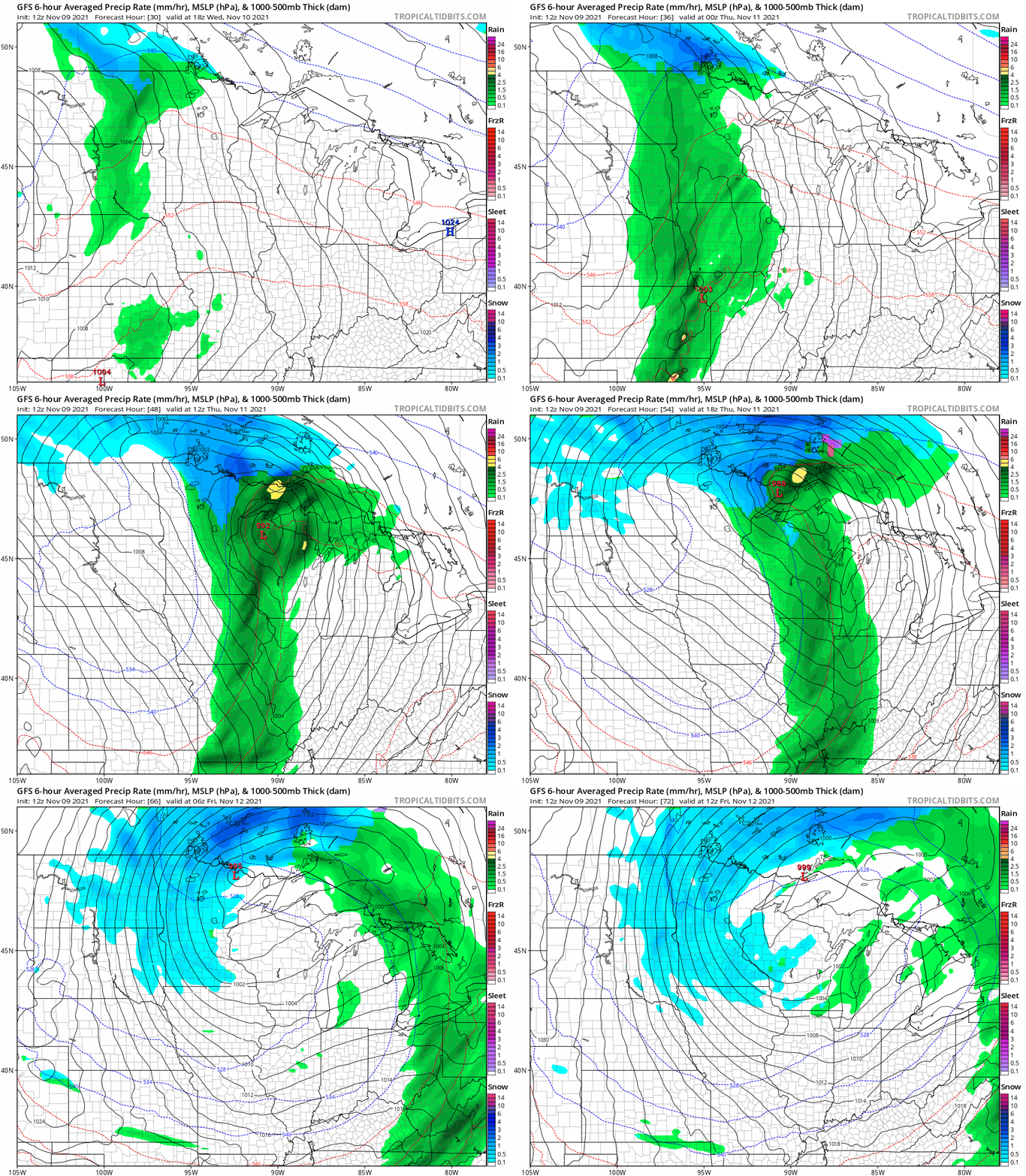
Accumulating, even plowable snow looks likely along the Canadian border region. A band of 3 to 6 inches looks likely from Lake of the Woods through International Falls. Snowfall totals will drop off as you move southward in Minnesota.
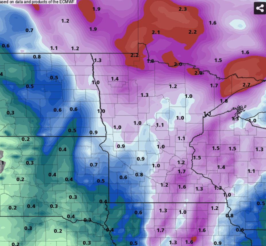
An inch of rain?
The consensus among forecast models favors an inch of rainfall across much of Minnesota by Friday. Most of the precipitation will fall as rain Wednesday into early Thursday south of the snow zone. The rest will fall as snow showers Friday in the colder wrap-around.
Here’s the European model precipitation output through Friday:
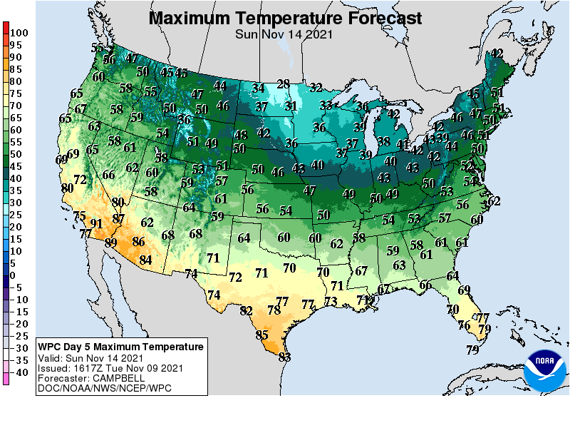
Much colder air
The air mass behind this system looks legitimately wintry. Highs this weekend will hover in the 30s across Minnesota.
Weekend Clipper?
Some, but not all, forecast models push a Clipper system into parts of Minnesota this weekend in the much colder air mass behind the first storm. NOAA’s GFS model pushes a potentially impressive snowmaker through North Dakota into southern Minnesota late Saturday into Sunday.
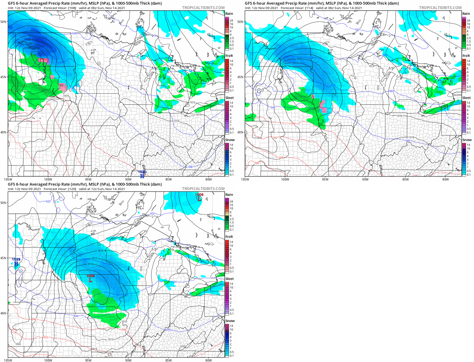
It’s still early, about four days out, so take this map with a grain of salt. But several inches of snow are possible from North Dakota into southern Minnesota if this system tracks as current forecast models suggest.
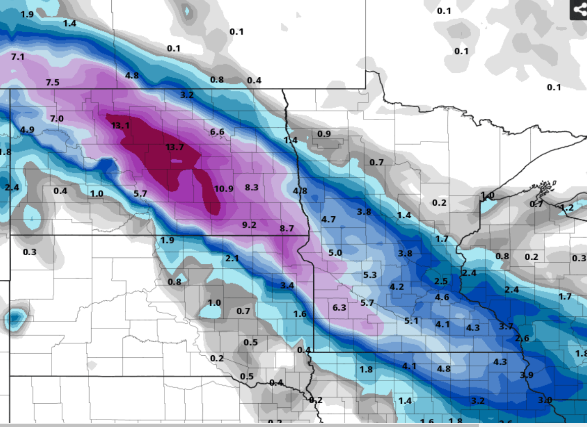
Things may look very wintry around much of Minnesota by Sunday.
Stay tuned as we track the likely forecast models variations over the next few days.

