
Plowable snow for northern Minnesota, gale warnings for Lake Superior
Rain and snow coverage increasing in Minnesota
Go Deeper.
Create an account or log in to save stories.
Like this?
Thanks for liking this story! We have added it to a list of your favorite stories.


Our well-advertised weather system is moving through Minnesota.
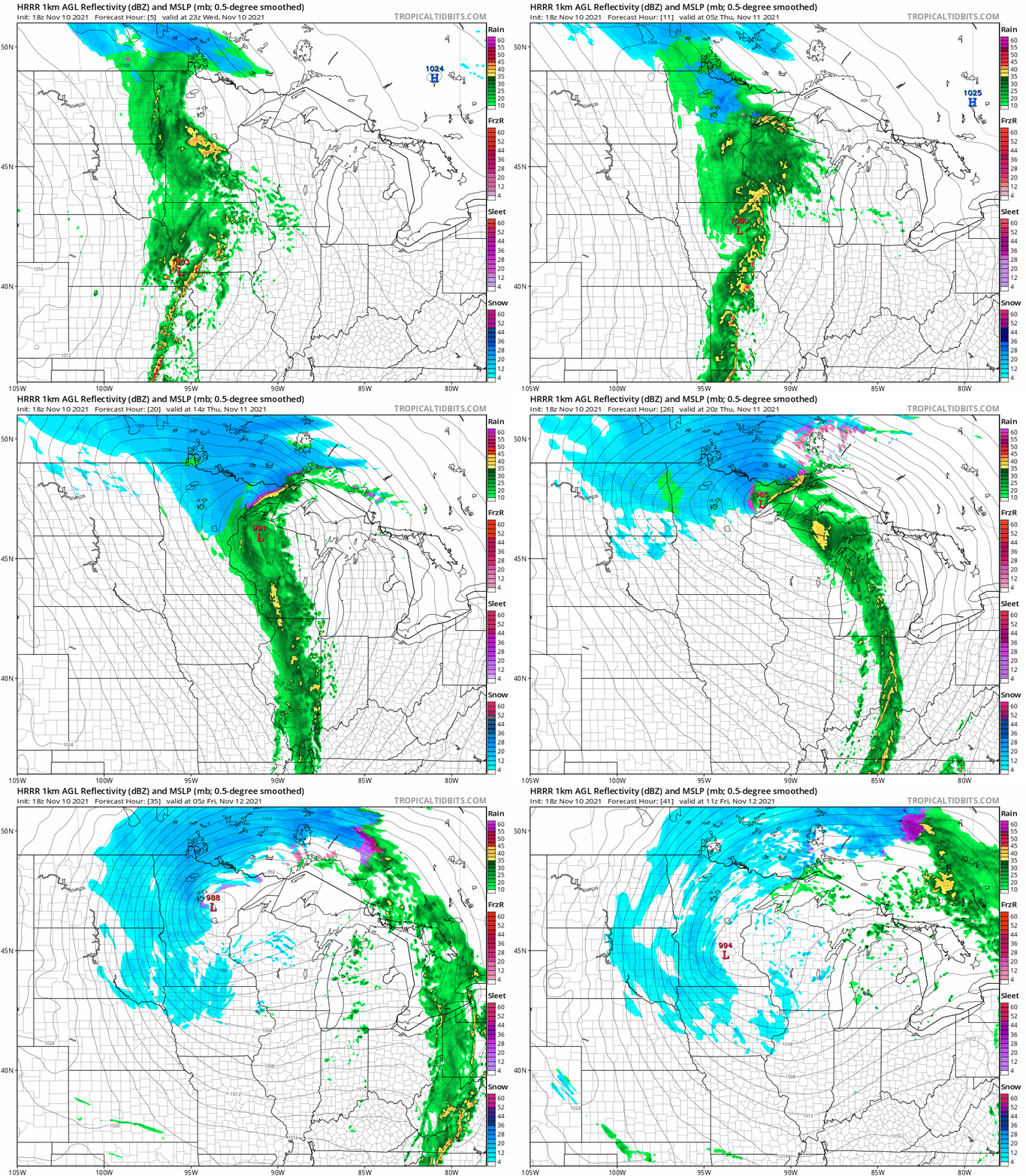
Rain is increasing in coverage around Minnesota Wednesday. The rain will change to snow across northern Minnesota as we move through Wednesday night and Thursday.
NOAA’s HRRR model shows the low-pressure system spinning through Iowa toward the North Shore, then looping back southward toward the Twin Cities area by Friday morning.
Plowable snow up north
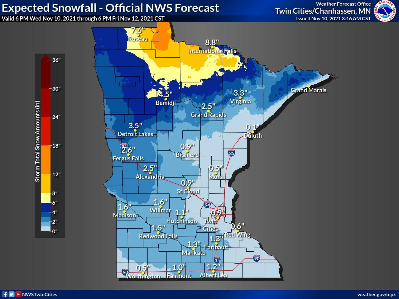
You can see on the loop above how snow will persist across north-central Minnesota. The southern end of the snow zone looks likely to deliver 1 to 3 inches of snow as far south as the Brainerd lakes area and Mille Lacs. The heaviest snowfall favors north-central Minnesota from Lake of the Woods through Internations Falls. That’s where 6 to 9 inches could fall by Friday.
Turn Up Your Support
MPR News helps you turn down the noise and build shared understanding. Turn up your support for this public resource and keep trusted journalism accessible to all.
Snow showers in the colder wrap-around behind the system should produce a coating to an inch or so from the Twin Cities westward by Friday morning.
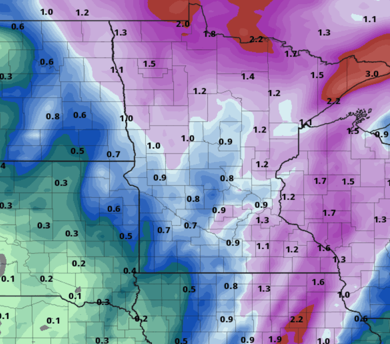
In the warmer portion of the storm, rainfall totals will approach 1 inch for much of eastern and northern Minnesota with this system. The highest precipitation totals will be a mix of rain and snow along the North Shore ridges, where 2 to 3 inches of precipitation could fall.
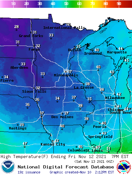
Temperatures behind the storm will plummet. Highs will hover in the 30s by Friday and through the weekend.
Gale warnings for Lake Superior
Strong easterly winds will run a long fetch of open water across Lake Superior into the North Shore. Big waves as high as 16 feet are forecast.
Grand Portage to Grand Marais MN- Grand Marais to Taconite Harbor MN
- 957 AM CST Wed Nov 10 2021
...SMALL CRAFT ADVISORY REMAINS IN EFFECT FROM 4 PM THIS AFTERNOON TO MIDNIGHT CST TONIGHT... ...GALE WARNING REMAINS IN EFFECT FROM MIDNIGHT TONIGHT TO 6 PM CST THURSDAY... ...SMALL CRAFT ADVISORY REMAINS IN EFFECT FROM 6 PM TO 9 PM CST THURSDAY...
* WHAT...For this afternoon and evening, east winds 15 to 25 kt with gusts up to 30 kt and waves 5 to 8 ft expected. For the Gale Warning overnight tonight and Thursday morning, east winds 20 to 30 kt with gusts up to 45 kt and waves 9 to 14 ft expected. Waves possibly up to 16 feet early Thursday.
* WHERE...Grand Portage to Grand Marais MN and Grand Marais to Taconite Harbor MN.
* WHEN...For the Gale Warning, from midnight tonight to 6 PM CST Thursday. For the Small Craft Advisory, from 4 PM this afternoon to midnight CST tonight, then again from 6 PM to 9 PM CST Thursday.
* IMPACTS...Strong winds will cause hazardous waves which could capsize or damage vessels and reduce visibility.
Here comes the big seasonal change, Minnesota.

