
Storm rages: Snow up north, flooded streets in Grand Marais
Winter storm warning for northern Minnesota

Go Deeper.
Create an account or log in to save stories.
Like this?
Thanks for liking this story! We have added it to a list of your favorite stories.


Our latest storm system leaves no doubt the season is changing.
A combination of wind, rain. and snow is blasting Minnesota. The low-pressure storm is stalled out and swirling along the North Shore. NOAA’s GFS model tracks the low and precipitation into Friday:
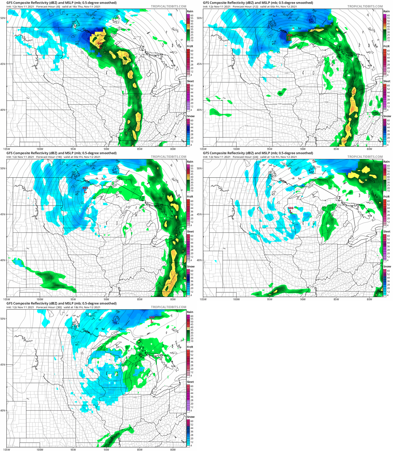
Winds have gusted to 52 mph in Grand Marais. Streets are flooded in the town Thursday.
Winter storm warnings are up for parts of northern Minnesota. Winter weather advisories wrap around western Minnesota.
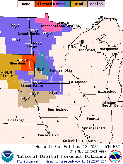
Including the cities of Roseau, Warroad, Greenbush, Baudette, Red Lake, Redby, and Ponemah 405 AM CST Thu Nov 11 2021
...WINTER STORM WARNING IN EFFECT FROM NOON TODAY TO NOON CST FRIDAY...
* WHAT...Heavy snow expected. Total snow accumulations of 4 to 6 inches. Winds gusting as high as 40 mph tonight.
* WHERE...Roseau, Lake Of The Woods and North Beltrami Counties.
* WHEN...From noon today to noon CST Friday.
* IMPACTS...Travel could be very difficult. The hazardous conditions could impact the morning or evening commute.
And blizzard warnings cover parts of the eastern Dakotas and western Minnesota.
Including the cities of Wheaton, Ortonville, Britton, Sisseton, Webster, Clark, Watertown, Milbank, Hayti, and Clear Lake
1050 AM CST Thu Nov 11 2021
...BLIZZARD WARNING REMAINS IN EFFECT FROM 6 PM THIS EVENING TO 6 PM CST FRIDAY... * WHAT...Blizzard conditions expected. Total snow accumulations of 2 to 4 inches, with locally higher amounts. Winds gusting as high as 55 mph.
* WHERE...Portions of northeast South Dakota and west central Minnesota.
* WHEN...From 6 PM this evening to 6 PM CST Friday.
* IMPACTS...Plan on slippery road conditions. The combination of strong winds and falling snow will significantly reduce visibility. Patchy blowing snow will add to the hazardous driving conditions, which are expected to impact the Friday morning commute.
Snow showers will cover most of Minnesota Thursday night into Friday. Total snowfall accumulations of more than 6 inches are likely up north, with 1 to 3 inches across western Minnesota. The Twin Cities could see a coating on grassy areas by Friday morning.
Turn Up Your Support
MPR News helps you turn down the noise and build shared understanding. Turn up your support for this public resource and keep trusted journalism accessible to all.

