
Winter storm, blizzard warnings north and west; more snow Saturday night
A coating of white across much of Minnesota by Sunday morning.

Go Deeper.
Create an account or log in to save stories.
Like this?
Thanks for liking this story! We have added it to a list of your favorite stories.


Here we go Minnesota.
The calendar still says fall, but wintry weather conditions are taking hold across Minnesota through this weekend. System No. 1 is impacting across northern and western Minnesota the most through Friday.
A follow-on Alberta clipper looks likely to sail through the colder air mass this weekend and drop a swath of snow across most of central Minnesota, including the Twin Cities.
Winter storm warnings, blizzard warnings, and winter weather advisories are posted across northern and western Minnesota.
Turn Up Your Support
MPR News helps you turn down the noise and build shared understanding. Turn up your support for this public resource and keep trusted journalism accessible to all.
Including the cities of Wheaton, Ortonville, Britton, Sisseton, Webster, Clark, Watertown, Milbank, Hayti, and Clear Lake
243 PM CST Thu Nov 11 2021
...BLIZZARD WARNING REMAINS IN EFFECT FROM 6 PM THIS EVENING TO 6 PM CST FRIDAY... * WHAT...Blizzard conditions expected. Total snow accumulations of 2 to 5 inches, with locally higher amounts. Winds gusting as high as 55 mph.
* WHERE...Portions of northeast South Dakota and west central Minnesota.
* WHEN...From 6 PM this evening to 6 PM CST Friday.
* IMPACTS...Plan on slippery road conditions. The combination of strong winds and falling snow will significantly reduce visibility. Patchy blowing snow will add to the hazardous driving conditions, which are expected to impact the Friday morning commute.
Here’s a breakdown of the two wintry weather systems.
System No. 1
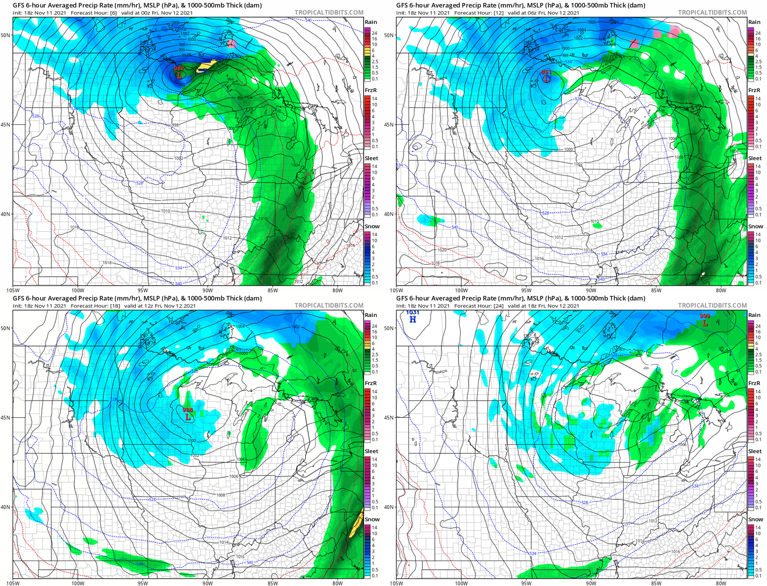
The season’s first significant wintry storm continues into Friday. The low-pressure center has stalled along the North Shore and will loop back southeast on Friday.
The National Oceanic and Atmospheric Administration’s Global Forecast System model depicts the rain and snow zones through Friday:
Snowfall totals
Rain has been changing to snow in the colder air behind the system across north-central Minnesota. That process will continue into Friday.
Here’s a look at the likely snowfall totals by later Friday.
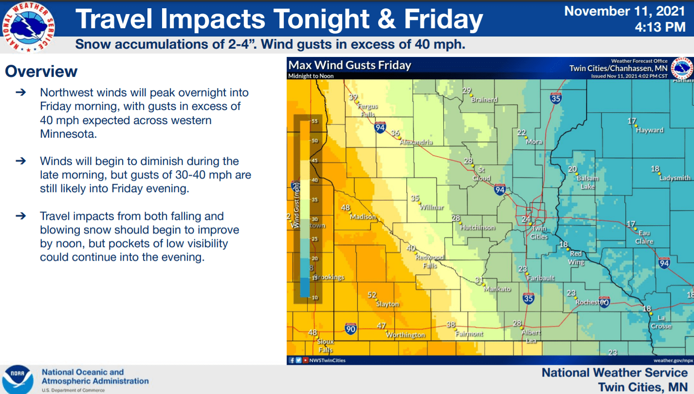
High winds
Pressure gradients will tighten across much of Minnesota through Friday. Winds will howl from the northwest and gusts will likely exceed 50 mph in open areas of southwest Minnesota Friday.
Wintry chill
The air mass behind this storm feels more December than November. Highs will hover in the 30s this weekend, and lows will be in the teens north and 20s south.
System No. 2: Weekend clipper
A second system looks likely to streak southeast into Minnesota this weekend. Forecast models currently favor a swath of snow from northwestern Minnesota along and north of Interstate 94 Saturday night into Sunday.
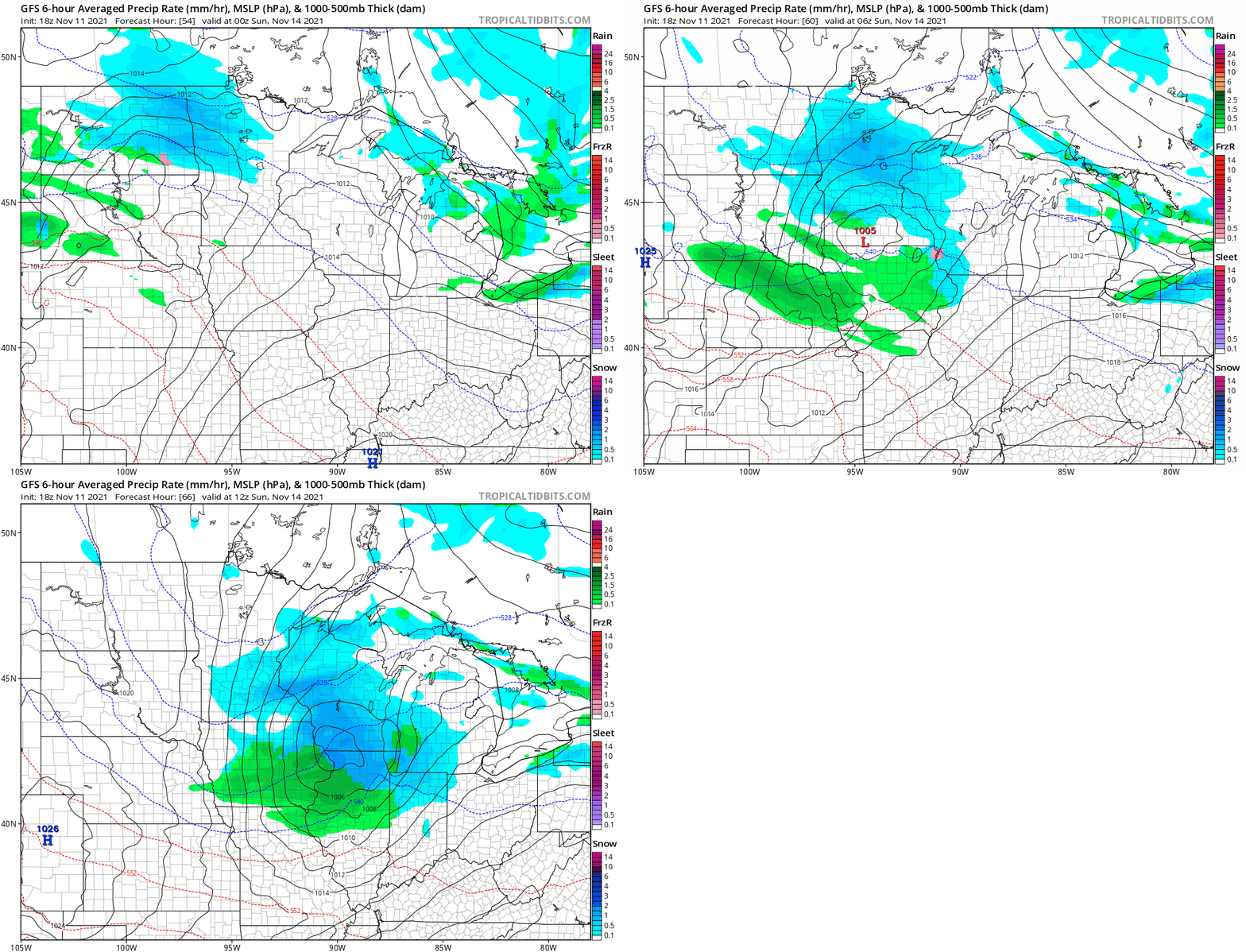
Both the European Centre for Medium-Range Weather Forecasts model and the American Global Forecast System crank out some impressive early snowfall totals with this system. These forecast models suggest a swath of between 2 and 5 inches on either side of I-94 through much of central Minnesota, possibly including the Twin Cities.
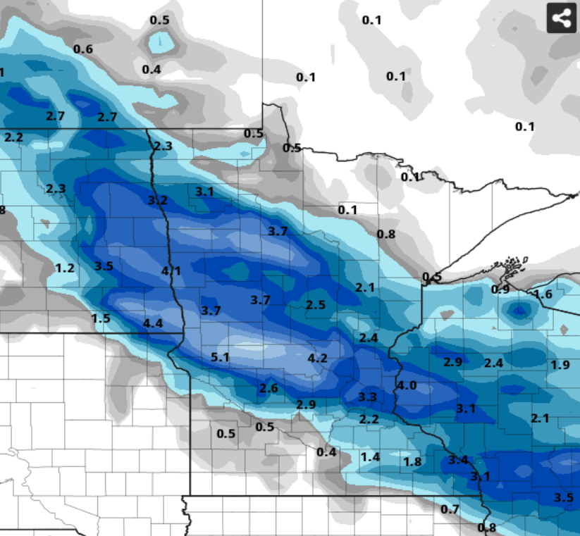
With plenty of subfreezing air in place Saturday night, this solution seems very possible.
So snow is accumulating in much of northern and western Minnesota through Friday. By Sunday morning, many of us in central Minnesota, including the Twin Cities, may wake up to our first significant coating of white.
Stay tuned.

