
Winter storm watch now includes southern Twin Cities
Storm track shifting north. Heavy snow more likely to include part or all of Twin Cities Friday.
Go Deeper.
Create an account or log in to save stories.
Like this?
Thanks for liking this story! We have added it to a list of your favorite stories.


This is why we watch storm tracks closely with each passing forecast model run.
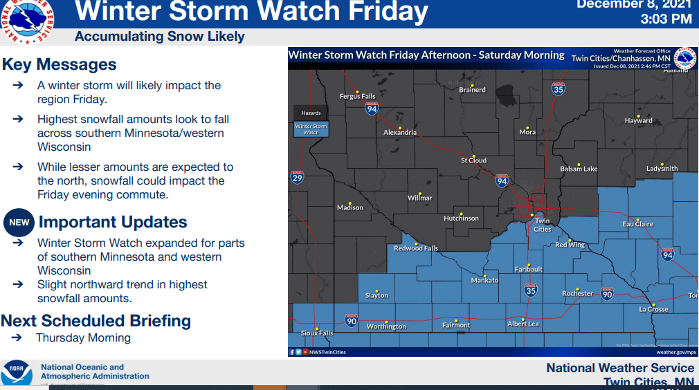
The winter storm watch zone (above) has been expanded northward to include the southern Twin Cities Friday.
Friday’s winter storm track is trending northward on the most recent forecast models runs. One example, NOAA’s 18Z GFS model run has pushed Friday’s low-pressure system track about 60 miles further north than previous runs.
Of course, that track could still drift back south Thursday, but if the trend holds that would shove the heavier snow bands into parts or all of the Twin Cities Friday.
Turn Up Your Support
MPR News helps you turn down the noise and build shared understanding. Turn up your support for this public resource and keep trusted journalism accessible to all.
Here’s the latest storm scenario from NOAA’s 18Z GFS model.

Again this is just one model, but other models mimic this northward trend. Here’s the 18Z GFS model snowfall output by Saturday. Note the potential for 5-inch to double-digit snowfall totals into and around the Twin Cities.

The morning run (12Z) Canadian model also picked up on the northward trend. It cranks out some prolific snowfall totals just south of the Twin Cities with heavy snow in the Twin Cities.
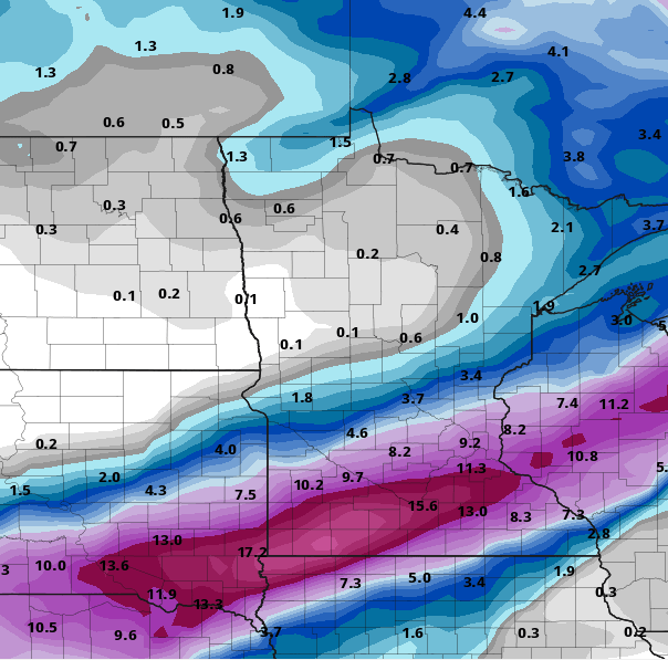
Here’s the latest Twin Cities National Weather Service snowfall projection. It’s shifted significantly north from Wednesday morning’s map.

We’ll watch the forecast models closely Thursday. Current trends suggest the Twin Cities into at least part of the heavy snow band with Friday’s weather system.
Keep the shovel handy.
Stay tuned.

