
Blowing snow and a flash freeze make for a slow start Thursday
High winds slowly diminish through the day
Go Deeper.
Create an account or log in to save stories.
Like this?
Thanks for liking this story! We have added it to a list of your favorite stories.


Although the brunt of the storm has departed, Minnesota is still feeling the lingering impacts from Wednesday’s storm with high winds, blowing snow and cold temperatures that are turning yesterday’s rain and snow melt to ice.
Thursday’s forecast
The potent storm which brought everything from record temperatures to severe weather across Minnesota Wednesday is now moving away from the state. The impacts of the storm will slowly diminish during the day.
However, the strong winds Minnesota saw overnight on the backside of the storm are still a problem Thursday morning. Much of the state still has persistent gusts over 30 and occasionally 40 mph.
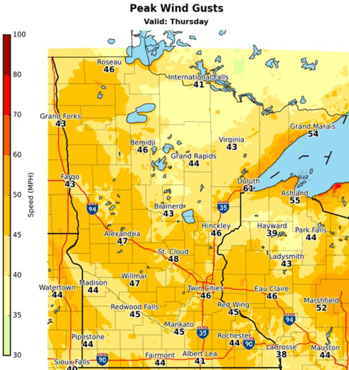
Those winds very slowly diminish during the day.
Turn Up Your Support
MPR News helps you turn down the noise and build shared understanding. Turn up your support for this public resource and keep trusted journalism accessible to all.
The problem of high winds is compounded by light, lingering snow in central and northern Minnesota.
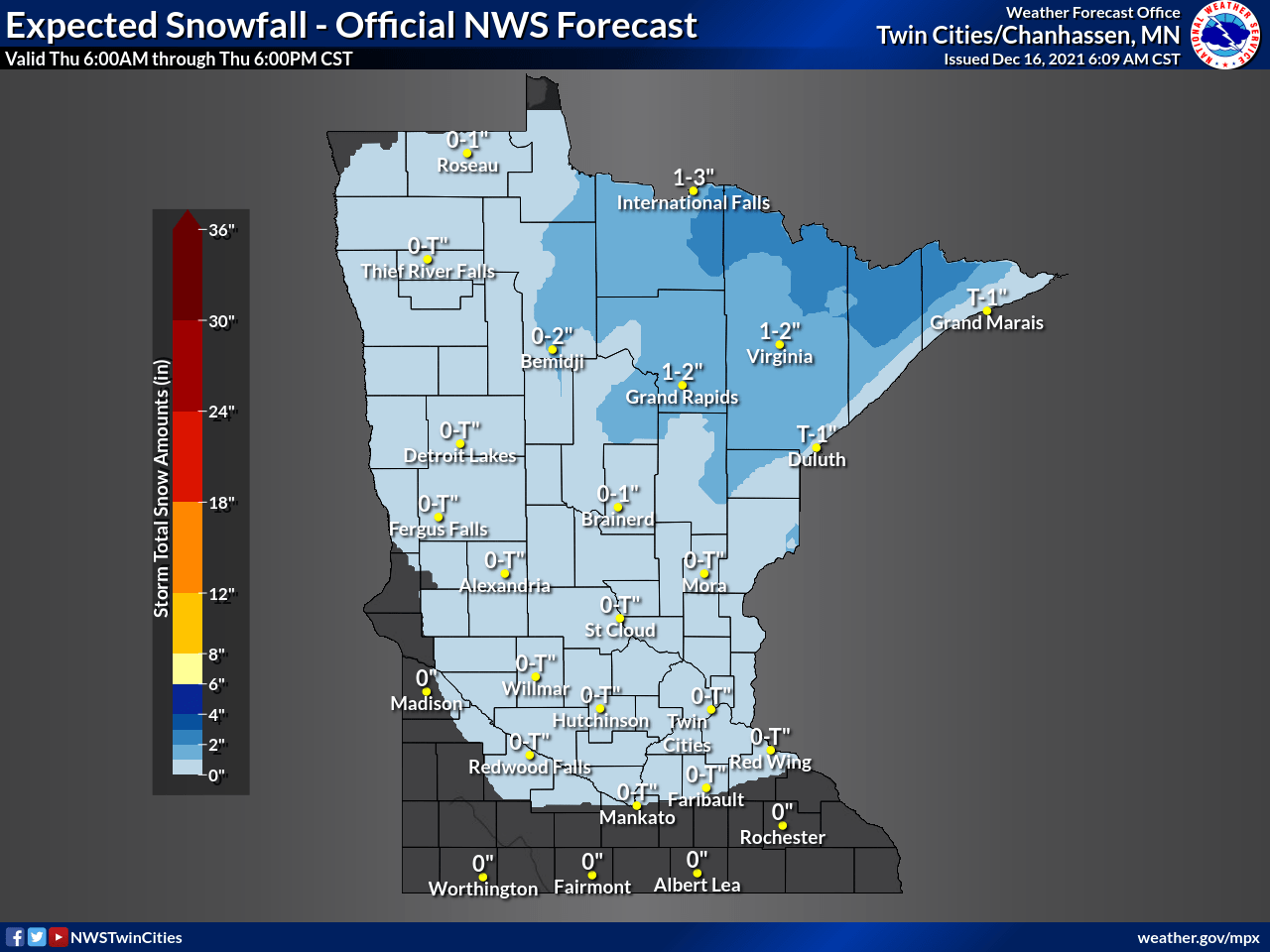
Even though most places will only see an additional inch through midday — with the snow also winding down — the falling snow plus high winds are causing visibility problems on some roadways.
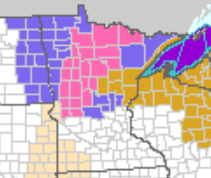
Because of this, most of central and northern Minnesota is starting the day under either a winter storm warning (pink), winter weather advisory (purple) or high wind warning (gold). These warnings and advisories end between 8 a.m. northwest and noon northeast as storm impacts lessen.
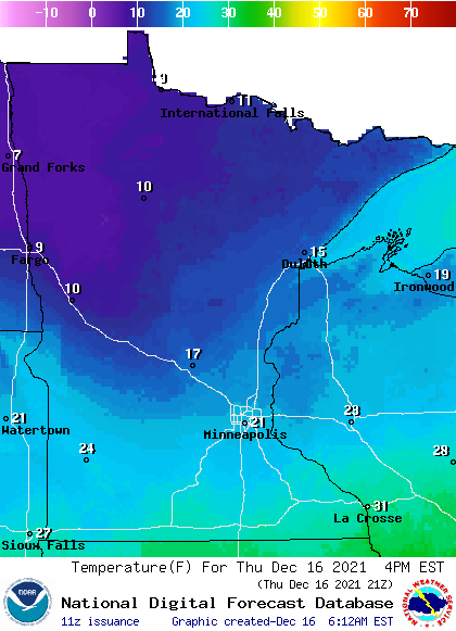
The high winds are also ushering in much colder air, causing what is considered a “flash freeze.” Wednesday’s warm air caused a significant snow melt, then temperatures plummeted overnight.
For example, the Twin Cities had a record high Wednesday of 58 around 8 p.m. By 6 a.m. Thursday, the temperature was 24. That was a 34-degree drop in 10 hours and is refreezing most of the moisture on the ground. Be prepared for slick spots as you head out Thursday morning.
That colder air also means most of the state already saw its highs around midnight. Morning temperatures range from the teens north to 20s south as of 7 a.m., and with the colder air moving across the state, most places will drop a couple more degrees by the afternoon.
Friday brings another chance of snow to Minnesota.
That extended forecast, including your weekend outlook, will be updated around 9 a.m.
Programming note
You can hear my live weather updates on Minnesota Public Radio at 7:49 a.m. Monday through Friday morning.

