
Light snow expands for much of Minnesota through Friday
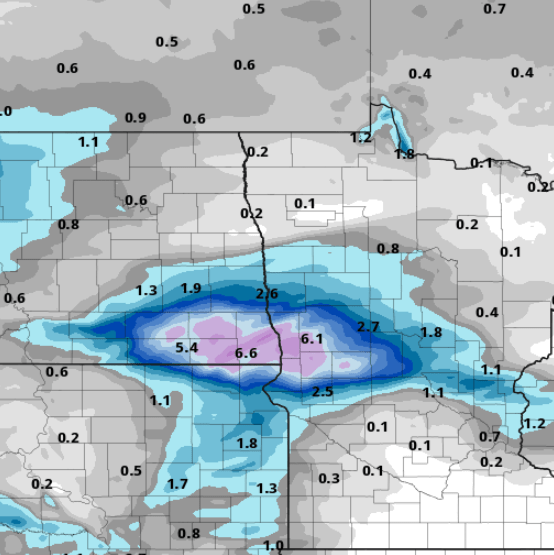
Highest accumulations favror western Minnesota. Twin Cities on the edge.
Go Deeper.
Create an account or log in to save stories.
Like this?
Thanks for liking this story! We have added it to a list of your favorite stories.


Our next snowmaker crosses Minnesota through Friday.
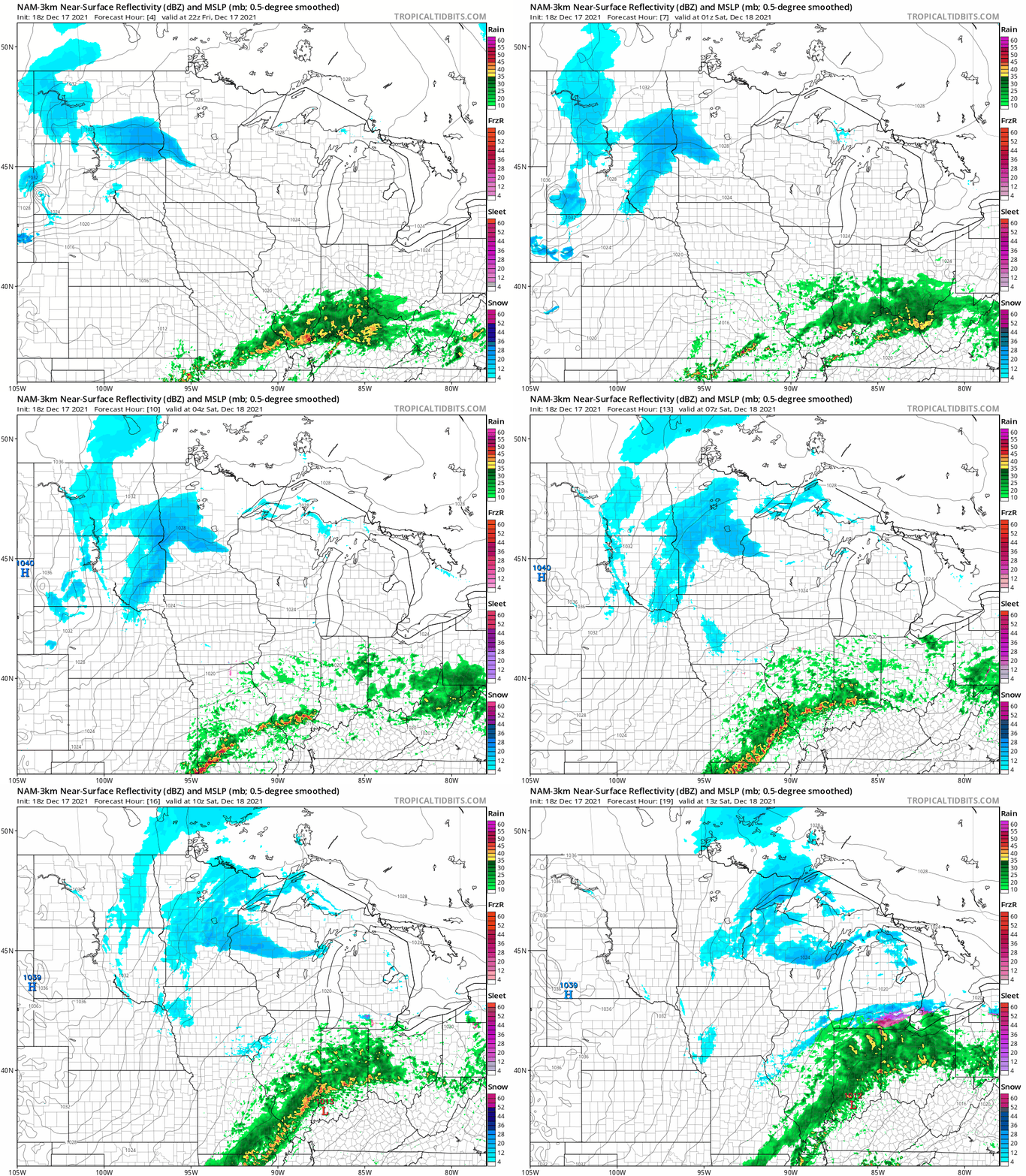
A weak to moderate snow producer will lay down a light coating of snow from near the Twin Cities west and north across part of Minnesota. NOAA’s latest 18Z HRRR model pushes a snow zone from western Minnesota eastward through tonight into Saturday morning. The forecast loop below runs between 4 p.m. Friday and 7 a.m. Saturday.
The most persistent snowfall and heaviest snowfall rates favor western Minnesota. The latest midday Friday forecast models forecast a zone of a few inches of snow across western Minnesota. That’s a bit higher than the forecast earlier Friday.
NOAA’s HRRR model and others crank out a zone of 3 to 6 inches in western Minnesota, with a lighter band of a coating to around 2 inches running into and just north of the Twin Cities.
Winter weather advisories are posted for parts of western Minnesota and the eastern Dakotas.
Including the city of Wheaton
1123 AM CST Fri Dec 17 2021
...WINTER WEATHER ADVISORY REMAINS IN EFFECT UNTIL MIDNIGHT CST TONIGHT...
* WHAT...Snow. Additional snow accumulations of 1 to 3 inches.
* WHERE...Traverse County.
* WHEN...Until midnight CST tonight.
* IMPACTS...Plan on slippery road conditions. The hazardous conditions could impact the evening commute. PRECAUTIONARY/PREPAREDNESS ACTIONS... Slow down and use caution while traveling.
With temperatures in the teens across most of Minnesota through Friday, roads will become snowy and slick, especially northwest of the Twin Cities.
Use caution and expect slick roads in areas that pick up snowfall through Friday.
Turn Up Your Support
MPR News helps you turn down the noise and build shared understanding. Turn up your support for this public resource and keep trusted journalism accessible to all.

