
Christmas week warm front ahead; heavy snow chance emerging Christmas Day?
Christmas Eve looks mild. A chance of snow lurks Christmas Day.
Go Deeper.
Create an account or log in to save stories.
Like this?
Thanks for liking this story! We have added it to a list of your favorite stories.


The forecast heading through Christmas week offers some changes.
First, we enjoy a quiet and mostly sunny Wednesday. Highs will approach 30 degrees in southern Minnesota with 20s across most of the state.

Thursday brings some light snow to the northern half of Minnesota once again. By Christmas Eve, a warm front will blow through Minnesota.
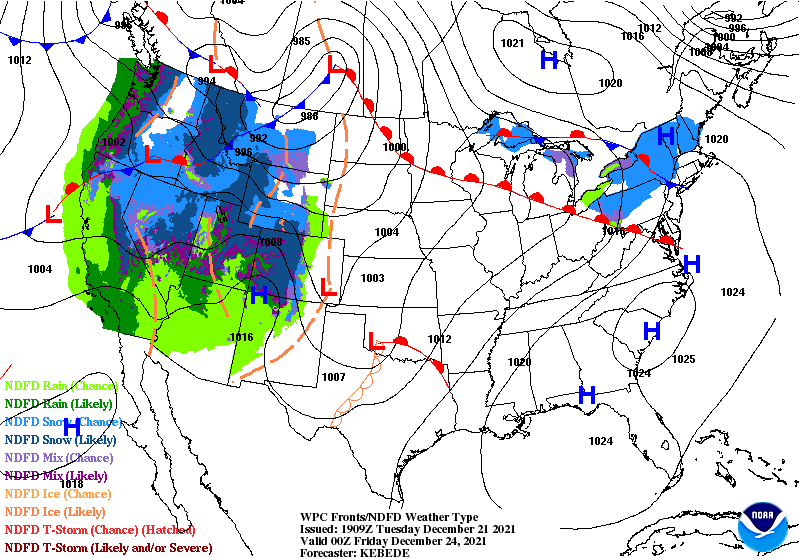
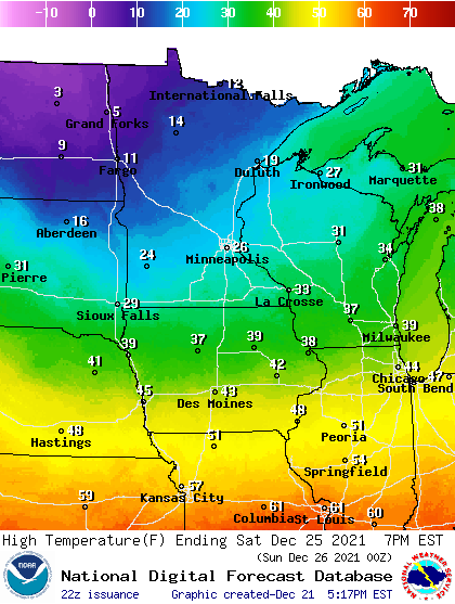
Highs on Christmas Eve will reach the balmy 40s in the Twin Cities and southern Minnesota, with 30s up north.
Turn Up Your Support
MPR News helps you turn down the noise and build shared understanding. Turn up your support for this public resource and keep trusted journalism accessible to all.

Some perspective here. The average high for the Twin Cities this week is 26 degrees. So temperatures will run 15 degrees above average across much of Minnesota on Christmas Eve. So far December is running 4.2 degrees warmer than average in the Twin Cities.
Snow chances emerging on Christmas Day?
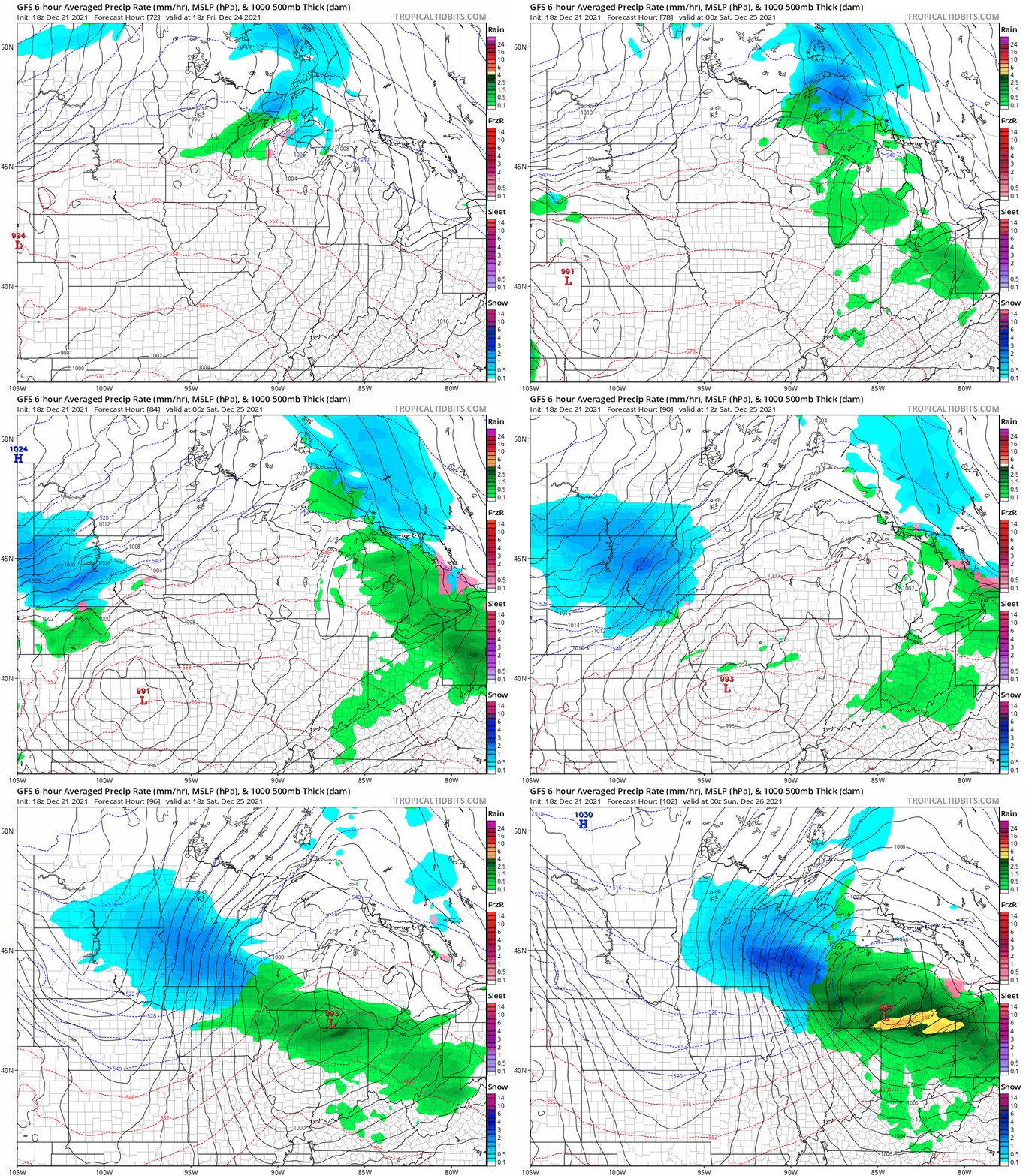
Tuesday’s forecast models picked up on a potential low-pressure system moving toward Minnesota Christmas Day. Both the American GFS and Canadian models picked up on this trend, which gets our attention.
NOAA’s GFS model shows the chance for light rain showers Christmas Eve, then a solid area of moderate to heavy snow pushing into Minnesota on Christmas Day.
It’s too early to tell how reliable this trend is. But that this point it looks like we’ll need to be on the watch for the potential of significant to heavy snow across parts of Minnesota on Christmas Day.
Stay tuned.

