
February thaw ahead? 3 to 4 days above freezing possible next week
Highs in the 30s and 40s look possible for southern Minnesota next week

Go Deeper.
Create an account or log in to save stories.
Like this?
Thanks for liking this story! We have added it to a list of your favorite stories.


We’re not done with winter’s cold just yet in Minnesota. But next week is trending much milder.
While it may stay below freezing most of the week in northern Minnesota, southern Minnesota looks likely to have a few days above the thawing point. That would be a welcome break from the consistent cold for many.
The upper air pattern across Minnesota next week suggests we’ll ride the boundary between chilly arctic and milder Pacific air masses. That should allow a couple swipes of milder air into Minnesota next week. The Canadian and European models are the strongest with this trend as of today.
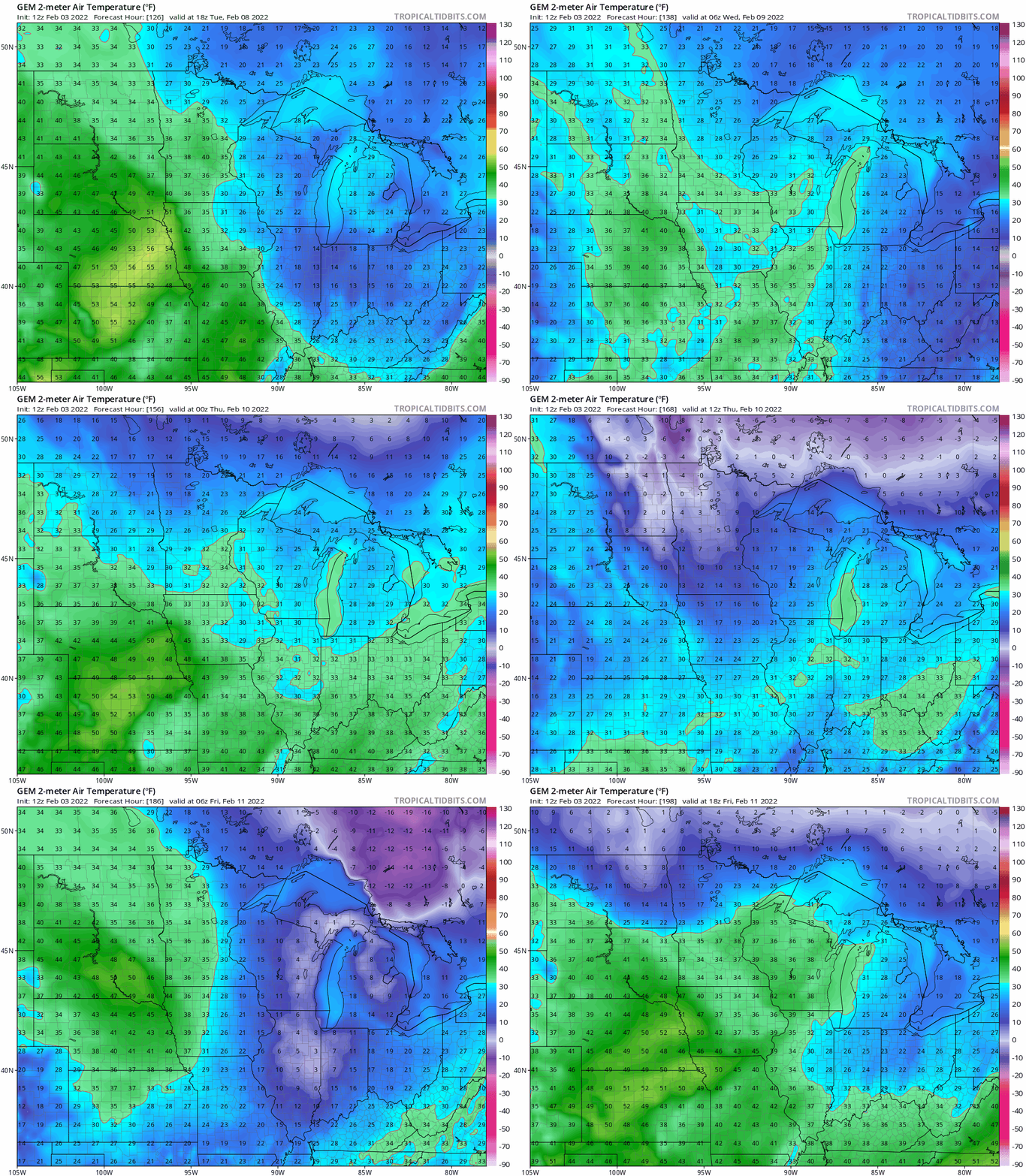
Check out the Canadian model temperature animation between next Tuesday and Friday. It blows a few pulses of temperatures in the 30s across southern Minnesota, with 40s in the southwest.
Turn Up Your Support
MPR News helps you turn down the noise and build shared understanding. Turn up your support for this public resource and keep trusted journalism accessible to all.
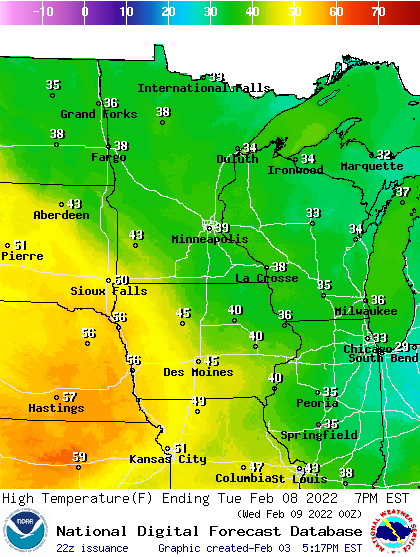
NOAA’s high temperatures forecast map for next Tuesday agrees. Highs may get close to 40 in the Twin Cities Tuesday, with 40s in southwest Minnesota. Once again, note the 50s to near 60 degrees in Nebraska. Winter has been a fleeting concept not that far southwest of Minnesota this year.
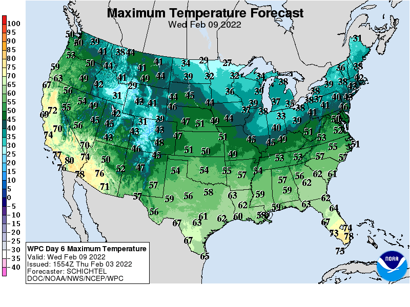
Milder air continues for southern Minnesota next Wednesday.
More cold ahead
It’s far too early to believe we’re done with subzero cold across Minnesota. The medium-range forecast models suggest more subzero air is possible after about Feb. 12. But the latest model runs have backed off on the magnitude of a possible mid-February cold wave.
One thing to watch for next week and beyond is the unusual lack of snow cover across South Dakota, western Iowa, Nebraska and extreme southwest Minnesota.
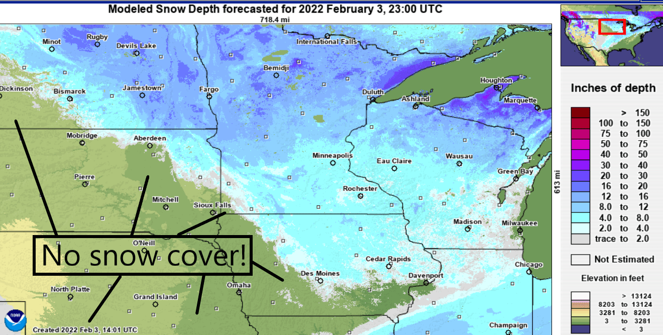
The lack of snow will add to the warming capability of any milder air masses blowing into southern Minnesota from the west and southwest. And if this pattern lasts into March, it could mean a more rapid warmup if winds begin to blow more consistently from the southwest.
Stay tuned.

