Winter storm watch up north
Heavier snowfall north of I-94. Snowy p.m. rush hour for Twin Cities?

Go Deeper.
Create an account or log in to save stories.
Like this?
Thanks for liking this story! We have added it to a list of your favorite stories.


Here comes the next clipper.
Snow begins in northwestern Minnesota Thursday morning. By early afternoon, flakes will be flying above parts of the North Shore. The snowfall sails southeast through Minnesota Thursday.

The Twin Cities will see some spotty mixed rain and snow showers Thursday, but could get a shot of more vigorous sloppy snowfall just in time for afternoon rush hours. Naturally.
The worst travel impacts will be across northern Minnesota. Let’s break down the warnings, advisories and likely snowfall totals and impacts Thursday.
Turn Up Your Support
MPR News helps you turn down the noise and build shared understanding. Turn up your support for this public resource and keep trusted journalism accessible to all.
Winter storm watch
A winter storm watch is posted for parts of the North Shore around Grand Marais, Minn., for Thursday. This area likely sees the heaviest snowfall totals Thursday.
Southern Cook- Including the city of Grand Marais
343 PM CST Wed Feb 9 2022
...WINTER STORM WATCH REMAINS IN EFFECT FROM THURSDAY AFTERNOON THROUGH FRIDAY MORNING...
* WHAT...Heavy snow possible. Total snow accumulations of 3 to 6 inches possible. Winds could gust as high as 35 mph.
* WHERE...Southern Cook County. This includes the Tribal Lands of the Grand Portage Reservation.
* WHEN...From Thursday afternoon through Friday morning.
* IMPACTS...Plan on slippery road conditions. The hazardous conditions could impact the morning or evening commute.
Storm track and snowfall timing
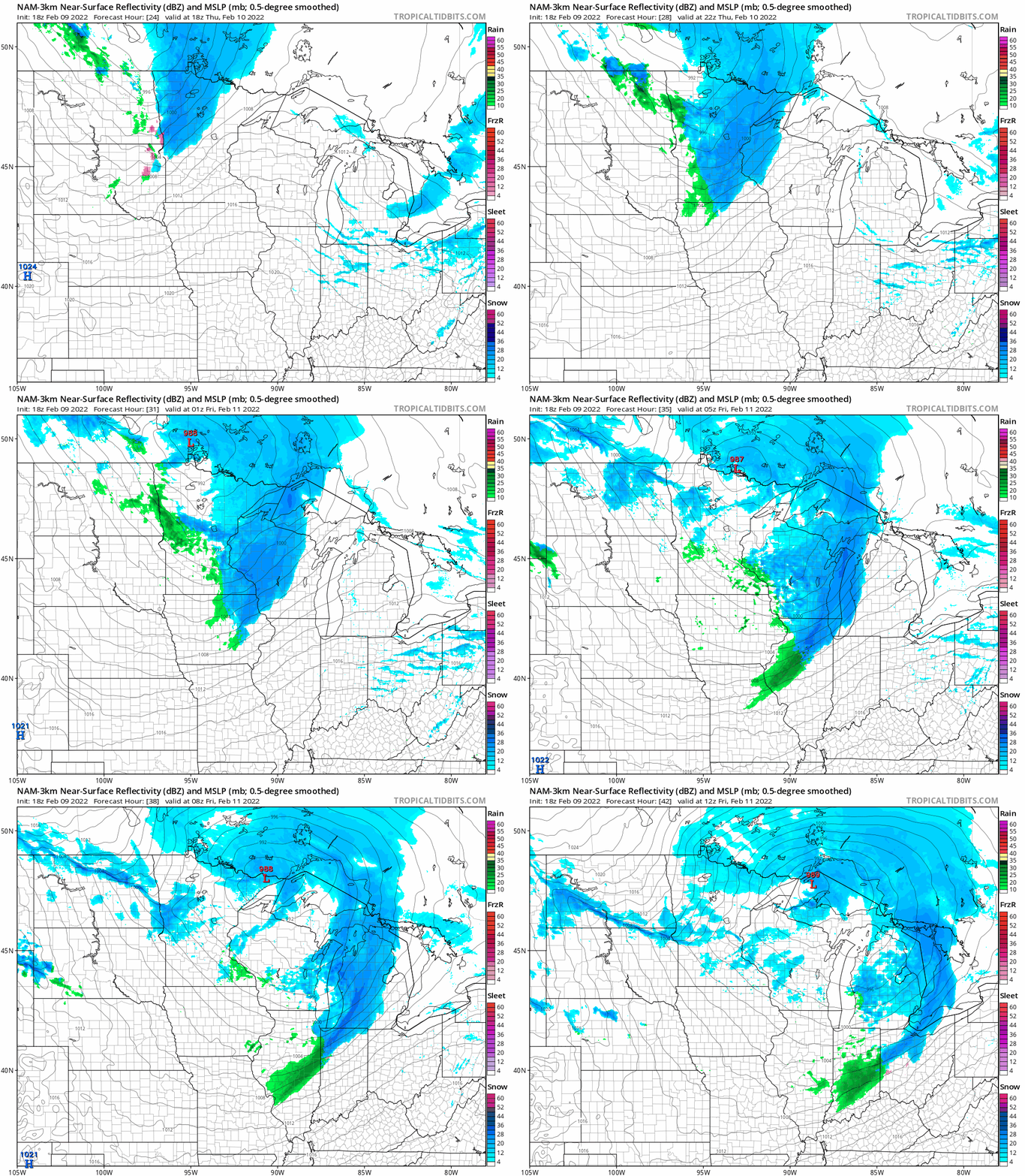
NOAA’s NAM 3 km resolution forecast model tracks snow into northwest Minnesota Thursday morning, then pushes the snow shield south and east through the day. Under this scenario, the Twin Cities will see a mix of rain and snow showers, with a possible snowy burst around afternoon rush hours.
The loop below runs between 6 a.m. Thursday and 6 a.m. Friday.
Snowfall totals
Overall snowfall totals still favor a range of 3 to 6 inches across much of northeast Minnesota. Lake-enhanced snowfall could boost totals over 6 inches again along the Sawtooth Mountains above the North Shore of Lake Superior.
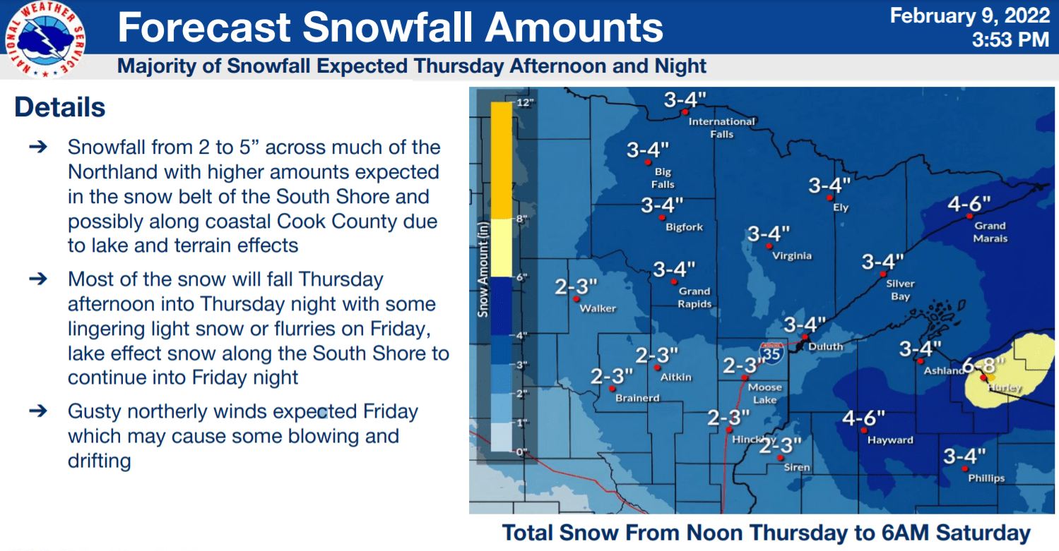
The Twin Cities likely picks up a coating to around an inch or so. Temperatures will hover near the freezing mark late Thursday, so it could be a sloppy mix for the Twin Cities on roads.
Arctic air Friday
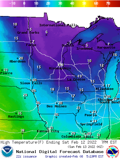
A shot of arctic air blows in Friday and Saturday. Lows Saturday morning will dip slightly below zero in the Twin Cities and southern Minnesota. Lows up north will be in the 20s to 30s below zero.
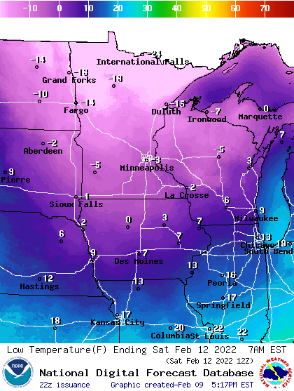
Highs Saturday will be mostly in the single digits above zero.