
Shot of snow coming for Twin Cities afternoon commute
Widespread snow across northern Minnesota.
Go Deeper.
Create an account or log in to save stories.
Like this?
Thanks for liking this story! We have added it to a list of your favorite stories.


Here’s a quick update as we look forward through Thursday afternoon for snow up north and rush hour in the Twin Cities.
Our inbound clipper system is pretty much on track with my thinking from Wednesday. Snow is widespread across northern Minnesota Thursday afternoon into the evening.
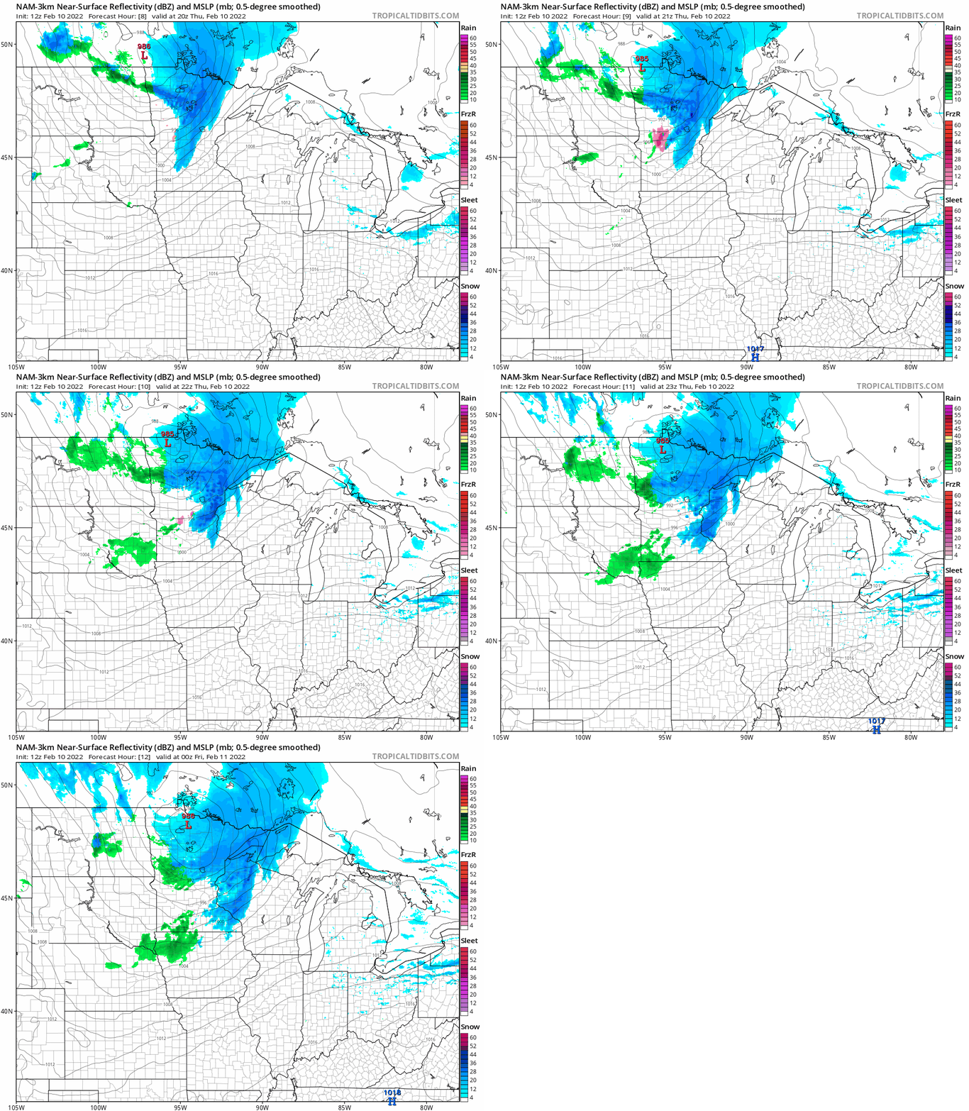
The National Oceanic and Atmospheric Administration’s North American Mesoscale 3 km system and other models paint a north-south oriented band of snow sweeping from St. Cloud in central Minnesota through the Twin Cities between about 3 and 6 p.m.
This should bring a brief but vigorous shot of wind-whipped snow during the afternoon rush hours for much of the Twin Cities. Overall accumulations will likely land around an inch for the Twin Cities, with heavier totals as you move north.
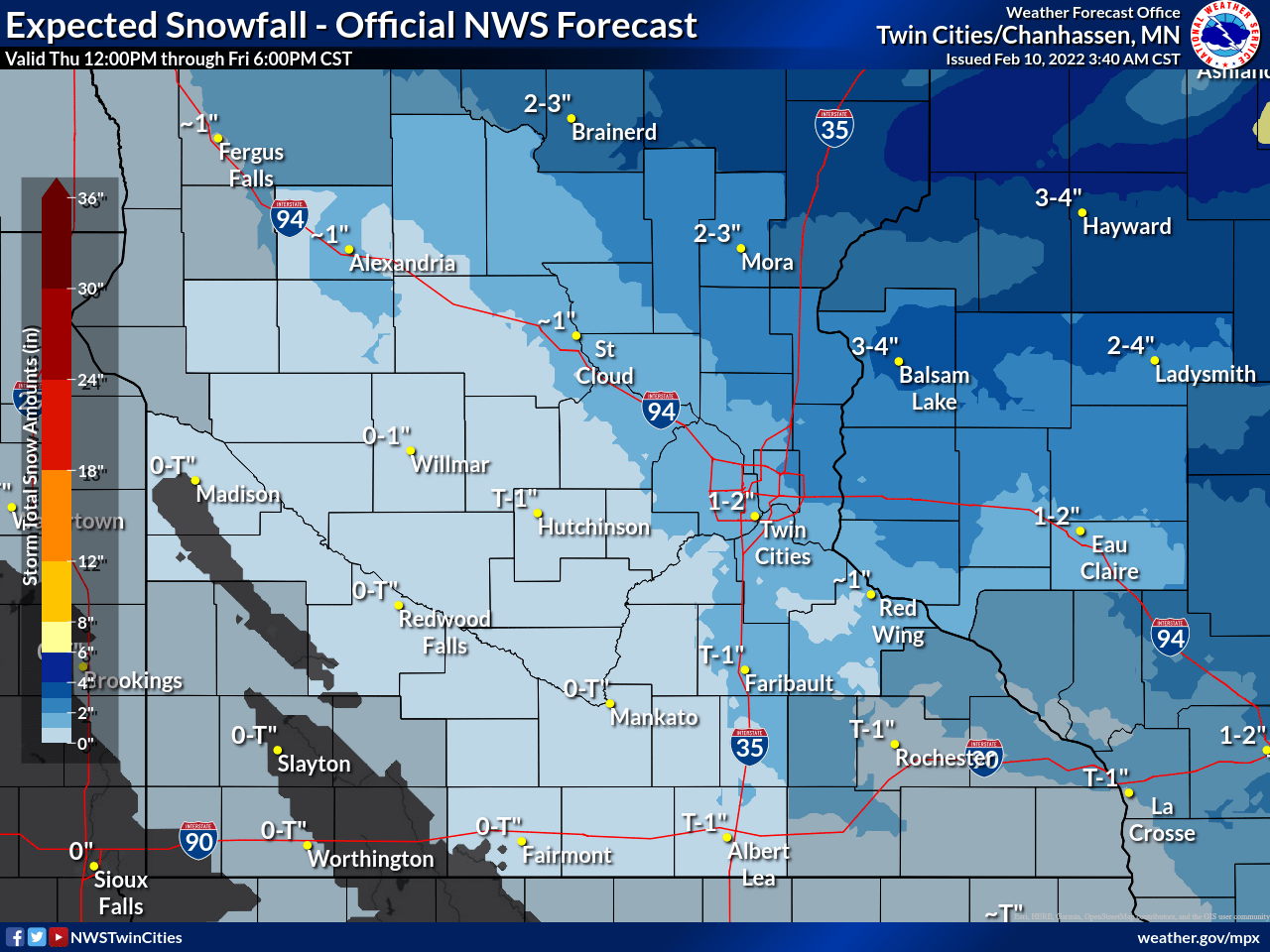
The best chance for a couple of inches favors areas north and northeast of the Twin Cities. Expect the potential for some slick roads late Thursday afternoon and early evening around the Twin Cities.
Heavier snowfall up north
The snow continues on and off through Thursday night in northern Minnesota. By Friday morning, widespread snowfall totals between 2 and 6 inches look likely. Winter weather advisories cover most of northern Minnesota.
The heaviest totals will fall along the North Shore and through the Sawtooth Mountains. I won’t be surprised to see some totals in excess of 6 inches in the hills above Grand Marais.

Turn Up Your Support
MPR News helps you turn down the noise and build shared understanding. Turn up your support for this public resource and keep trusted journalism accessible to all.

