Blizzard warnings northwest, messy clipper overnight
Warmest Twin Cities temps occur overnight. Then an arctic front blows in Friday.

Go Deeper.
Create an account or log in to save stories.
Like this?
Thanks for liking this story! We have added it to a list of your favorite stories.


It’s a wild weather picture across Minnesota overnight into Friday.
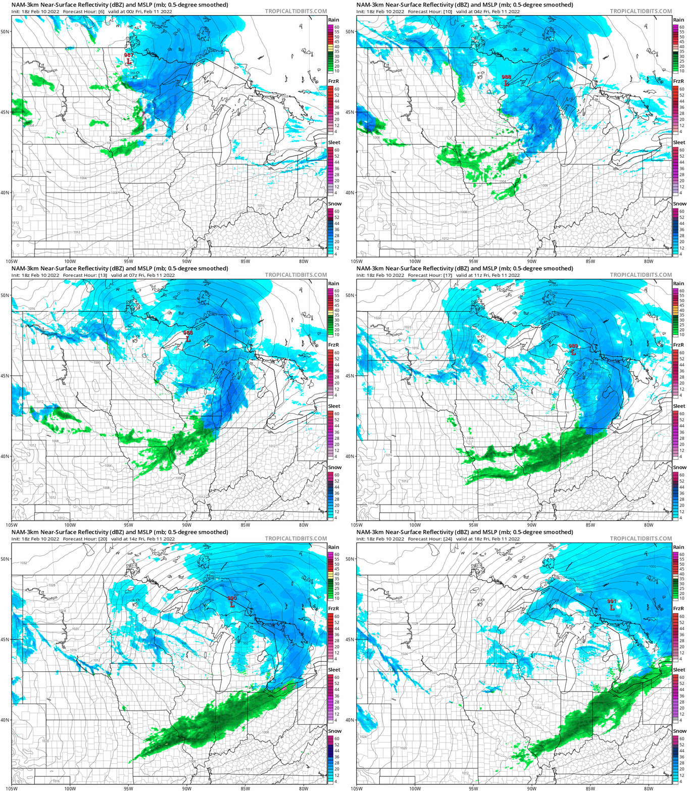
Our sloppy Alberta clipper sails through Minnesota with a mix of snow, sleet and rain overnight. The National Oceanic and Atmospheric Administration’s North American Mesoscale 3 km resolution model shows the precipitation pattern through noon Friday:
Blizzard warnings for Red River Valley
Blizzard warnings are up for the Red River Valley into Friday morning. Winds gusting to 55 mph will whip snow airborne and create near-zero visibility at times.
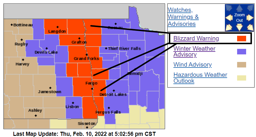
Including the cities of Crookston, East Grand Forks, Ada, Twin Valley, Halstad, Hallock, Karlstad, Lancaster, Warren, Stephen, Argyle, Langdon, Cavalier, Walhalla, Drayton, Pembina, Neche, St. Thomas, Grafton, Park River, Grand Forks, Finley, Hope, Mayville, Hillsboro, Hatton, Portland, Edinburg, Adams, and Lankin
346 PM CST Thu Feb 10 2022
...BLIZZARD WARNING REMAINS IN EFFECT FROM 9 PM THIS EVENING TO 9 AM CST FRIDAY... * WHAT...Blizzard conditions expected. Total snow accumulations of up to one inch. Winds gusting as high as 55 mph.
* WHERE...Portions of northwest Minnesota and northeast and southeast North Dakota. * WHEN...From 9 PM this evening to 9 AM CST Friday.
* IMPACTS...Plan on slippery road conditions as temperatures fall rapidly. Widespread blowing snow will significantly reduce visibility. The hazardous conditions could impact the morning commute. Dangerously cold wind chills as low as 30 below zero could cause frostbite on exposed skin in as little as 10 minutes.
* ADDITIONAL DETAILS...Strong north winds combined with falling snow will lead to whiteout conditions during the overnight period and into Friday morning. These conditions could last into early Friday afternoon if snow showers persist.
Heavy snow for northeastern Minnesota
Moderate to heavy snow has covered roads across northeastern Minnesota. Slippery road conditions will persist in many areas into Friday morning.
Turn Up Your Support
MPR News helps you turn down the noise and build shared understanding. Turn up your support for this public resource and keep trusted journalism accessible to all.
Winter storm warnings cover areas around Grand Marais. Winter weather advisories cover most of northern Minnesota.
Including the city of Grand Marais
252 PM CST Thu Feb 10 2022
...WINTER STORM WARNING IN EFFECT UNTIL 10 AM CST FRIDAY...
* WHAT...Heavy snow. Additional snow accumulations of 5 to 7 inches. Winds gusting as high as 40 mph.
* WHERE...Southern Cook County. This includes the Tribal Lands of the Grand Portage Reservation.
* WHEN...Until 10 AM CST Friday.
* IMPACTS...Travel could be very difficult. The hazardous conditions could impact the morning or evening commute.
Most of northeast Minnesota will tally 2 to 6 inches of fresh snowfall by Friday morning. With lake and topographic enhanced snow bands along the North Shore, I won’t be surprised if we see some local 8 to 10-inch snowfall totals along the upper North Shore once again with this system.
Twin Cities: Messy wintry mix
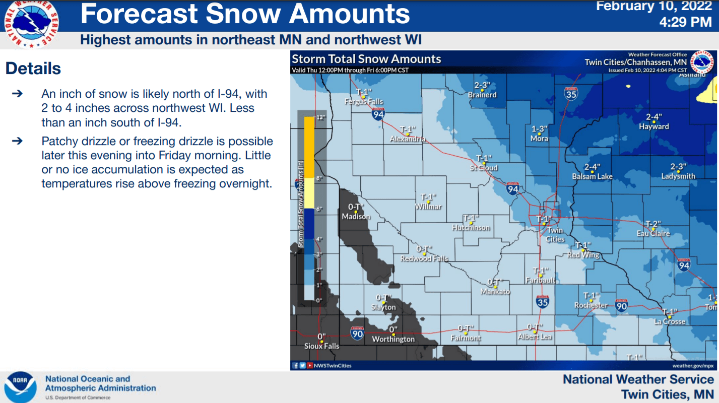
We’ve seen a mixed bag of precipitation with this latest system across much of southern Minnesota. Milder air mixing in has produced snow, sleet, and rain at times. Precipitation will gradually decrease across southern Minnesota overnight.
Arctic air into the weekend
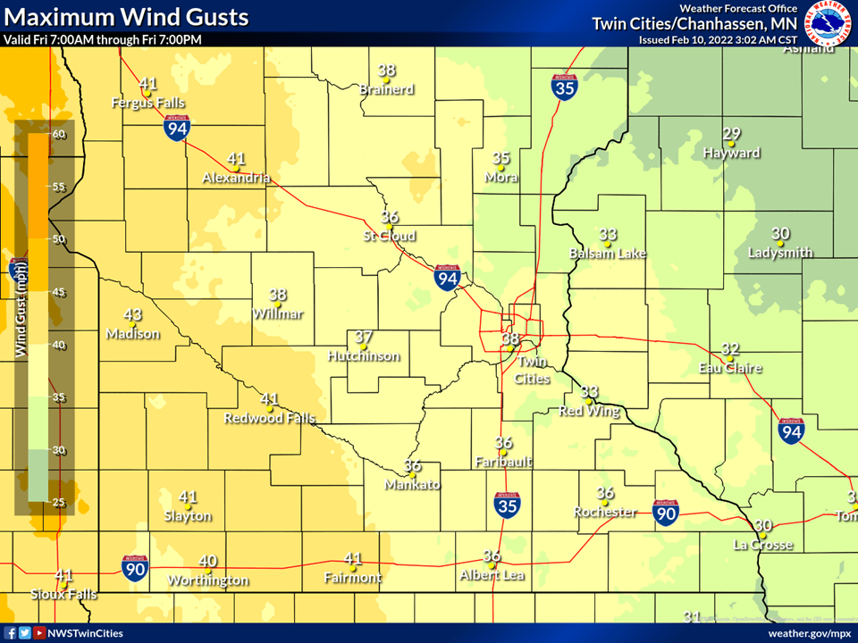
Gusty winds behind the arctic front Friday will hit 40 mph and higher across parts of Minnesota.
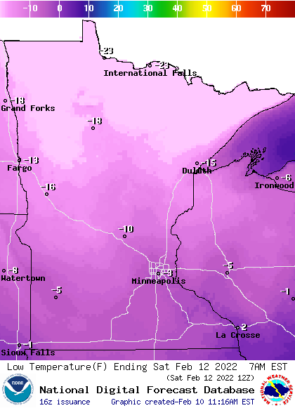
Temperatures will approach minus 30 once again across northern Minnesota by Saturday morning, and near zero in the Twin Cities.
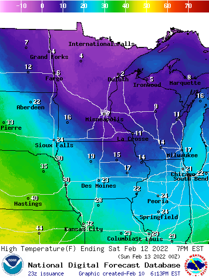
Highs this weekend will hover in the teens south and single digits north.