
Roller coaster temperature week ahead
Minnesota rides the sharp boundary between frigid arctic air and much milder air this week

Go Deeper.
Create an account or log in to save stories.
Like this?
Thanks for liking this story! We have added it to a list of your favorite stories.


It’s an up-down temperature forecast for Minnesota this week.
We’re moving into that time of the year in late winter when we start to see more volatile temperature swings. The warms are getting warmer, but there’s still plenty of cold air up north to send temperatures crashing in between warm episodes.
Tuesday brings a stiff southerly wind and milder temperatures to Minnesota. The breeze will make it feel cooler, but highs will reach the 30s Tuesday across southern Minnesota edging into the Twin Cities.
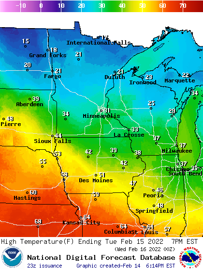
Temperatures crash through the 20s again Wednesday. The bottom of the cold later this week occurs Thursday.
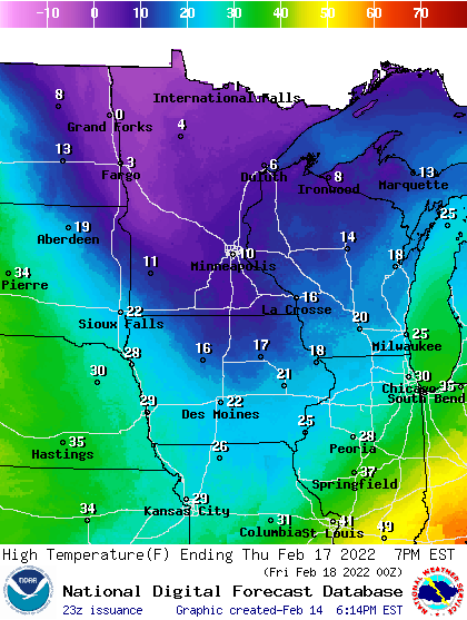
Friday and Sunday bring milder air once again. Check out the forecast highs on Sunday. It could hit 40 again in the Twin Cities. And springlike 60s are not that far away in Nebraska and Kansas!
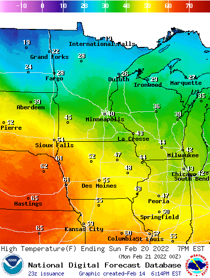
I’m watching for a weather pattern that will turn our winds into the southwest. When that happens, it could warm up suddenly in Minnesota — at least temporarily.
Stay tuned.
Turn Up Your Support
MPR News helps you turn down the noise and build shared understanding. Turn up your support for this public resource and keep trusted journalism accessible to all.

