
Snowier pattern emerging for next week?
Northern Minnesota snow Friday. Growing chances for significant Twin Cities snow next week?
Go Deeper.
Create an account or log in to save stories.
Like this?
Thanks for liking this story! We have added it to a list of your favorite stories.


It’s never safe to look too far around the weather corner in Minnesota this time of year. That light you see at the end of the February tunnel could be an oncoming snow train.
It’s still early, but most of the reliable forecast models are starting to gin up the potential for significant snow across central and southern Minnesota next week. First, northern Minnesota gets another shot of snow Thursday.
Friday snow up north
The February storm track has favored a series of clippers across northern Minnesota. In the Arrowhead, Grand Marais and Lutsen picked up another 3.5 inches of fresh snow Tuesday.
The next clipper plows across northern Minnesota Friday. This one looks pretty productive, especially near the Canadian border region, with a snow track basically along a line from Grand Forks, N.D., to Duluth.
Turn Up Your Support
MPR News helps you turn down the noise and build shared understanding. Turn up your support for this public resource and keep trusted journalism accessible to all.
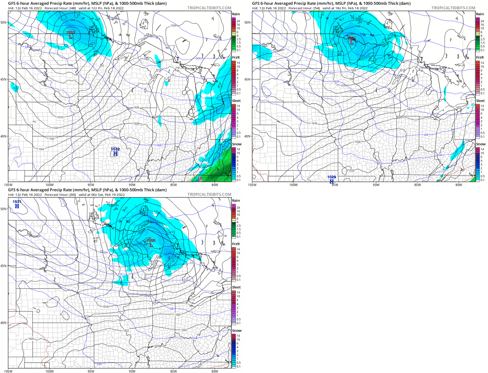
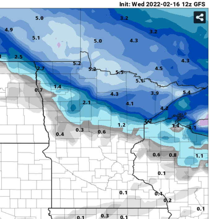
The highest snowfall totals Friday will fall closer to the Canadian border. A solid zone of 3 to 6 inches looks likely from Lake of the Woods, through International Falls and Ely, along the Gunflint Trail, to Grand Marais. It’s more like 1 to 3 inches along and north of the Grand Forks-to-Duluth line.
Here’s the National Oceanic and Atmospheric Administration’s Global Forecast System model (Kuchera) snowfall output:
Twin Cities: Heavier snows next week?
Forecast models have been hinting at the potential for significant snows next week in central and southern Minnesota. That includes the greater Twin Cities area.
It’s still too early to paint reliable storm tracks and snowfall totals, but most forecast models lay out some snowfall Monday through Tuesday across our region.
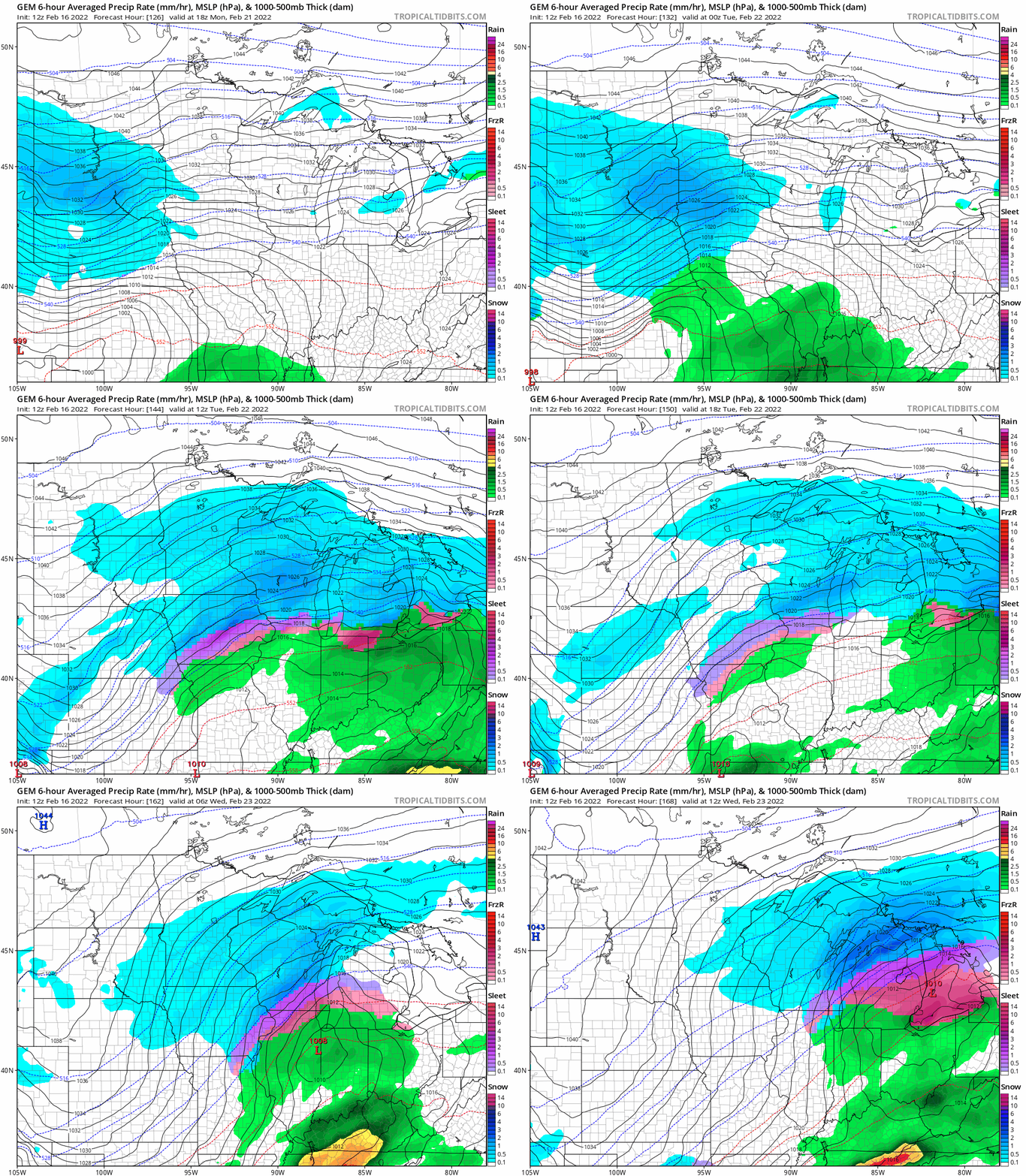
Don’t take this model output specifically, but the Canadian model gives you the idea of a couple of shots of snow possible Monday into early Wednesday across central and southern Minnesota.
You’ll probably see some eye-opening snowfall totals posted on social media for huge snowfall totals next week across Minnesota. They’re likely too aggressive at this point so I won’t be posting them here, but just know that we’re watching the potential for significant possible plowable snow next week in central and southern Minnesota.
Stay tuned.

