
Blizzard eases; significant snow likely Monday and Tuesday
Growing potential for heavy snowfall next week across central Minnesota
Go Deeper.
Create an account or log in to save stories.
Like this?
Thanks for liking this story! We have added it to a list of your favorite stories.


The forecast of blizzard conditions panned out Friday.
Including the cities of Alexandria, Long Prairie, Little Falls, Morris, Glenwood, and St Cloud
250 PM CST Fri Feb 18 2022
...BLIZZARD WARNING REMAINS IN EFFECT UNTIL 9 PM CST THIS EVENING...
* WHAT...Blizzard conditions reducing visibility to one quarter mile or less in blowing snow. Winds gusting as high as 50 mph.
* WHERE...Portions of central and west central Minnesota.
* WHEN...Until 9 PM CST this evening.
* IMPACTS...Plan on slippery road conditions as dropping temperatures with falling snow could result in flash freezing on roads. Areas of blowing snow could significantly reduce visibility. The hazardous conditions could impact the evening commute. Gusty winds could bring down tree branches.
The severe blizzard raked western and central Minnesota for several hours Friday.
This video reportedly along Minnesota Highway 371 near Brainerd and Nisswa shows more than a dozen crashed and abandoned cars Friday.
Numerous roads were closed across western and central Minnesota.
Turn Up Your Support
MPR News helps you turn down the noise and build shared understanding. Turn up your support for this public resource and keep trusted journalism accessible to all.
Wind gusts hit 60 mph at several locations Friday. Most locations had gusts over 50 mph.
Quiet weekend ahead
We can be thankful for a quieter weather pattern this weekend across Minnesota. Saturday brings sunshine and lighter winds. Highs will range from the teens east to 30s west.
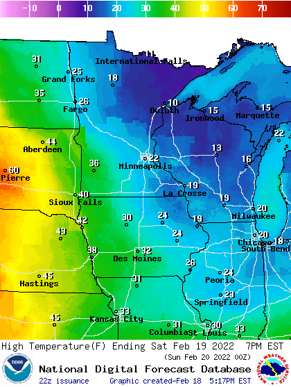
Sunday brings another one-day thaw to Minnesota. Highs will reach the 40s in southern Minnesota and possibly even 50 degrees in southwestern Minnesota Sunday afternoon.
It's amazing how close unseasonably warm air has been the last few weeks. Highs will be in the 60s again as close as Omaha, Neb., and Sioux City, Iowa.
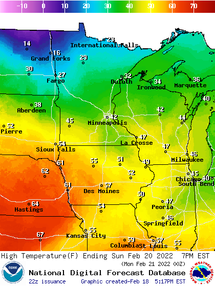
Models from the European Centre for Medium-Range Weather Forecasts and the National Oceanic and Atmospheric Administration’s Global Forecast System are cranking out 44 degrees for the Twin Cities Sunday afternoon.
Snowy pattern emerging next week
A two-piece storm system appears ready to deliver significant snowfall to central and southern Minnesota early next week. The heaviest snow bands currently lay out from western Minnesota eastward to in or near the greater Twin Cities area.
NOAA’s GFS model shows snowfall into the Twin Cities already before rush hours Monday morning. The snow may continue in spurts through Tuesday.
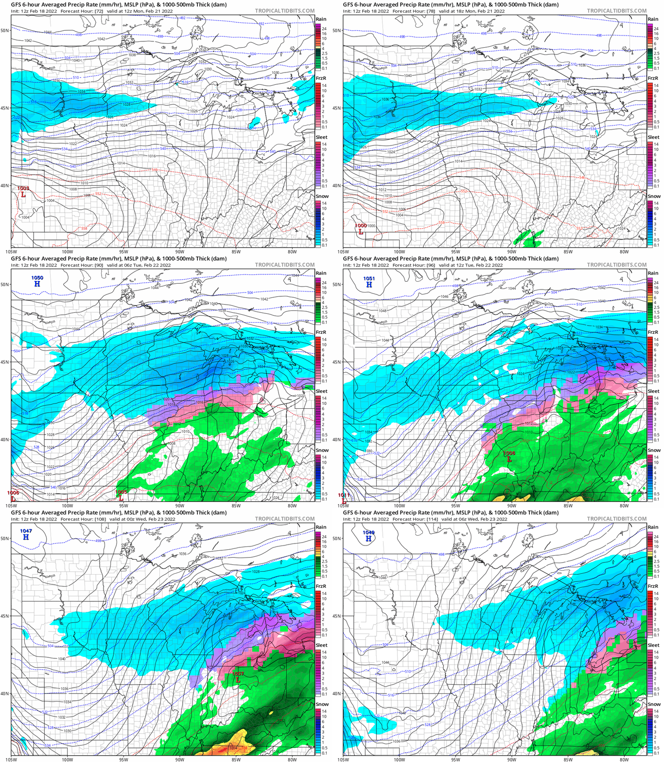
We’re still about 48 to 60 hours out from snowfall across Minnesota. That’s too early to be confident about posting forecast model snowfall output, which will change over the weekend. But I think the chances are growing of double-digit snowfall totals for some parts of central and southern Minnesota, and possibly the Twin Cities by late Tuesday.
Stay tuned for updates over the weekend.

