
Quiet through Friday, then wet and sloppy
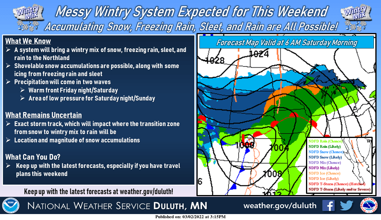
Heavy snow still looks likely from western through northern Minnesota this weekend
Go Deeper.
Create an account or log in to save stories.
Like this?
Thanks for liking this story! We have added it to a list of your favorite stories.


Welcome to the calm … before the slop.
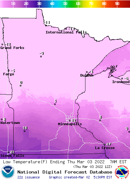
Our weather looks quiet through most of Friday across Minnesota. A cool front makes a weak southward push through Thursday. Lows early Thursday morning will dip below zero across northern Minnesota. We’ll bottom out around 12 above in the Twin Cities.
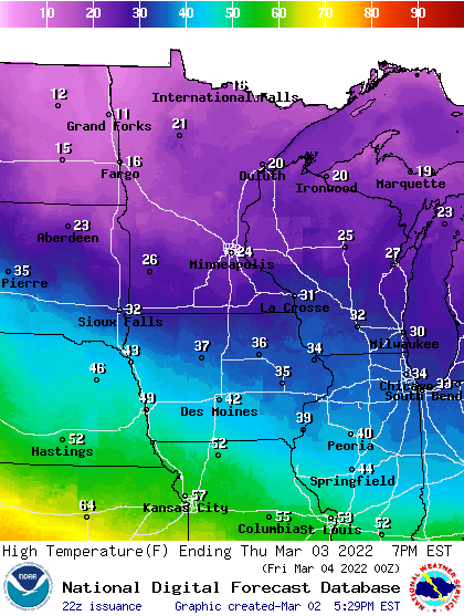
Thursday brings highs in the teens and 20s across Minnesota.
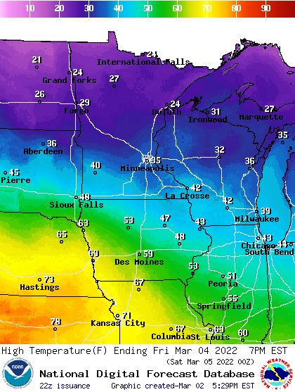
Friday is the start of the milder push ahead of our relatively mild weekend storm. Highs will reach the 30s and 40s across southern Minnesota. And check out those highs in the 70s just south and west of Minnesota, to around 80 degrees in Kansas.
Turn Up Your Support
MPR News helps you turn down the noise and build shared understanding. Turn up your support for this public resource and keep trusted journalism accessible to all.
Spring is not far away geographically speaking. It’s coming weather fans. We just need a sustained wind shift into the southwest in the coming weeks.
Weekend slop storm
I wrote in detail earlier Wednesday about our inbound weekend weather system. We’re still on track for what looks like a mostly ice to rain situation in the Twin Cities Friday night into Saturday. The heaviest snowfall still appears to favor western, central and northern Minnesota.
One interesting factor with the weekend storm. Forecast models suggest it will mostly rain in the Twin Cities, which could take out our snow cover across much of southern Minnesota including the Twin Cities. Rain is the most efficient way to remove snow in spring in Minnesota.
Check out the snow cover map from late Wednesday afternoon. We are down to a sketchy 4 inches on the ground in the Twin Cities.
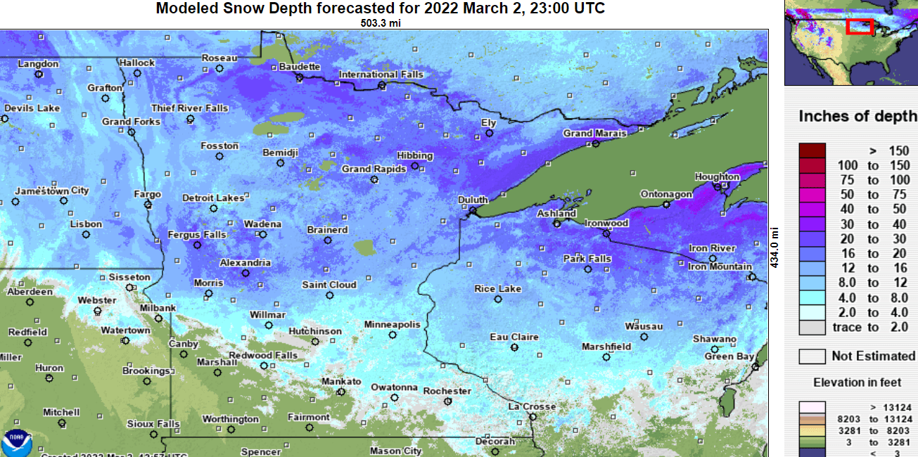
The ground conditions around the greater Twin Cities could look very different by Sunday. Assuming the forecast storm track stays north.
Stay tuned.

