
Weekend storm update: Messy mix, heavier snow north and west of MSP
Freezing drizzle and sleet could start late Friday night. Rain and thunder possible Saturday.

Go Deeper.
Create an account or log in to save stories.
Like this?
Thanks for liking this story! We have added it to a list of your favorite stories.


Get ready for a messy weather smorgasbord this weekend Minnesota.
Our inbound weekend storm system looks messy — really messy.
Forecast models continue to paint a wide and changing variety of weather across Minnesota this weekend. We can expect everything from ice and sleet, to rain, snow and thunder in Minnesota. Did I mention there’s a severe weather risk, too?
The freezing line will hover around and north of the Twin Cities this weekend. That will produce a variety of winter weather precipitation types.
Turn Up Your Support
MPR News helps you turn down the noise and build shared understanding. Turn up your support for this public resource and keep trusted journalism accessible to all.

Let’s break down the potpourri of weather types we can expect across Minnesota this weekend.
The system
A sloppy Colorado low will track toward southeast Minnesota by late Saturday night. The storm will bring a mixed bag of precipitation across Minnesota.
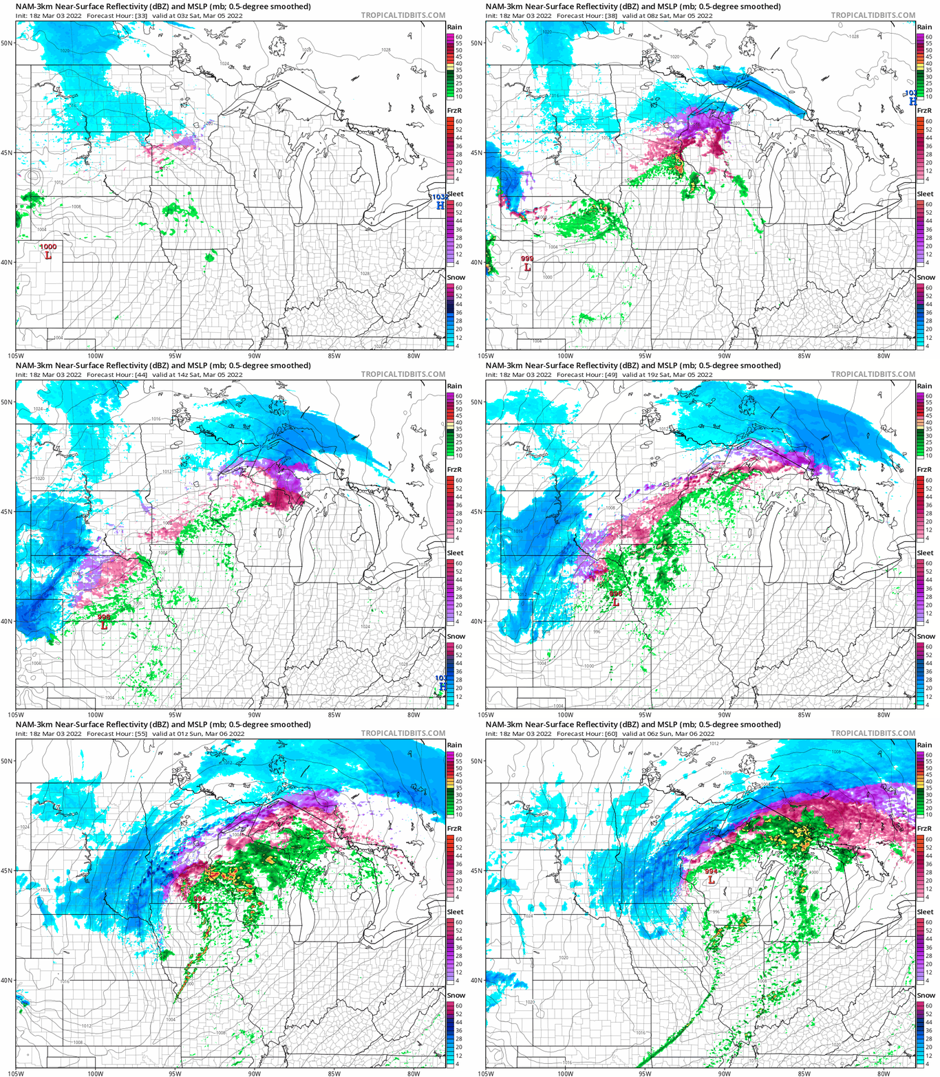
Southeast Minnesota will see mostly rain. The Twin Cities likely sees freezing drizzle and sleet as we approach midnight Saturday, changing to mostly rain Saturday, then ending as some wet snow late Saturday night into Sunday morning. It looks like mostly snow as you move west and north of the Twin Cities area.
NOAA’s NAM 3 km resolution model paints the precip zones between 10 p.m. Friday and midnight Sunday (Saturday night).
Snowfall totals
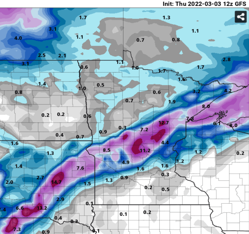
Forecast models vary widely right now for the precise location and intensity of snowfall. It should be noted forecast models show a trend that shifts the heavier snow bands slightly southward Thursday. That would place the heaviest snowfall bands from near Granite Falls and Appleton, through St. Cloud, Mille lacs toward the North Shore.
Here’s NOAA’s GFS (Kuchera) model snowfall output. It may be on the heavy side, but a band of 4 inches to locally 10 inches looks possible from western Minnesota through the North Shore.
Rainfall
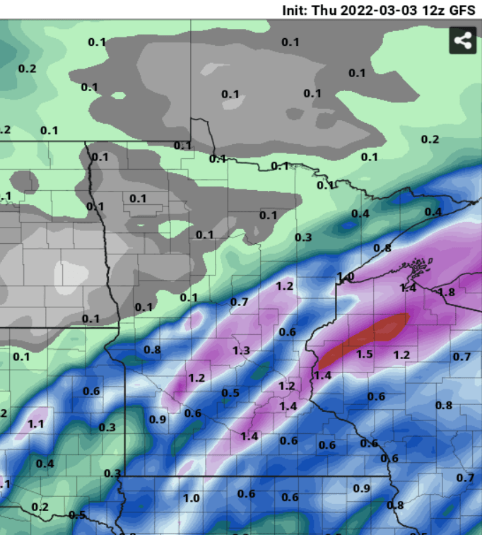
This will be heavy wet snow. In areas that see mostly rain, we could pick up an inch of moisture this weekend.
Severe risk
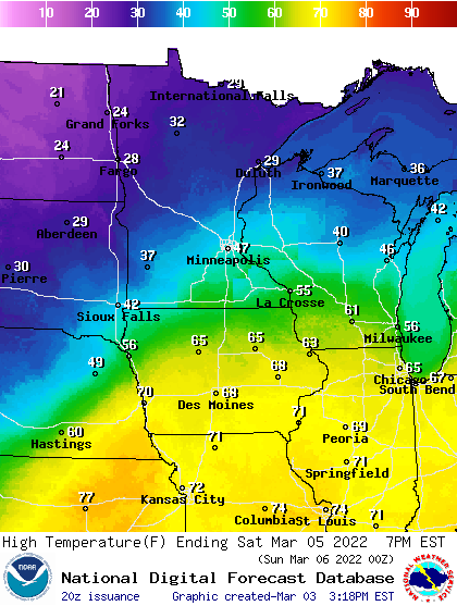
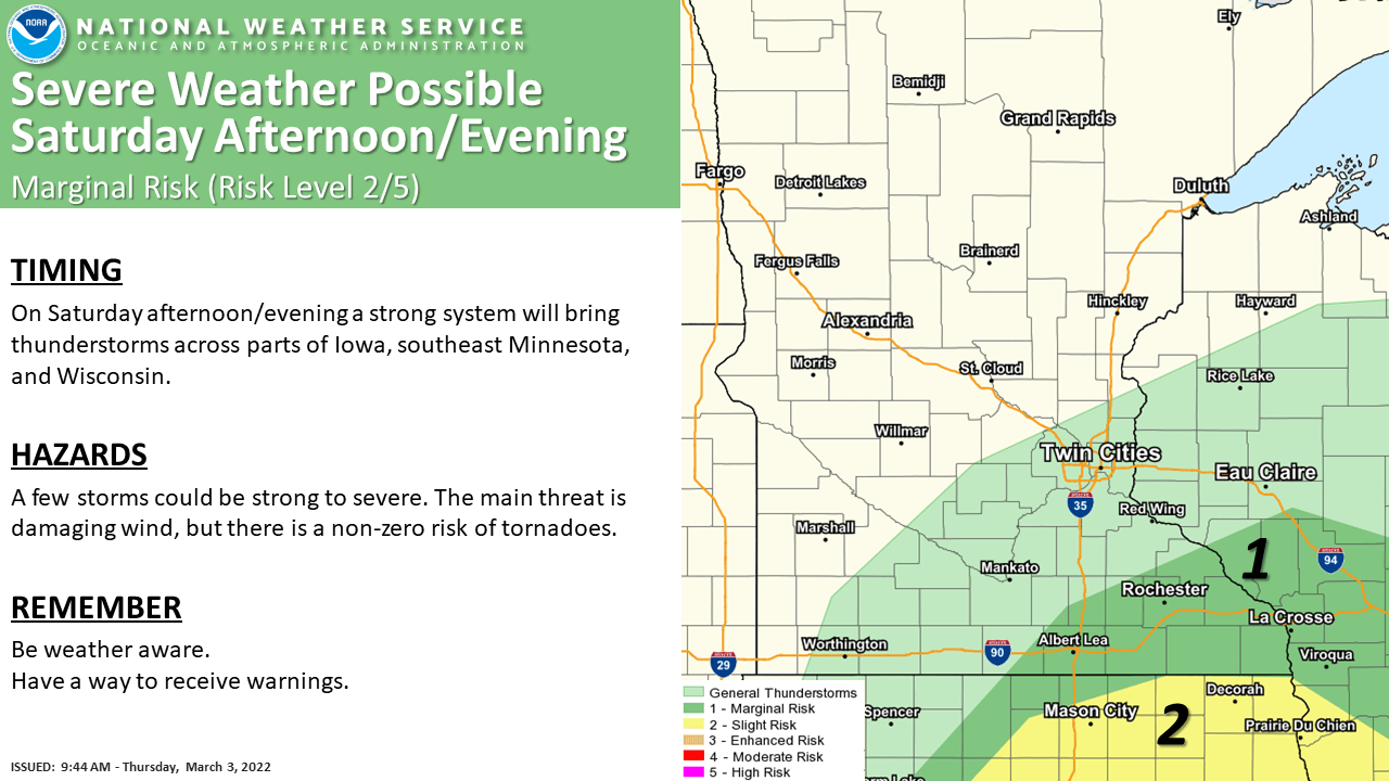
There’s enough warmth and instability that we’ll likely see scattered thunderstorms from the Twin Cities area south and east Saturday. Highs Saturday will soar into the 40s and 50s from the Twin Cities south and east.
NOAA’s Storm Prediction Center has painted a marginal severe risk that includes part of southeast Minnesota.
So, tornadoes on Dec. 15 last year, and severe thunderstorm warnings on March 5? Severe weather off-season is shrinking fast in Minnesota.
Stay tuned.

