
Frigid week rolls on, 50s ahead next week?
Subzero overnight temps up north, 50s still look likely next week

Go Deeper.
Create an account or log in to save stories.
Like this?
Thanks for liking this story! We have added it to a list of your favorite stories.


Three more days, Minnesota.
That’s how long until a significant warming trend blows into Minnesota. But between now and Sunday, temperatures will mimic January levels across our state.
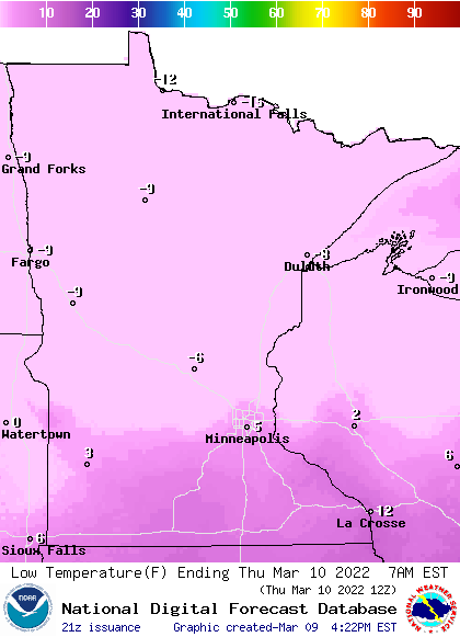
Low temperatures Thursday morning will dip below zero across the northern half of Minnesota.
Highs Thursday afternoon struggle into the 20s in the south, with teens up north once again.
Turn Up Your Support
MPR News helps you turn down the noise and build shared understanding. Turn up your support for this public resource and keep trusted journalism accessible to all.
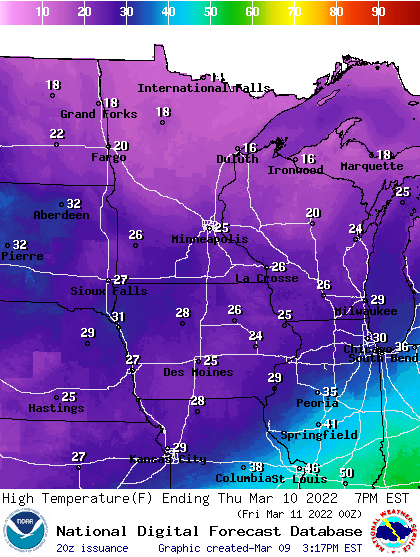
The cold lingers through Saturday.
Milder by Sunday
Sunday afternoon is when I think many of us will breathe a big sigh of relief. Highs Sunday will rise into the 40s across southern Minnesota.
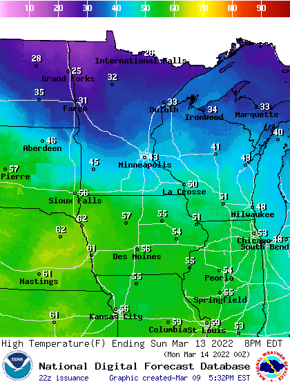
A clipper will bring more snow to northern Minnesota Sunday night and Monday.
Next week looks significantly milder. NOAA’s forecast products push highs into the 50s from the Twin Cities southward as soon as Tuesday. Pleasing hues return to the weather maps next week.
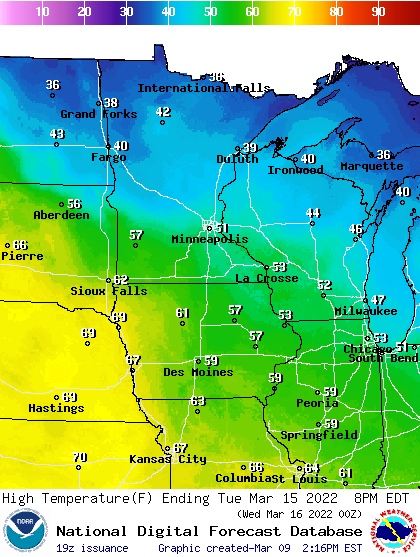
The European model cranks out highs well into the 50s in the Twin Cities with 60s in southern Minnesota by next Wednesday.
It’s coming. Hang in there.

