
Major warmup still on track for next week
Highs in the 50s looking likely, with 60s possible for southern Minnesota next week

Go Deeper.
Create an account or log in to save stories.
Like this?
Thanks for liking this story! We have added it to a list of your favorite stories.


Two more days. That’s how many more days Minnesota will have to endure this unseasonably cold March weather pattern.
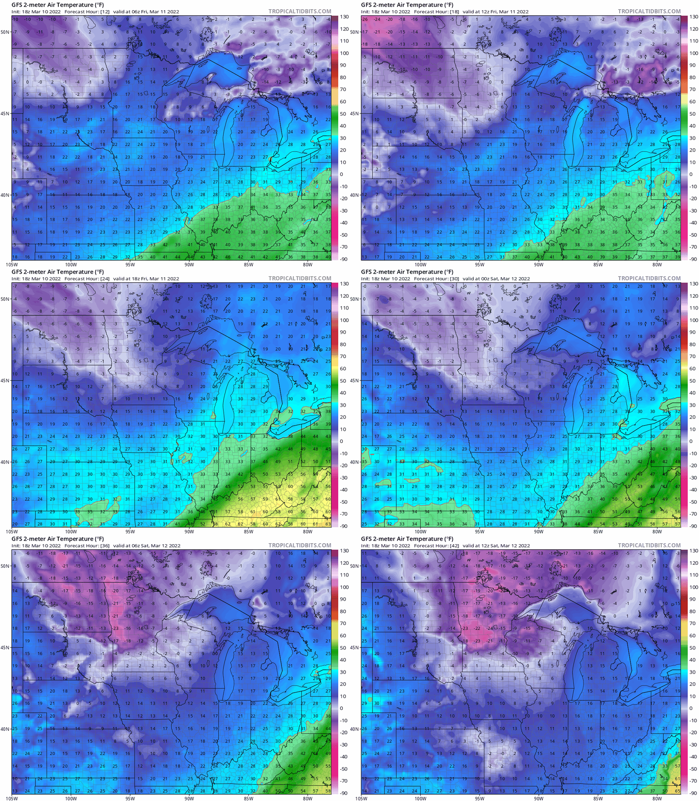
Our next cold front sweeps south through Minnesota early Friday morning. Watch how temperatures crash from the teens across much of Minnesota around midnight, to as cold as the minus 20s by Saturday morning across much of central and northern Minnesota.
Latest subzero in 13 years?
We’ll likely dip near or below zero Saturday morning in the Twin Cities. If we do, it will be the latest subzero temperature in the Twin Cities in 13 years. The last time we saw subzero temperatures this late in the season was March 12, 2009, when it hit minus 4 degrees.
Major warmup starts Sunday
Sunday afternoon brings high temperatures back into the 40s across southern Minnesota.
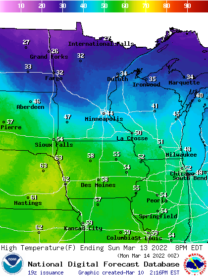
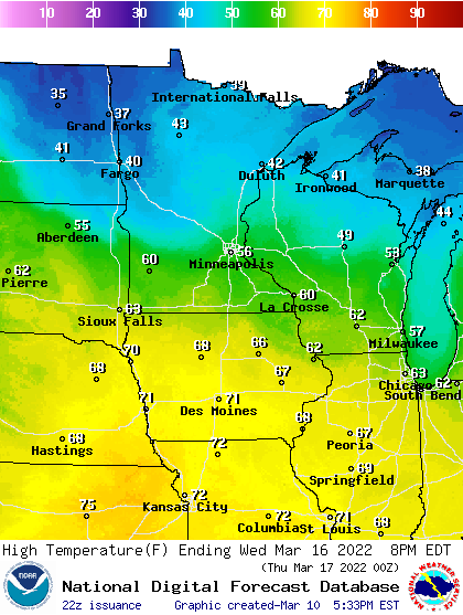
Monday could bring some snow to northern and central Minnesota, then a push of much warmer air arrives starting Tuesday. By next Wednesday, most forecast models are cranking out high temperatures in the 50s to 60s across southern Minnesota.
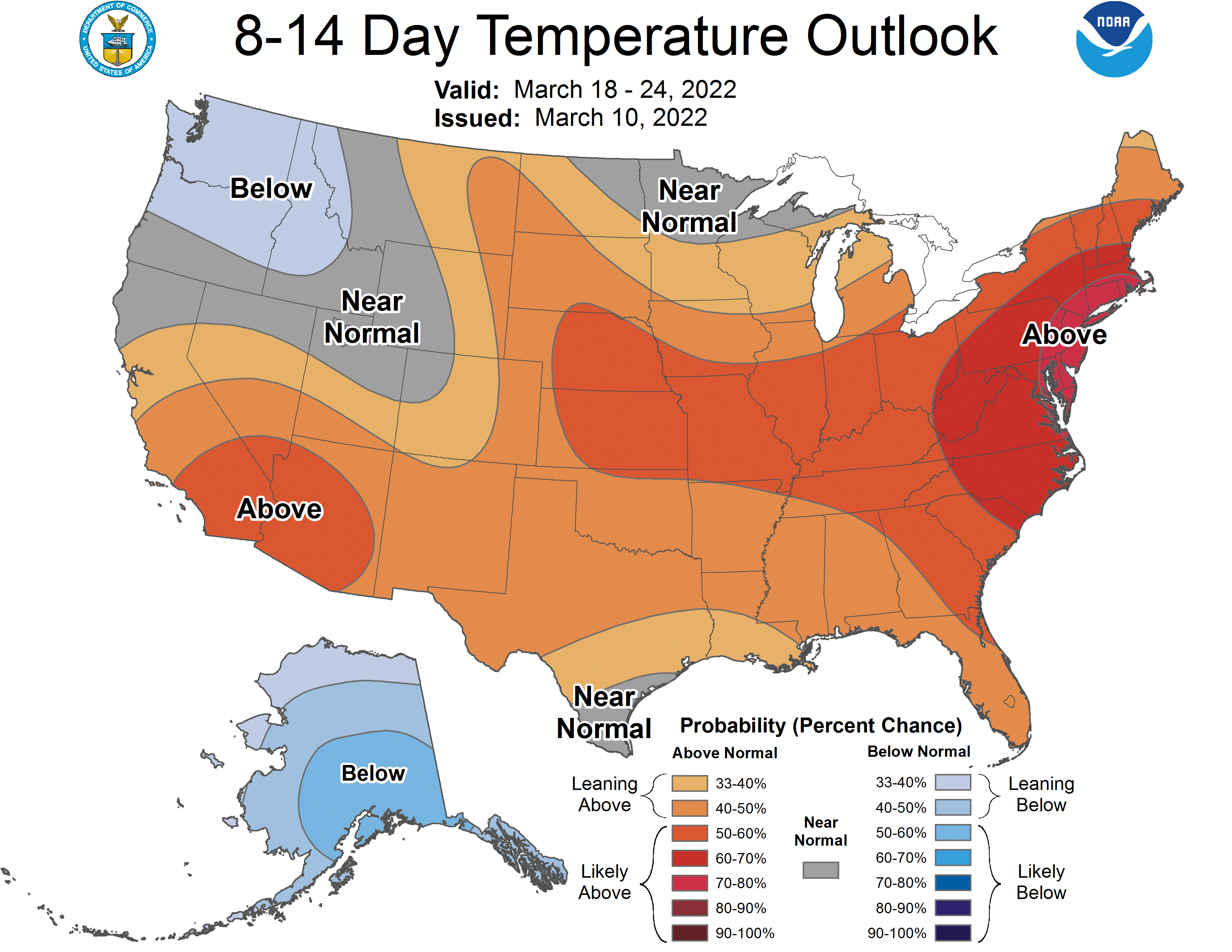
It appears the milder than average temperatures should stick around for a couple of weeks. NOAA’s eight to 14-day temperature outlook favors warmer than average temperatures overall for the southern half of Minnesota through March 24.
Stay tuned.
Turn Up Your Support
MPR News helps you turn down the noise and build shared understanding. Turn up your support for this public resource and keep trusted journalism accessible to all.

