
Sloppy spring storm will help ease drought in eastern MInnesota
A well-placed inch of liquid looks likely for the eastern half of Minnesota.
Go Deeper.
Create an account or log in to save stories.
Like this?
Thanks for liking this story! We have added it to a list of your favorite stories.


You can’t draw it up any better for Minnesota.
The weather maps look favorable for some drought-easing precipitation in the eastern half of Minnesota. The rain and snow coverage for our inbound storm system look likely to align perfectly with dry areas in Minnesota that need a good soaking or a shot of sloppy snow.
I wrote in detail about our inbound storm if you are looking for specifics on rain, ice, and snowfall coverage areas, timing, and totals.
This system won’t end drought in all of Minnesota, but it will help soak the driest areas as we move into early spring.
Turn Up Your Support
MPR News helps you turn down the noise and build shared understanding. Turn up your support for this public resource and keep trusted journalism accessible to all.
Check out last week’s U.S. Drought Monitor map for Minnesota.

Now look at the European model’s precipitation output for Minnesota through Wednesday.

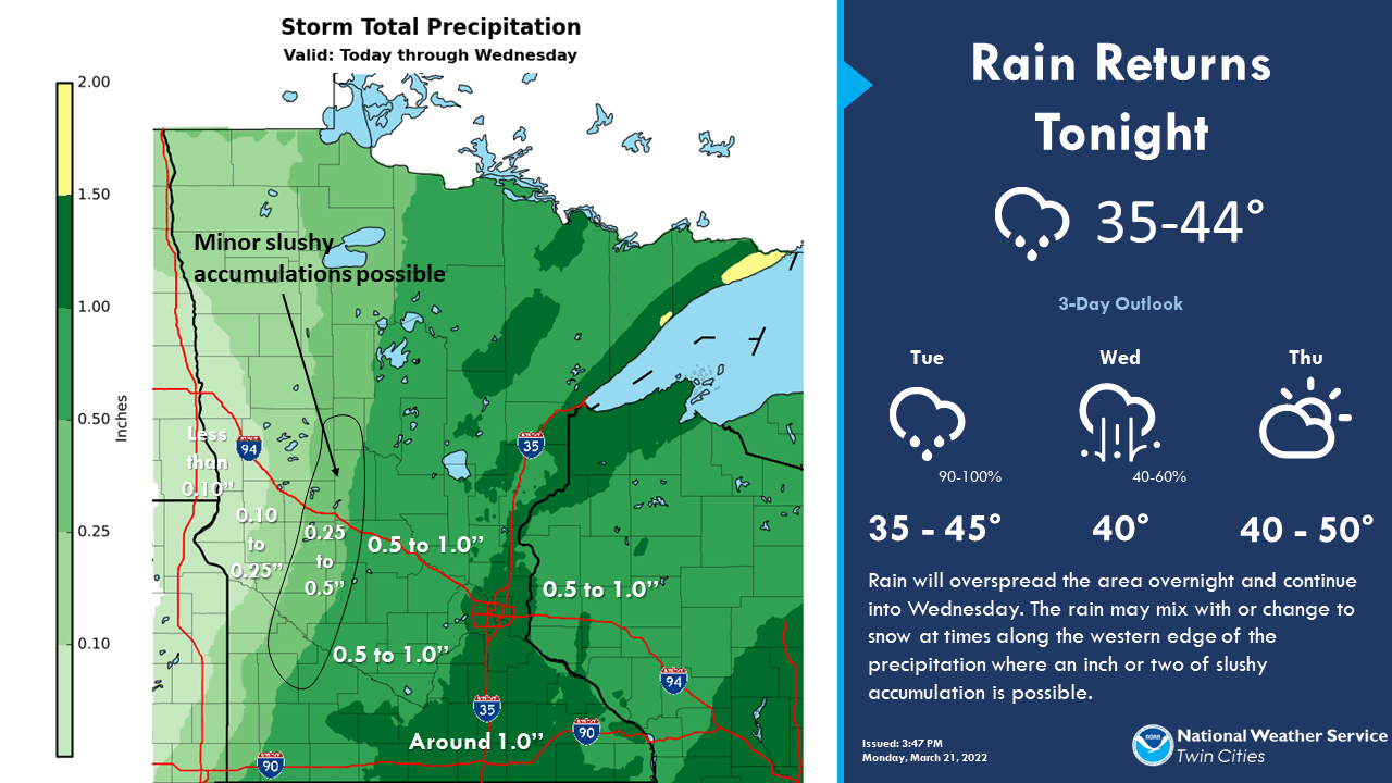
Over 1.5 inches of precipitation looks likely along with parts of the North Shore with this system. Here’s another look at the Twin Cities NWS precipitation outlook.
So for once, the weather maps across Minnesota align almost perfectly with bringing needed precipitation to our driest areas. Most of Tuesday’s precipitation may fall after the cutoff for getting incorporated into this week’s U.S. Drought Monitor update. But it could help shrink abnormally dry (yellow) and drought areas in the coming weeks.
Stay tuned.

