
Seasonably cool, sunny weekend; another shot of rain and snow next week?
A sunny but cool weekend ahead for Minnesota
Go Deeper.
Create an account or log in to save stories.
Like this?
Thanks for liking this story! We have added it to a list of your favorite stories.


Welcome to a pretty typical March temperature pattern, Minnesota.
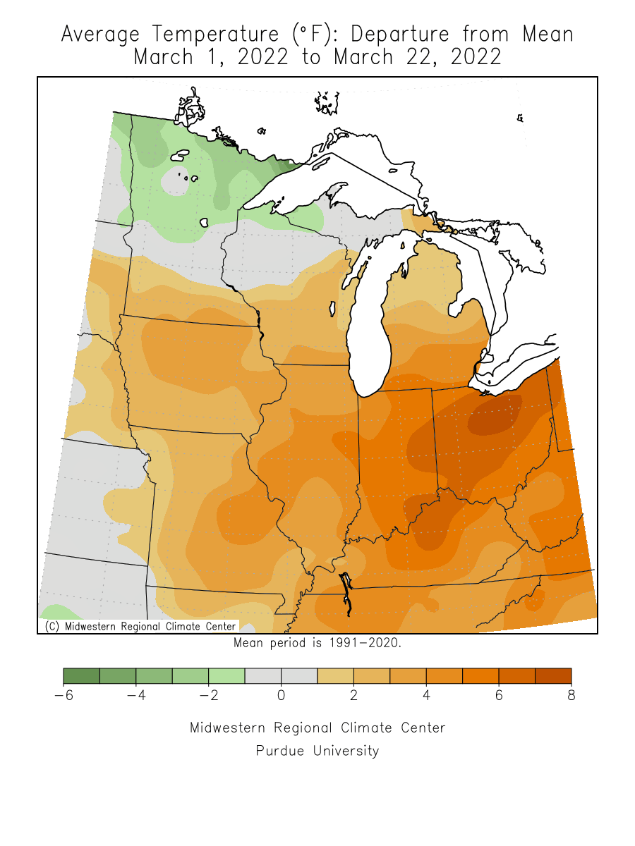
Temperatures so far this month are running near average in the Twin Cities and much of Minnesota overall. So far the average monthly temperature of 31.8 degrees at the Minneapolis-St. Paul International Airport is just 0.6 degrees warmer than average.
Temperatures across the state this month are running a couple of degrees above average in southern Minnesota, and a couple of degrees below average in the north.
Precipitation is running above average this month around the Twin Cities. The driest areas are in northwest Minnesota.
Turn Up Your Support
MPR News helps you turn down the noise and build shared understanding. Turn up your support for this public resource and keep trusted journalism accessible to all.
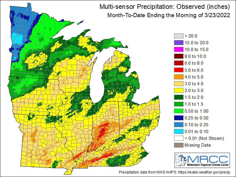
This week’s rain and snow will help ease the dryness in soils, rivers and lakes in the eastern half of Minnesota as we move into the spring season.
Seasonably cool
Overall temperatures will likely run from near to a few degrees cooler than average over the next week. The average high and low for the Twin Cities Friday are 46 and 29 degrees.
Highs across Minnesota Friday will reach the 40s with a few 50s west.
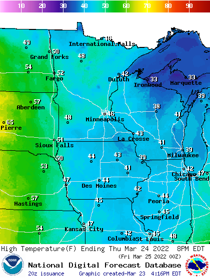
Clouds will linger Thursday, and another shot of light rain and snow showers will cross Minnesota Friday. The weekend looks sunny but cool.
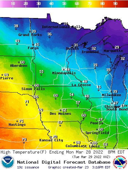
Temperatures rebound a bit Monday as another push of milder air from the south moves our way.
Another sloppy storm next week?
Forecast models suggest another sloppy low-pressure storm will push into Minnesota next week. With temperatures hovering a few degrees either side of the freezing mark again, it looks like another round of rain, ice and snow is possible.
NOAA’s GFS model suggests a slow-moving system that could stall over Minnesota with a mix of rain, ice and snow between Tuesday and Thursday next week.
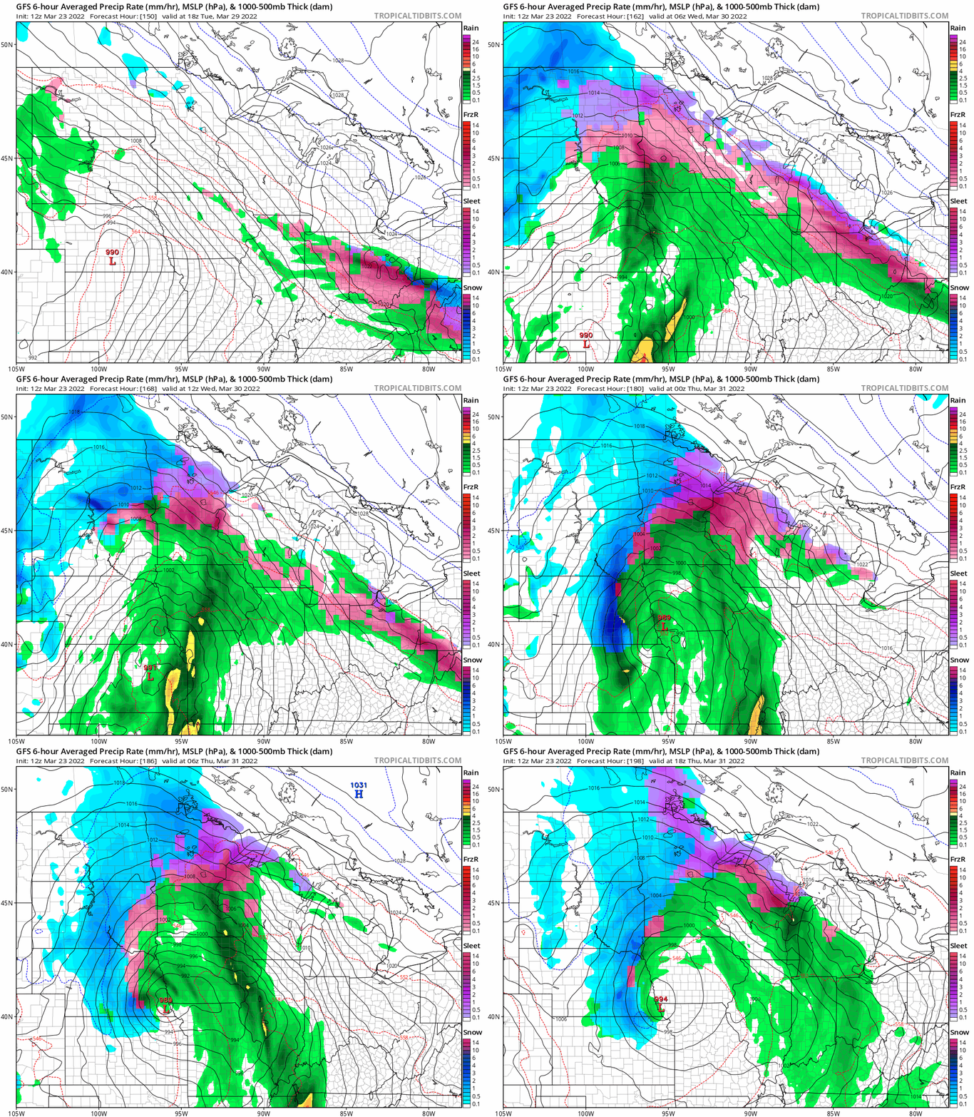
If this system develops as currently seen by the forecast models, it looks like our drought may be over with rivers running higher in most of Minnesota by the end of next week.
Stay tuned.

