
Wintry mix ends Wednesday night; 50s return this weekend
A wide mix of rain, ice, and snow across Minnesota
Go Deeper.
Create an account or log in to save stories.
Like this?
Thanks for liking this story! We have added it to a list of your favorite stories.


Rain, thunder, ice, sleet, and snow. We’ve seen it all across Minnesota.
Our interesting midweek storm system winds down across Minnesota Wednesday night. Before it does, we’ll see a little more wintry mix zones through tonight.
Significant snowfall reports are coming in from northern Minnesota.
Two Harbors, 2.4 inches
Duluth National Weather Service office, 3.1 inches
Orr, 4.2 inches
Bemidji, 5.5 inches
Pelican Rapids, 7 inches
Lake Ida, 9.9 inches
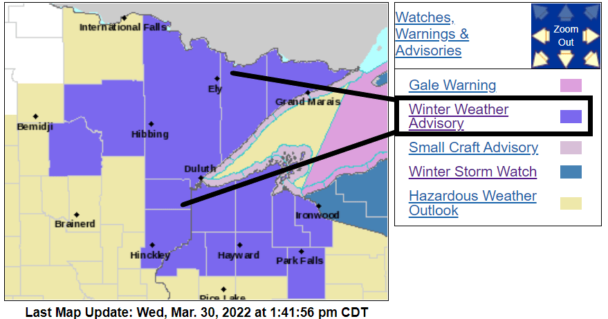
Winter weather advisories continue until midnight for most of northeast Minnesota and northwest Wisconsin.
Turn Up Your Support
MPR News helps you turn down the noise and build shared understanding. Turn up your support for this public resource and keep trusted journalism accessible to all.
Including the cities of Duluth, Pine City, Hinckley, Grantsburg, and Spooner
1032 AM CDT Wed Mar 30 2022
...WINTER WEATHER ADVISORY IN EFFECT UNTIL MIDNIGHT CDT TONIGHT...
* WHAT...Mixed precipitation. Additional snow accumulations of up to one inch and ice accumulations of a light glaze.
* WHERE...In Wisconsin, Burnett and Washburn Counties. In Minnesota, Carlton and South St. Louis and Pine Counties. This includes the Tribal Lands of the Fond du Lac Band and the Mille Lacs Band, Lena Lake and, Hinckley areas.
* WHEN...Until midnight CDT tonight.
* IMPACTS...Plan on slippery road conditions. The hazardous conditions could impact the evening commute.
For southern Minnesota and the Twin Cities, our wintry mixed bag will transition to mostly light snow into Wednesday evening. The National Oceanic and Atmospheric Administration’s NAM 3 km model paints bands of mostly light snow across the region shifting eastward after around 10 p.m.
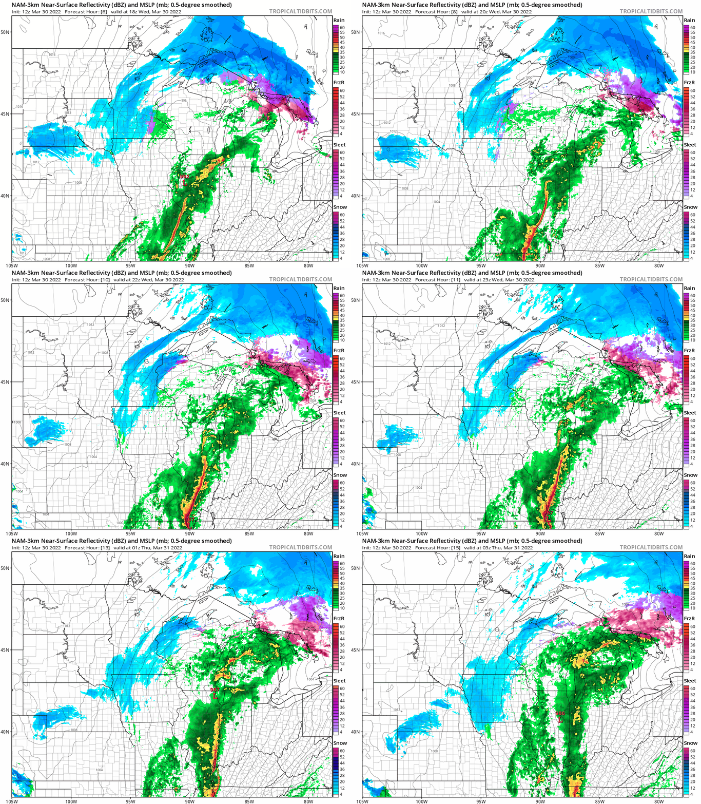
Overall snowfall accumulations look light, with under an inch in most areas around the Twin Cities. A couple more inches are likely in northern and southeast Minnesota and much of Wisconsin.

Milder this weekend
Our wintry mess will melt away by this weekend across southern Minnesota. High temperatures Friday return to the 40s across most of Minnesota.

And highs in the 50s return this weekend for the Twin Cities and most of southern and western Minnesota.

The average high temperature for this weekend in the Twin Cities is 50 degrees, with an average low of 32.

