
Another sloppy midweek storm ahead; winter storm watch up north
Mostly rain for the Twin Cities, heavy snow potential up north
Go Deeper.
Create an account or log in to save stories.
Like this?
Thanks for liking this story! We have added it to a list of your favorite stories.


Here we go again. Another midweek storm is aiming for Minnesota this week.
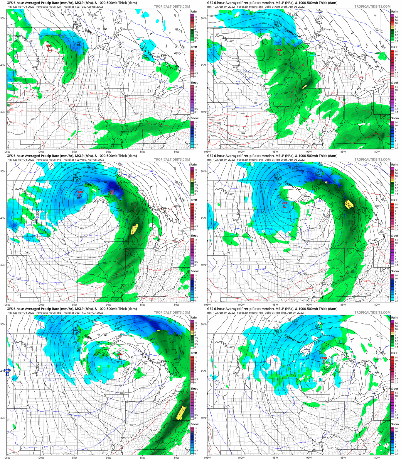
This is the third week in a row for a strong low-pressure system crossing Minnesota. This one will track a little farther north than the previous two systems.
It will bring mostly rain to central and southern Minnesota Tuesday, with snow up north. As colder air filters into the system, snow showers will become more widespread Wednesday and Thursday.
The National Oceanic and Atmospheric Administration’s Global Forecast System model tracks the slow-moving low-pressure storm this week across central Minnesota.
Turn Up Your Support
MPR News helps you turn down the noise and build shared understanding. Turn up your support for this public resource and keep trusted journalism accessible to all.
Wet system
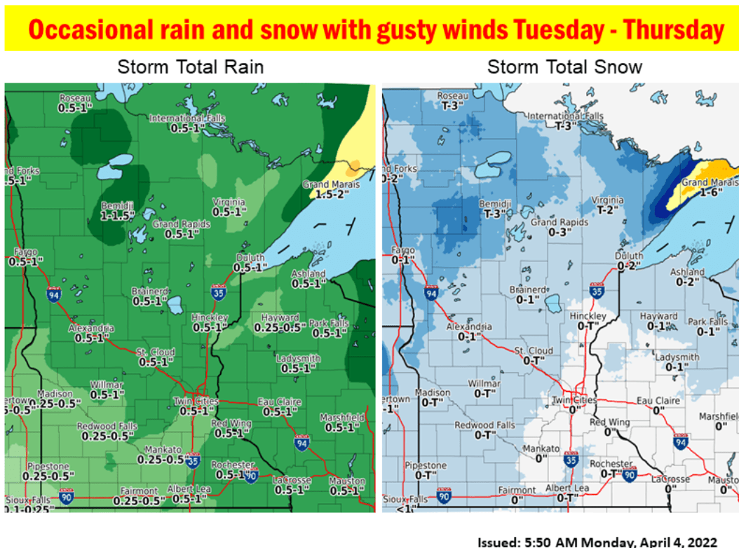
This system will bring another one-half to 1 inch of moisture to most of Minnesota. Liquid precipitation totals may reach 1 to 2 inches across northeastern Minnesota.
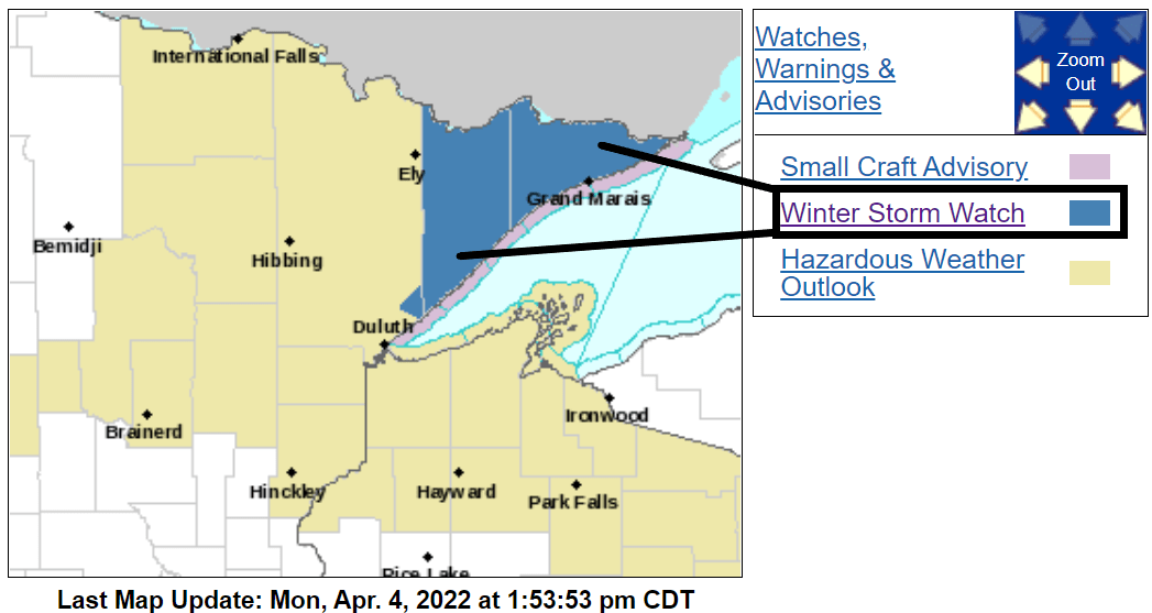
Winter storm watch up north
Heavy wet snow looks likely again for much of northern Minnesota. Another April winter storm watch has been posted for northeastern Minnesota.
Northern Cook and Lake-Southern Lake-Southern Cook- Including the cities of Isabella, Two Harbors, Silver Bay, and Grand Marais
401 AM CDT Mon Apr 4 2022
...WINTER STORM WATCH IN EFFECT FROM TUESDAY EVENING THROUGH WEDNESDAY EVENING...
* WHAT...Heavy wet snow possible. Total snow accumulations of 4 to 8 inches possible. Winds could gust as high as 40 mph.
* WHERE...Northern Cook and Lake, Southern Lake and Southern Cook Counties. This includes the Tribal Lands of the Grand Portage Reservation.
* WHEN...From Tuesday evening through Wednesday evening.
* IMPACTS...Travel could be very difficult. The hazardous conditions could impact the morning or evening commute.
Stay tuned as we track the system through midweek.
Weekend warming trend
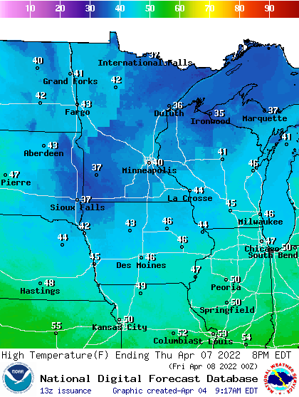
A strong warming trend finally arrives next weekend.
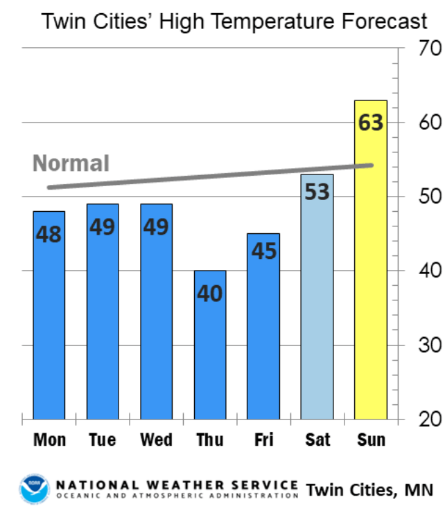
Hang in there.

