
Heavy snow targeting northern Minnesota
Double-digit April snowfall totals possible
Go Deeper.
Create an account or log in to save stories.
Like this?
Thanks for liking this story! We have added it to a list of your favorite stories.


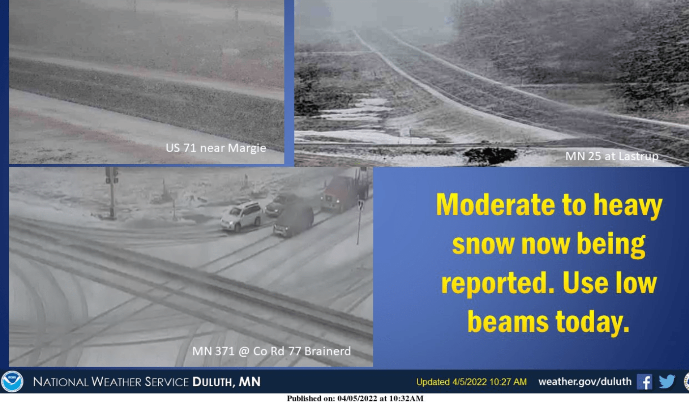
Our slow-moving storm has arrived with rain in the Twin Cities and southern Minnesota. Up north, heavy wet snow is piling up.
I’ve already seen reports of 6 to 8 inches in northern Minnesota around Lake Itasca.
Waubun, in Mahnomen County, is reporting 8 inches of new snow.
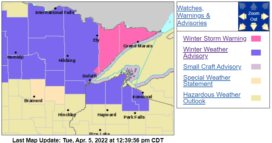
Our low-pressure system stalls over Minnesota through Thursday. Expect additional waves of snow up north and rain mixing with snow in southern Minnesota Wednesday into Thursday. Winter storm warnings and winter weather advisories cover much of northern Minnesota.
Turn Up Your Support
MPR News helps you turn down the noise and build shared understanding. Turn up your support for this public resource and keep trusted journalism accessible to all.
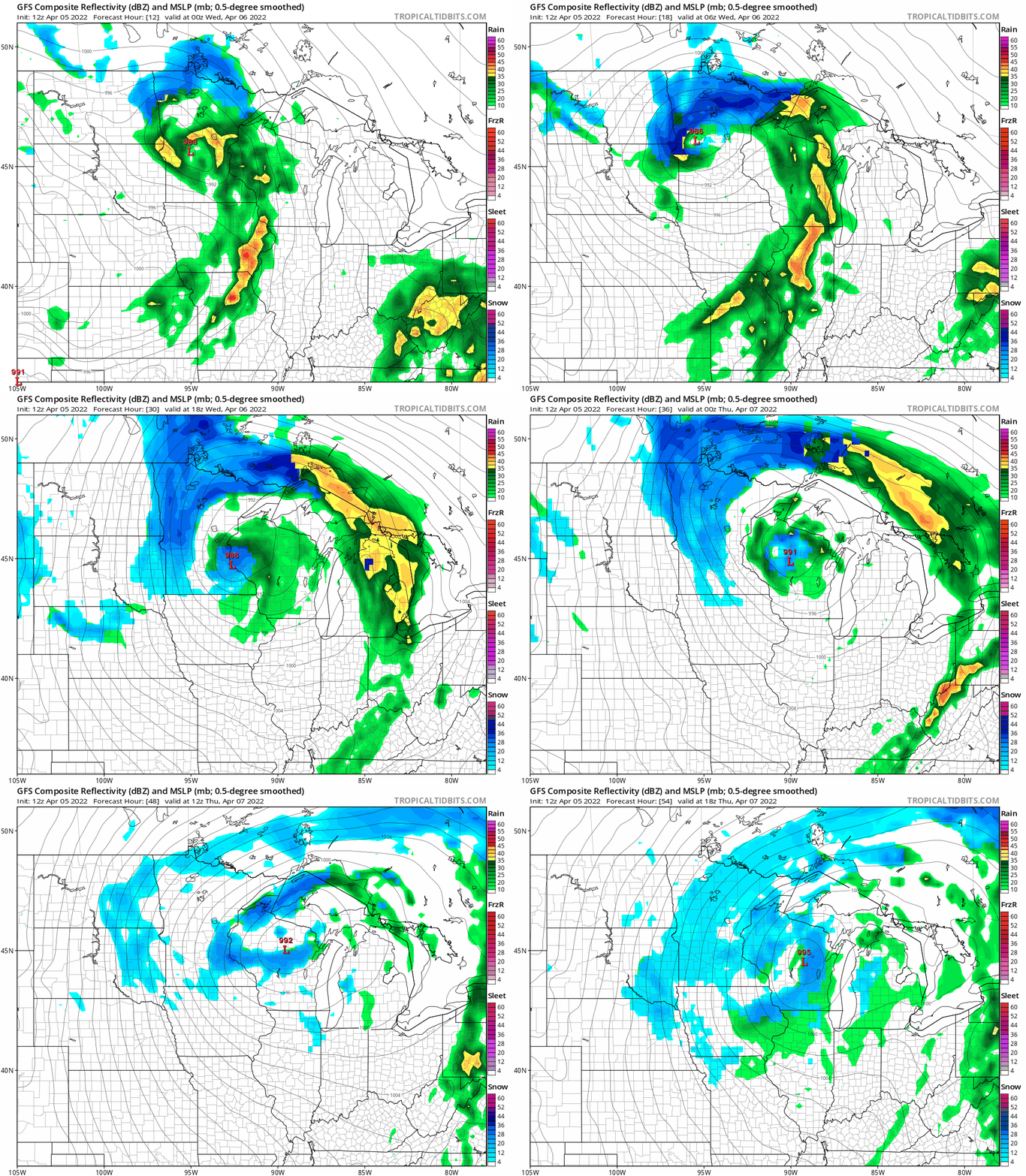
The National Oceanic and Atmospheric Administration’s Global Forecast System model shows the low swirling across the Upper Midwest into Thursday. Note the pockets of heavy snowfall. It’s possible the Twin Cities could get another snowy coating by Thursday morning.
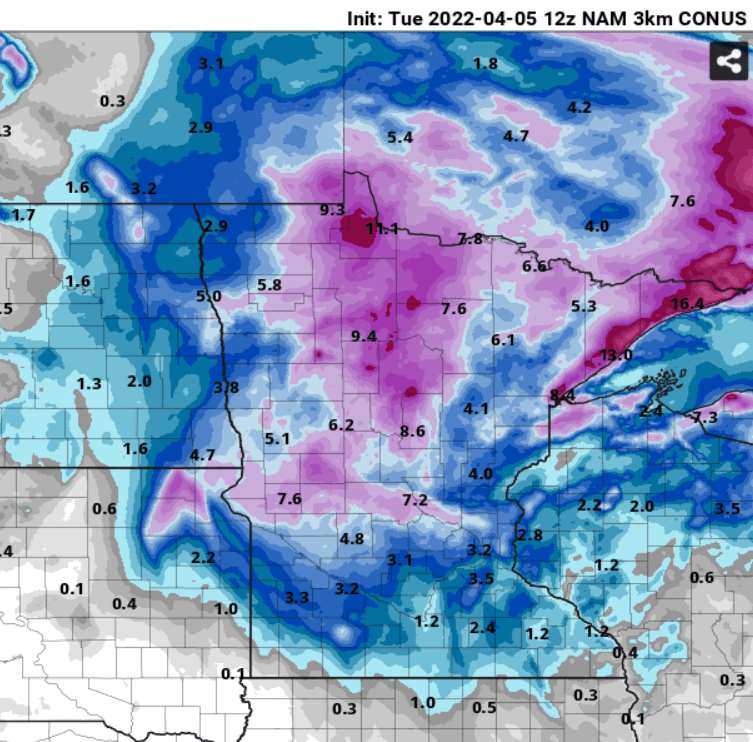
Locally heavy snowfall totals
I’m leaning heavier on snowfall totals than some of the current forecasts up north.
With 6 to 8 inches already on the ground in parts of northern Minnesota the forecast model notions of double-digit snowfall totals I’m seeing across parts of northern Minnesota by later Wednesday seem entirely possible.
NOAA’s North American Mesoscale Forecast System 3 km model is among this cranking out significant double-digit snowfall across parts of northern Minnesota by Thursday.
We could again see a snowy coating in the Twin Cities by Thursday morning.
The weekend looks sunnier and milder. But our spring of 2022 is reluctant across most of Minnesota this year.

