
Warming trend: 60s return this week, 70 next weekend
Sunnier, warmer spring like weather is one the way
Go Deeper.
Create an account or log in to save stories.
Like this?
Thanks for liking this story! We have added it to a list of your favorite stories.


Sunnier and warmer.
Boy, that felt good to type.
A pattern change this week brings sunnier skies and warmer temperatures to Minnesota. Weak high pressure will be strong enough to erode the gray canopy that’s enveloped Minnesota for what seems like weeks. April brought an abundance of clouds and rainfall.
Check out the lack of sunshine recorded last month courtesy of the Twin Cities National Weather Service office:
Turn Up Your Support
MPR News helps you turn down the noise and build shared understanding. Turn up your support for this public resource and keep trusted journalism accessible to all.
Clouds will thin across southern and central Minnesota overnight. A clear wedge brings more sunshine for most of the day Tuesday and Wednesday.
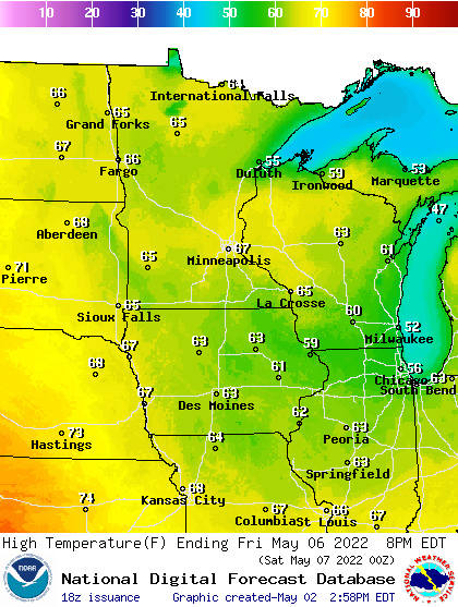
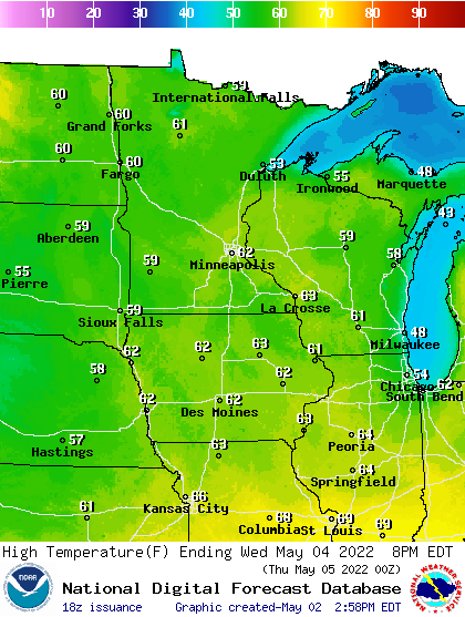
Strong May sunshine will help boost temperatures and spirits this week. Highs will be close to 60 in the Twin Cities Tuesday and push into the 60s Wednesday across a good part of Minnesota.
By late this week temperatures will rise into the upper 60s for much of Minnesota.
And forecast models are cranking out 70s for highs from Mother’s Day into early next week.
Right now, the European Centre for Medium-Range Weather Forecasts model is the most aggressive with the warmup for next week. It cranks up the heat into the mid-80s by Tuesday, May 10.
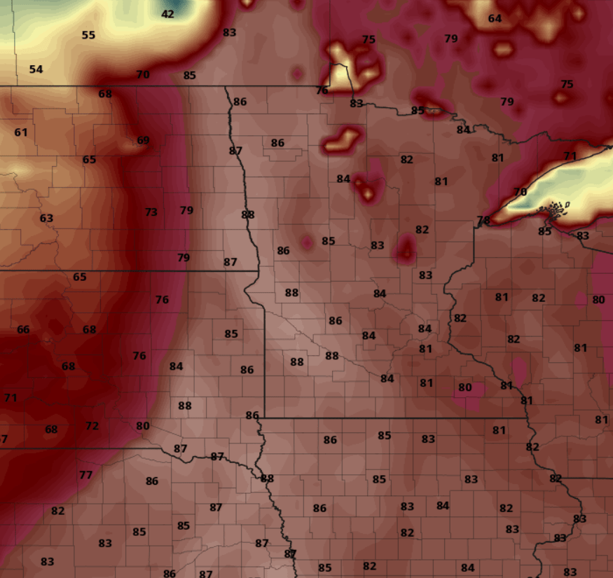
Much warmer days are on the way, Minnesota.

