
Pleasant June temps this week; steamy summer air mass next week?
This week brings a comfortable air mass to Minnesota.
Go Deeper.
Create an account or log in to save stories.
Like this?
Thanks for liking this story! We have added it to a list of your favorite stories.


This is the time of year when meteorologists can come up for a little air.
I posted last week about the stormiest spring of the year for much of Minnesota by the metric of severe weather warnings.
So it’s nice to finally get a brief breather from Minnesota’s Severe Spring of 2022.
This first full week of June features a pleasant air mass with high temperatures generally in the 70s.
Turn Up Your Support
MPR News helps you turn down the noise and build shared understanding. Turn up your support for this public resource and keep trusted journalism accessible to all.

Temperatures will warm a few degrees later this week as high temperatures climb into the mid to upper 70s late this week. The average high in the Twin Cities for Saturday is 78 degrees; the average low is 59.

Scattered showers Tuesday
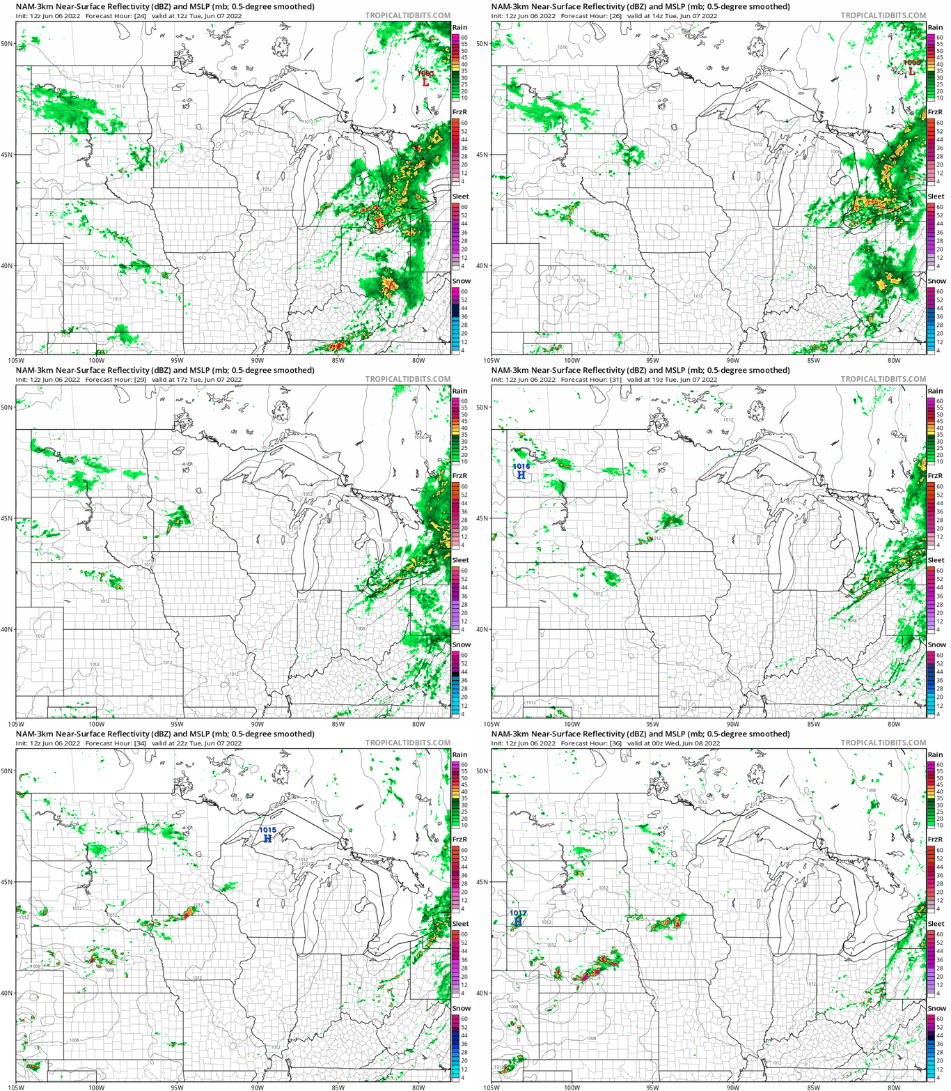
A minor weather system crosses Minnesota Tuesday. Look for a few scattered rain showers that may favor the midday hours around the Twin Cities and southern Minnesota.
The National Oceanic and Atmospheric Administration’s NAM 3 km resolution model paints the shower zones Tuesday:
Summery air mass next week?
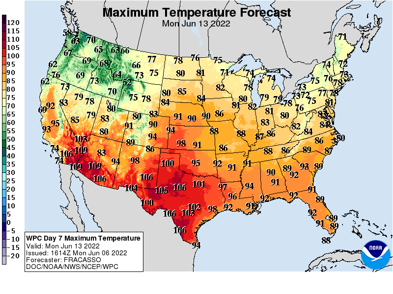
The forecast models for next week are leaning toward a more summery air mass. A few model runs have hinted at a potentially steamy and partly stormy air mass for parts of Minnesota next week. Highs in the 80s look more likely, and dew points could surge into the tropical upper 60s to around 70 degrees.
Here’s an early peek at the high temperature forecast for next Monday, June 13. You can see the steamy air mass building to the south of Minnesota next week.
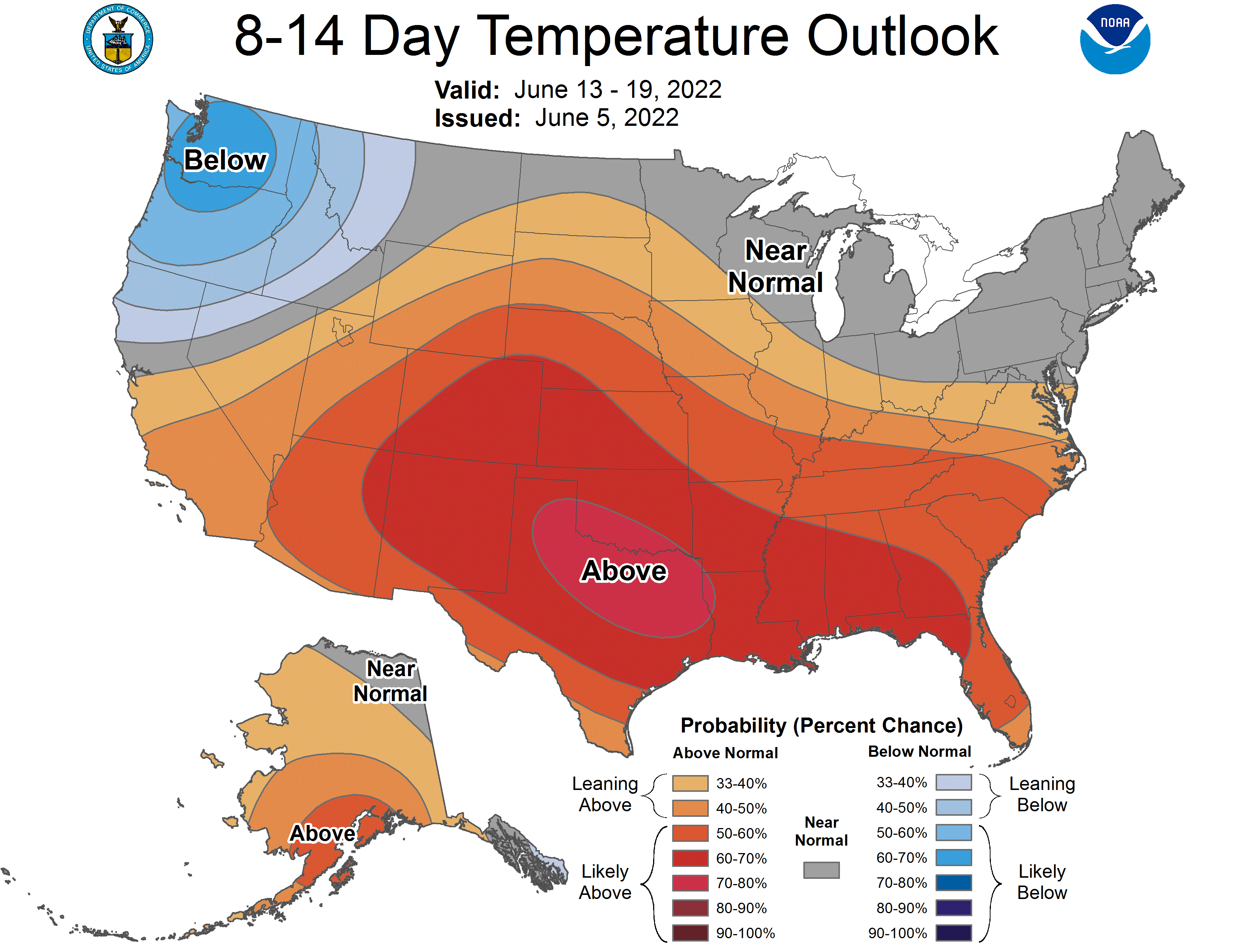
It should be noted that a few model runs have suggested highs in the 90s next week! NOAA’s eight- to 14-day outlook favors near- to above-average temperatures across Minnesota.
Stay tuned.

