
Big weekly variations in rainfall for Minnesota crops
Some heavy rainfall in southern Minnesota is helping crops. But dry pockets emerging.

Go Deeper.
Create an account or log in to save stories.
Like this?
Thanks for liking this story! We have added it to a list of your favorite stories.


It’s like rainfall bingo for Minnesota farmers.
Summer rainfall totals are typically localized. That has been true over the past week as many farmers in our state look for much-needed rainfall this time of year.
Take a look at the seven-day observed rainfall map above. You can see how southern Minnesota has picked up significant rainfall in the past week. Two to more than five inches fell across areas basically from near Mankato southward into northern Iowa. Areas in the southwest Twin Cities picked up one to two inches of rain in the past week.
But further northward, rainfall has been tougher to come by in parts of central and northern Minnesota. Rainfall totals of less than an inch are common in many areas in the past week.
Turn Up Your Support
MPR News helps you turn down the noise and build shared understanding. Turn up your support for this public resource and keep trusted journalism accessible to all.
Crop conditions vary
Monday’s Minnesota Crop Report shows a mixed bag of conditions across Minnesota.
Overall 64 percent of Minnesota corn crop is rated good (54 percent) or excellent (12 percent). But 29 percent of corn is rated in just fair condition. Many counties need more rainfall in the next week to help keep crops healthy.
Here’s more detail from this week’s report.
Topsoil moisture supplies were rated 3 percent very short, 12 percent short, 75 percent adequate, and 10 percent surplus. Subsoil moisture supplies were rated 2 percent very short, 11 percent short, 78 percent adequate, and 9 percent surplus.
Corn condition was 1 percent very poor, 4 percent poor, 29 percent fair, 54 percent good, and 12 percent excellent. Soybean blooming was at 22 percent, 10 days behind last year and 5 days behind the 5-year average. Soybean condition was 1 percent very poor, 3 percent poor, 33 percent fair, 53 percent good, and 10 percent excellent.
Looking for rain
With the forecast for increasing heat next week, any rainfall we can get will be critical for many farmers. The best chances for significant rainfall appear to arrive Friday and Saturday. The European model suggests that eastern Minnesota could pick up an inch or more of rain in the next seven days. But little or no rain may fall in much of western Minnesota.

NOAA’s eight to 14-day outlook suggests drier than average weather through the next two weeks.
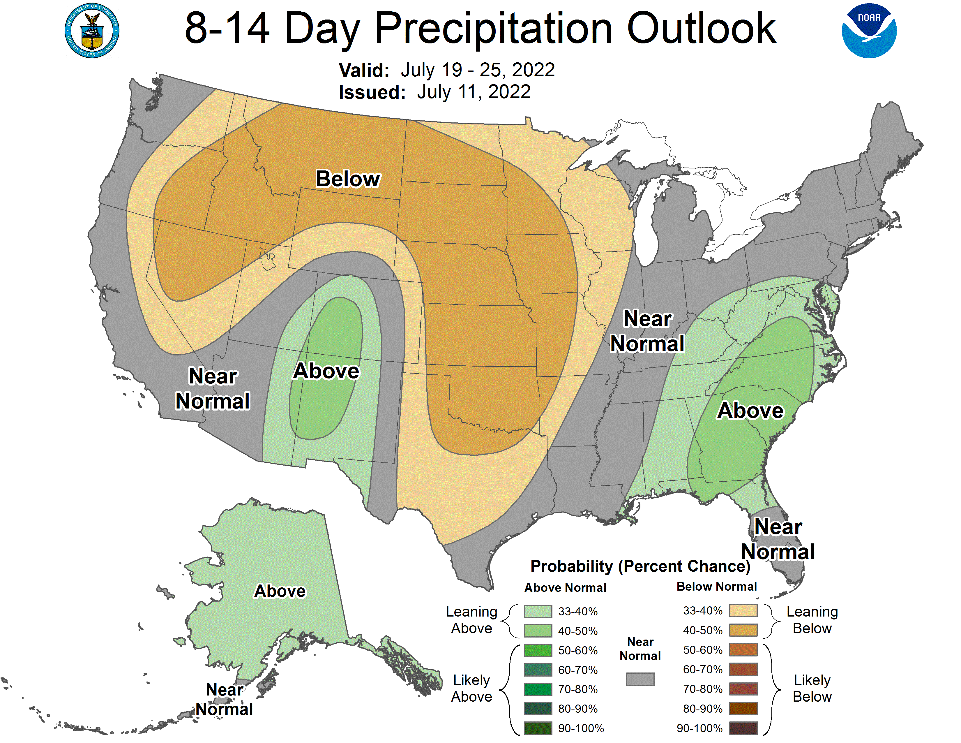
Keep in mind that localized thunderstorms can dump inches of rain in one location, with little or no rain not far away. Let’s hope enough rain falls in the next two weeks to keep crops in good condition across most of Minnesota.
Stay tuned.

